Corn Belt Map
Our Corn Belt map shows this region in bright yellow across the upper Midwest. The area spans states, like Nebraska, Iowa, and Indiana.
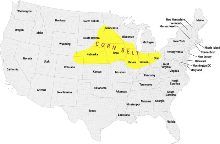
Our Corn Belt map shows this region in bright yellow across the upper Midwest. The area spans states, like Nebraska, Iowa, and Indiana.
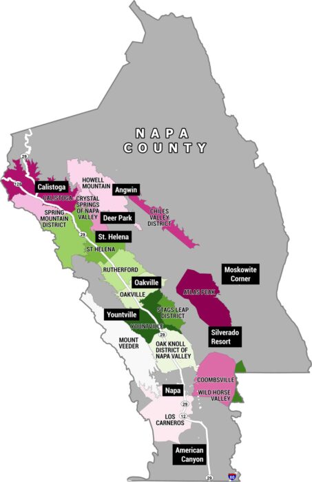
This is a map of Napa County, California, showing all of its American Viticultural Areas (AVAs). These are the official wine-growing regions.
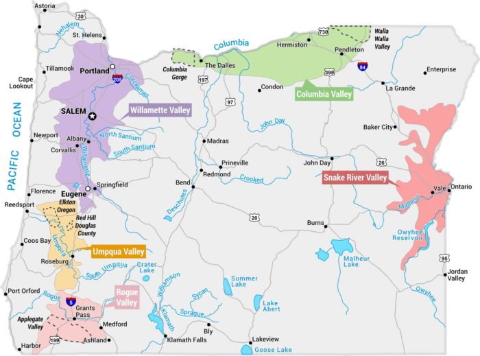
This map displays Oregon’s major wine regions (AVAs – American Viticultural Areas). Each one is shaded in a distinct color across the state.
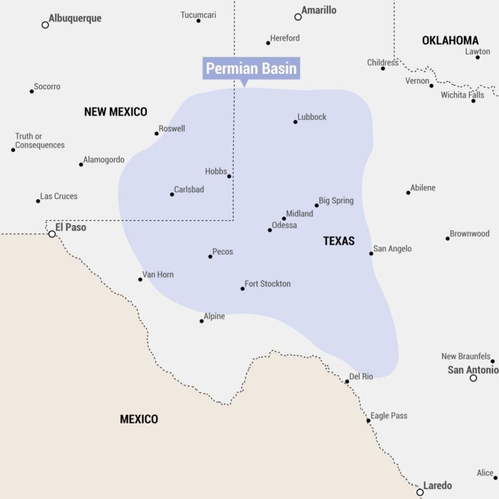
Our map of the Permian Basin is shown as a blue-shaded region spanning western Texas and southeastern New Mexico with cities and towns.
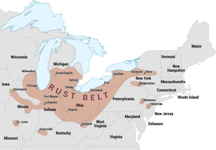
The Rust Belt was once an industrial heartland of the United States. Our map highlights the states and major cities that make up this region.
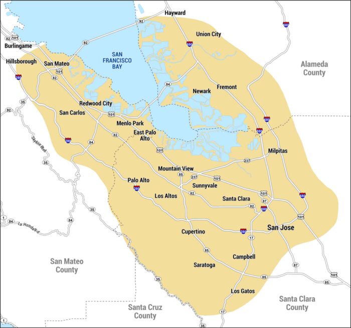
This map shows Silicon Valley along the southern end of San Francisco Bay. It includes San Jose, Mountain View, and other cities.
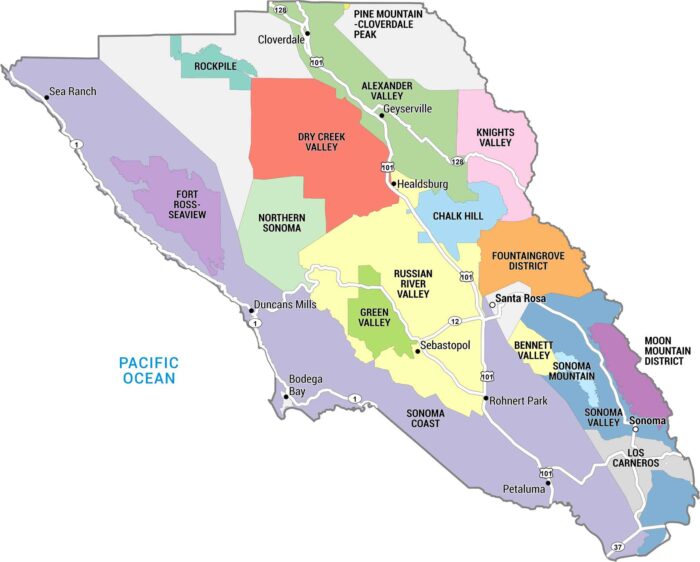
This map of Sonoma County highlights the region’s major cities, towns, and vineyard appellations in one of the country’s top wine regions.
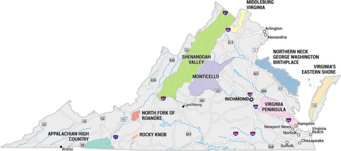
Virginia Wine Country rolls through the foothills of the Blue Ridge. Our map shows the 9 clusters of wineries in Virginia.