Map of Little Rock, Arkansas
Our map of Little Rock shows the Arkansas River running through downtown. Interstates 30 and 40 cross near the city.
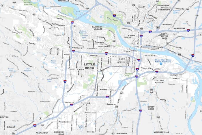
Our map of Little Rock shows the Arkansas River running through downtown. Interstates 30 and 40 cross near the city.
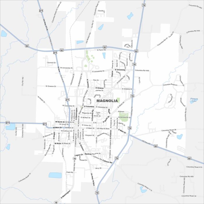
Explore Magnolia, located in southern Arkansas. Our map shows its highways that connect the town to forests and farmland.
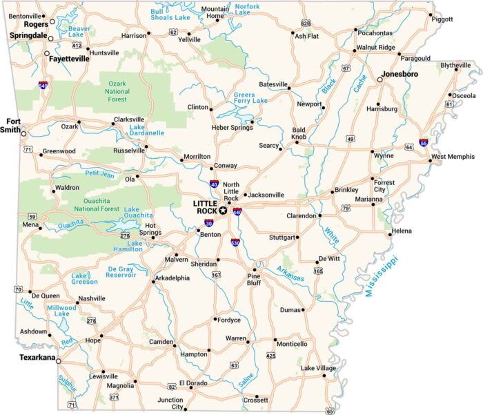
Here’s our map of Arkansas with cities, towns, rivers, and lakes. The Ozarks rise in the north and the Mississippi River flows in the east.
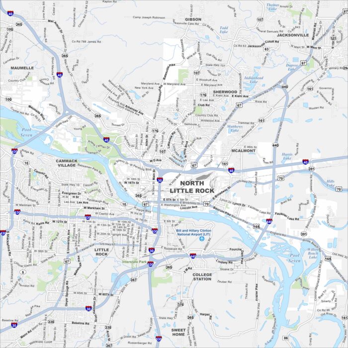
North Little Rock sits directly across the Arkansas River from Little Rock. Check out our map to see its parks, neighborhoods, and highways.
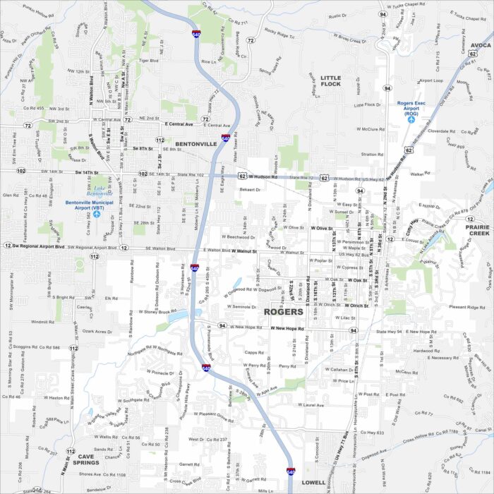
Our map of Rogers highlights the downtown, major routes, and trails. It also shows how the city connects with Bentonville and Fayetteville.
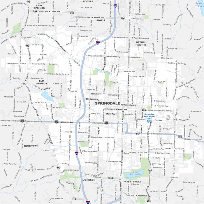
Our map of Springdale highlights a city in the Ozarks. It’s home to local trails and the Northwest Arkansas Naturals baseball team.
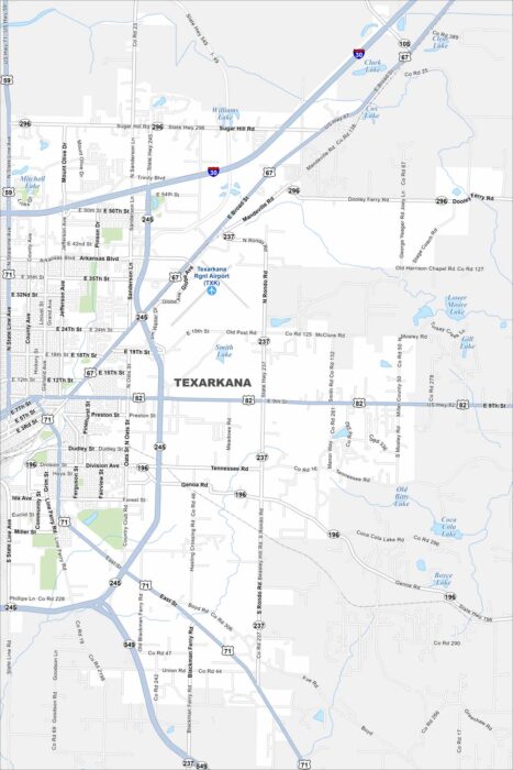
Our road map of Texarkana shows this border city split with Texas. It’s known for its federal courthouse that straddles two states.
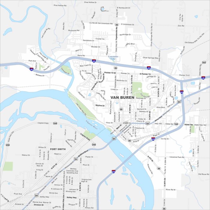
Van Buren is a historic Arkansas town on the Arkansas River. Our map helps you see its bridges, streets, and rail lines.
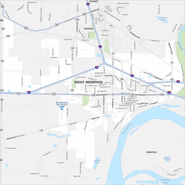
Start with this map of West Memphis across the Mississippi River from Memphis. Our map shows the main interstates and highways.