Map of Sterling Heights, Michigan
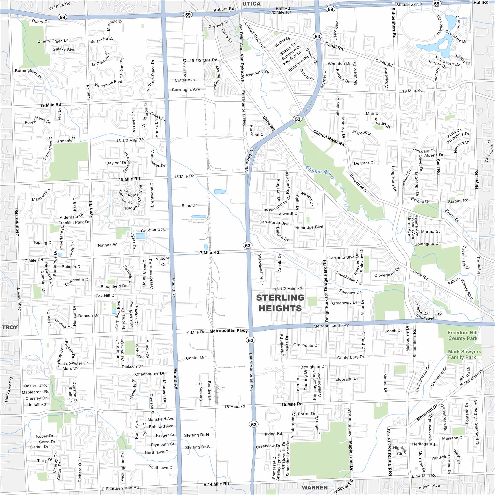
Our map of Sterling Heights shows this large Detroit suburb. Neighborhoods, parks, and busy roadways stretch across Macomb County.
Map Information
On the Map
Interstates/Highways: State Hwy 53, State Hwy 59 Major Roads: Metropolitan Pkwy, 15 Mile Rd, 17 Mile Rd, 18 Mile Rd, 14 Mile Rd, 19 Mile Rd, Mound Rd, Van Dyke Ave, Dequindre Rd, Ryan Rd, Dodge Park Rd, Schoenherr Rd, Hayes Rd, Utica Rd, Canal Rd, Hall Rd, 16 1/2 Mile Rd Major Rivers: Clinton River Parks and Preserves: Freedom Hill County Park, Mark Sawyers Family Par Nearby Communities: Utica, Sterling Heights, Troy, WarrenMichigan State Maps
Get to know Michigan with our detailed maps


City Maps of Michigan
Check out our maps of Detroit and other cities in Michigan


