Map of Scottsdale, Arizona
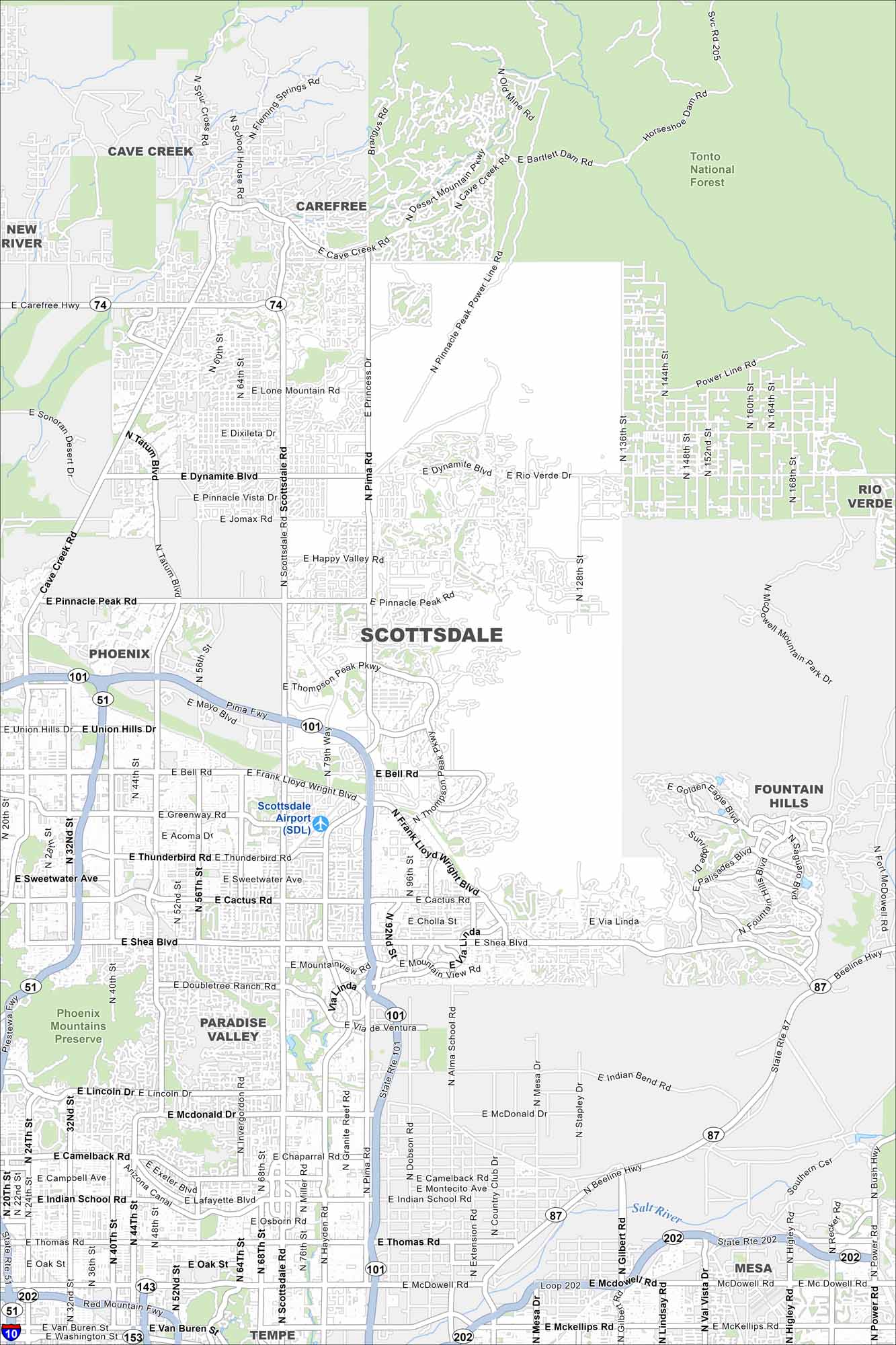
Our map of Scottsdale shows the highway, parks and trails leading into the McDowell Mountains. It’s a handy way to plan your visit through this part of the Phoenix metropolitan area.
Arizona State Maps
Check out our Arizona state maps we’ve put together


Map Information
On the Map
Interstates/Highways: Pima Fwy, Loop 101, State Rte 101, Loop 202, State Rte 202, Red Mountain Fwy, State Rte 87, Beeline Hwy, US Hwy 60, State Rte 51, Piestewa Fwy, State Rte 143, State Rte 153 Major Roads: Scottsdale Rd, Shea Blvd, Frank Lloyd Wright Blvd, Bell Rd, Thompson Peak Pkwy, Pima Rd, Dynamite Blvd, Pinnacle Peak Rd, Carefree Hwy, Indian School Rd, Thomas Rd, McDowell Rd, Camelback Rd, McDonald Dr, Lincoln Dr, Doubletree Ranch Rd, Cactus Rd, Thunderbird Rd, Greenway Rd, Rio Verde Dr Airports: Scottsdale Airport (SDL) Rivers and Creeks: Salt River Parks/Preserves/Forests: Tonto National Forest, Phoenix Mountains Preserve Nearby Communities: Phoenix, Paradise Valley, Tempe, Mesa, Fountain Hills, Rio Verde, Carefree, Cave Creek, New River Neighborhoods: Old Town ScottsdaleArizona City Maps
Here’s our full batch of Arizona city maps


