Map of Sanford, Florida
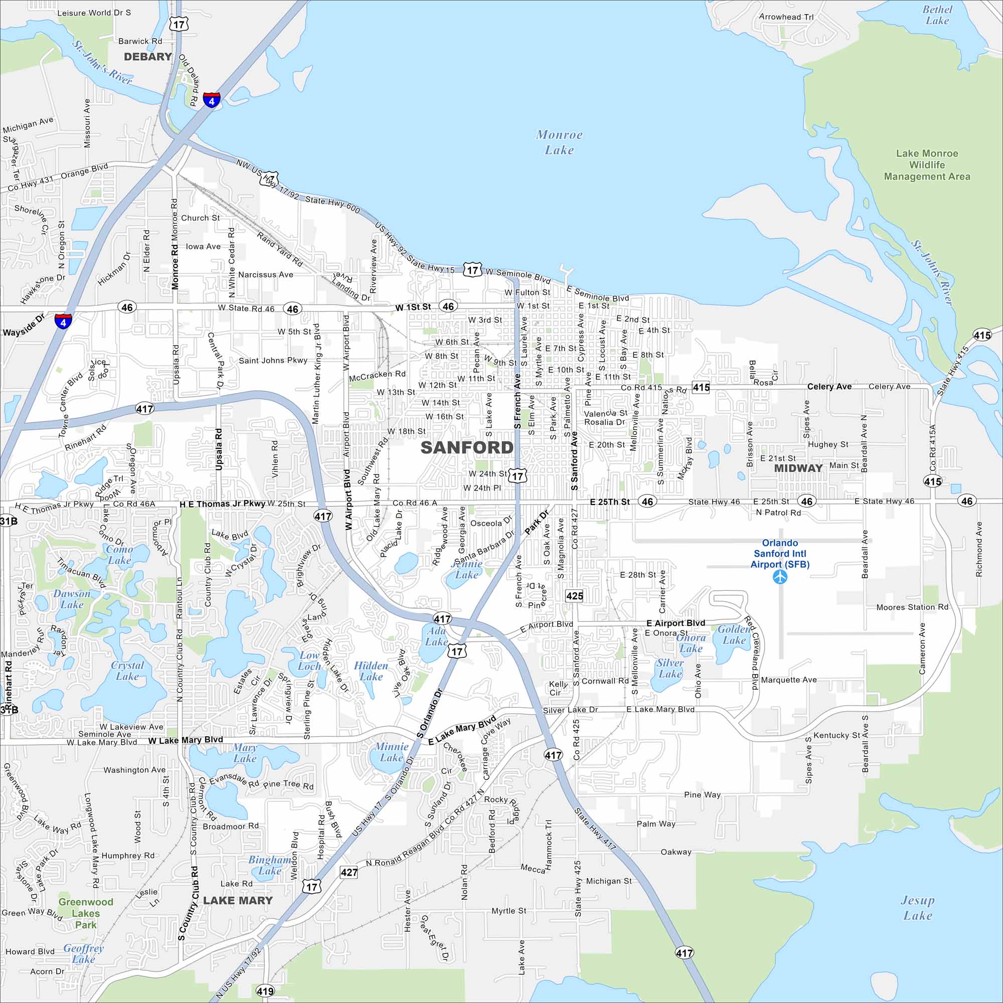
Here’s our map of Sanford, where Lake Monroe meets a lively historic downtown. Our map helps you find the waterfront, Sanford International Airport, and nearby neighborhoods.
Florida State Maps
Discover Florida through our state maps


Map Information
On the Map
Interstates/Highways: I-4, US Hwy 17/92, US Hwy 17, US Hwy 92, State Rte 46, State Rte 417, State Rte 415 Major Roads: Seminole Blvd, Lake Mary Blvd, Airport Blvd, 25th St, French Ave, Sanford Ave, 1st St, Country Club Rd, Celery Ave, Mellonville Ave, 13th St, 20th St, Upsala Rd, Monroe Rd, Oregon St, Central Park Dr, Airport Rd, Sipes Ave, Beardall Ave, Brisson Ave Airports: Orlando Sanford Intl Airport (SFB) Lakes and Reservoirs: Monroe Lake, Lake Monroe, Jesup Lake, Crystal Lake, Hidden Lake, Minnie Lake, Mary Lake, Bingham Lake, Como Lake, Dawson Lake, Ada Lake, Jennie Lake, Loch Low Major Rivers: St. Johns River Parks and Preserves: Lake Monroe Wildlife Management Area, Greenwood Lakes Park Nearby Communities: Midway, Lake Mary, DeBaryFlorida City Maps
Chart your course through Miami and Florida’s cities


