Map of Salisbury, North Carolina
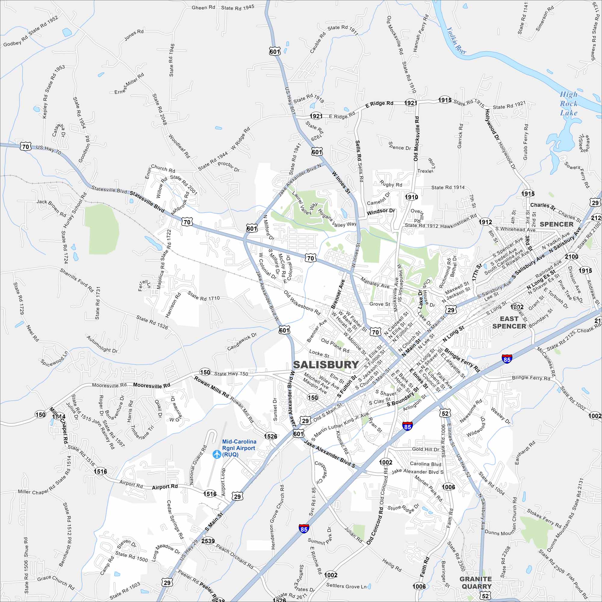
Our map of Salisbury highlights the historic downtown blocks. It shows how the city connects to nearby highways and towns. It’s a hub with a rich past.
Map Information
On the Map
Interstates/Highways: I-85, US Hwy 29, US Hwy 52, US Hwy 70, US Hwy 601, State Rte 150, State Rte 152 Major Roads: Jake Alexander Blvd, Innes St, Main St, Salisbury Ave, Long St, Brenner Ave, Statesville Blvd, Mooresville Rd, Lincolnton Rd, Faith Rd, Old Concord Rd, Julian Rd, Newsome Rd, Stokes Ferry Rd, Bringle Ferry Rd, Mocksville Ave, Ridge Rd, Woodleaf Rd, Milford Dr, Miller Rd Airports: Mid-Carolina Rgnl Airport (RUQ) Major Rivers: Yadkin River Nearby Communities: Spencer, East Spencer, Granite QuarryNorth Carolina State Maps
Get to know the mountains and coastlines of North Carolina.


City Maps of North Carolina
Journey through North Carolina with our city maps


