Map of Saginaw, Michigan
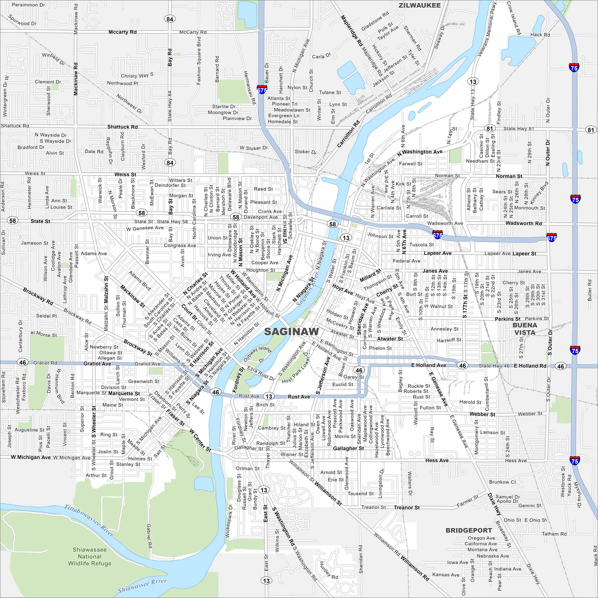
Our map of Saginaw highlights the river running through the city. It shows roads that link neighborhoods, downtown, and the bay. Use it to explore Saginaw, Michigan.
Map Information
On the Map
Interstates/Highways: I-675, I-75, State Rte 13, State Rte 46, State Rte 58, State Rte 81, State Rte 84 Major Roads: State St, Michigan Ave, Washington Ave, Gratiot Ave, Genesee Ave, Holland Ave, Bay Rd, Mackinaw St, Outer Dr, River Rd, Veterans Memorial Pkwy, Hess Ave, Williamson Rd, Lapeer Ave, Davenport Ave, Weiss St, Shattuck Rd, McCarty Rd, Dixie Hwy, Janes Ave Major Rivers: Saginaw River, Tittabawassee River, Shiawassee River Parks and Preserves: Shiawassee National Wildlife Refuge Nearby Communities: Zilwaukee, Buena Vista, BridgeportMichigan State Maps
Get to know Michigan with our detailed maps


City Maps of Michigan
Check out our maps of Detroit and other cities in Michigan


