Map of Royal Palm Beach, Florida
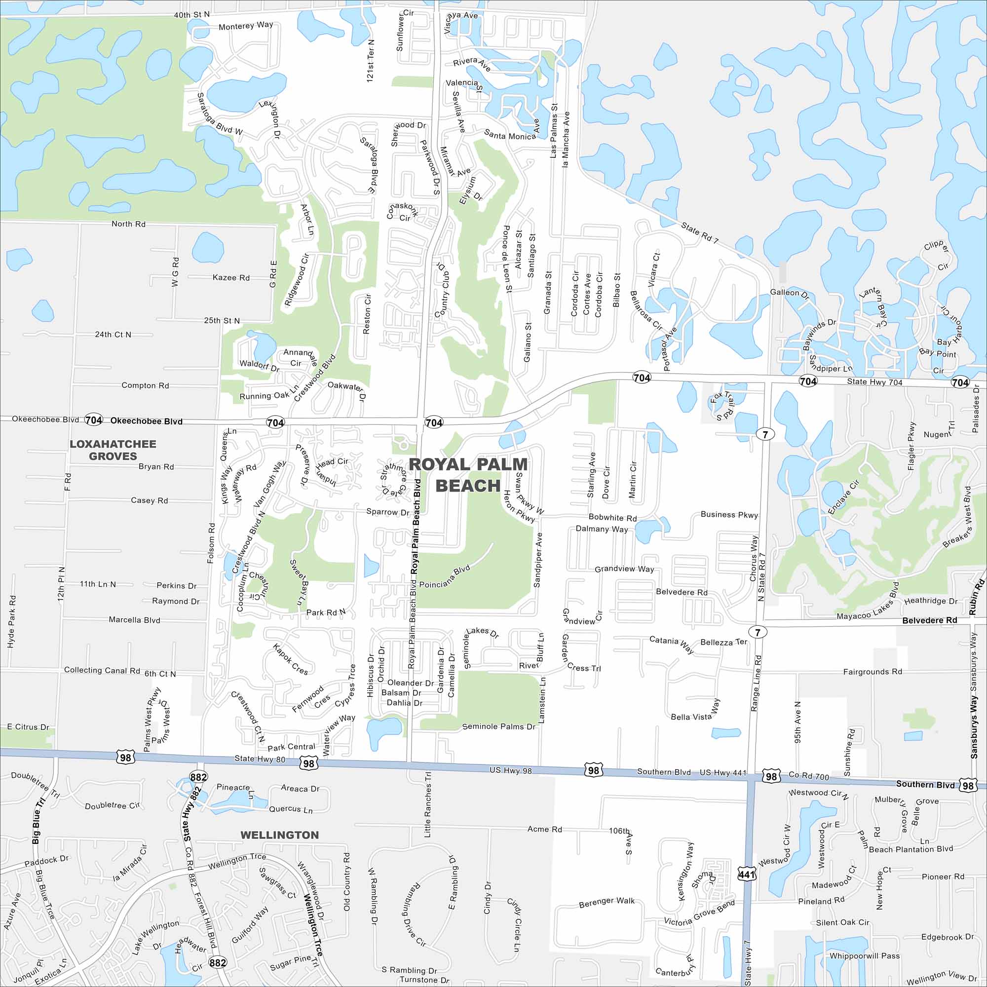
Our street map of Royal Palm Beach highlights parks, lakes, and neighborhoods. It shows how the roads connect through this growing community.
Florida State Maps
Discover Florida through our state maps


Map Information
On the Map
Interstates/Highways: US Hwy 98, US Hwy 441, State Rte 704, State Rte 882, State Rte 7 Major Roads: Southern Blvd, Okeechobee Blvd, Royal Palm Beach Blvd, Crestwood Blvd, Forest Hill Blvd, Belvedere Rd, Sansburys Way, Palms West Pkwy, Folsom Rd, La Mancha Ave, Ponce de Leon St, Madrid St, Sparrows Dr, Grandview Way, Wildcat Way, Acme Rd, 106th Ave S, Victoria Grove Blvd, Madison Green Dr, Country Club Dr Nearby Communities: Loxahatchee Groves, WellingtonFlorida City Maps
Chart your course through Miami and Florida’s cities


