Map of Rocky Mount, North Carolina
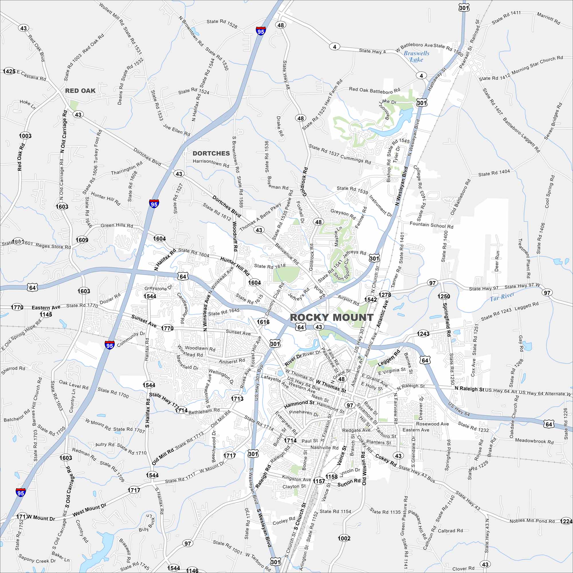
We’ve mapped out every major road in Rocky Mount. Downtown streets, local neighborhoods, and highway routes are all included. Get a full picture of this city in the Atlantic coastal plain region.
Map Information
On the Map
Interstates/Highways: I-95, US Hwy 64, US Hwy 301, State Rte 4, State Rte 43, State Rte 48, State Rte 97 Major Roads: Wesleyan Blvd, Atlantic Ave, Church St, Winstead Ave, Fairview Rd, Raleigh Rd, Cokey Rd, Benvenue Rd, Hunter Hill Rd, Dortches Blvd, Thomas A Betts Pkwy, Country Club Rd, Airport Rd, Sunset Ave, Thomas St, Washington St, Grand Ave, Springfield Rd, Leggett Rd, Old Wilson Rd Lakes and Reservoirs: Braswells Lake Major Rivers: Tar River Nearby Communities: Dortches, Red OakNorth Carolina State Maps
Get to know the mountains and coastlines of North Carolina.


City Maps of North Carolina
Journey through North Carolina with our city maps


