Map of Rochester Hills, Michigan
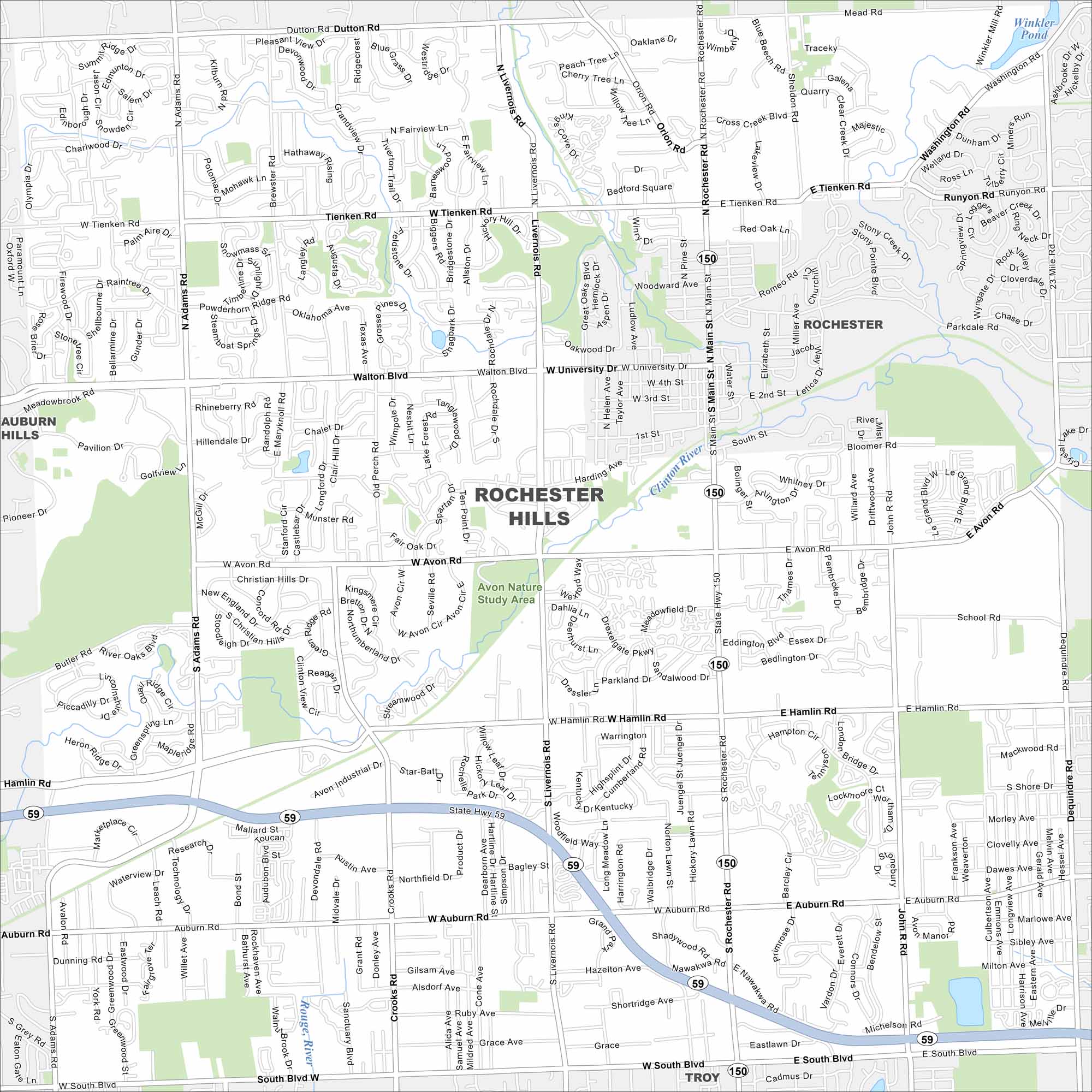
We’ve mapped out every major road in Rochester Hills. Find out how the neighborhoods connect and where the green spaces sit.
Map Information
On the Map
Interstates/Highways: State Rte 59, State Rte 150 Major Roads: Rochester Rd, Walton Blvd, Auburn Rd, Avon Rd, Tienken Rd, Hamlin Rd, Adams Rd, Livernois Rd, Crooks Rd, South Blvd, University Dr, Dequindre Rd, Main St, Dutton Rd, Mead Rd, Washington Rd, Letica Dr, Parkdale Rd, 23 Mile Rd, Winkler Mill Rd Lakes and Reservoirs: Winkler Pond, Crystal Lake Major Rivers: Clinton River Parks and Preserves: Avon Nature Study Area Nearby Communities: Auburn Hills, Rochester, TroyMichigan State Maps
Get to know Michigan with our detailed maps


City Maps of Michigan
Check out our maps of Detroit and other cities in Michigan


