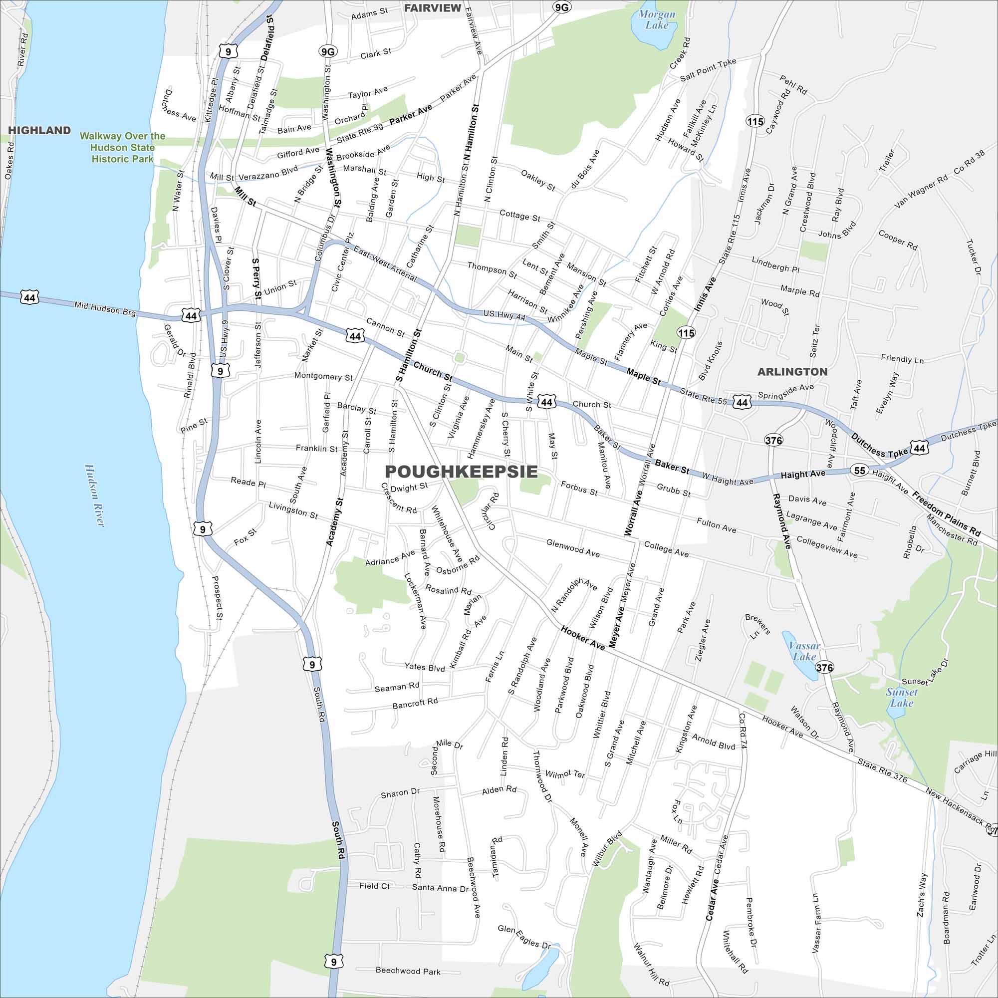
Map of Poughkeepsie, New York
Poughkeepsie stretches along the Hudson River with bridges connecting to west-side towns. Nearby hills shape neighborhoods and parks. The city is home to Vassar College and riverfront trails.
Map Information
On the Map
Interstates/Highways: US Hwy 44, US Hwy 9, State Rte 9g, State Rte 115, State Rte 55, State Rte 376 Major Roads: Main St, Church St, Mill St, Mansion St, Arterial, Market St, Hamilton St, Clinton St, Academy St, Smith St, Parker Ave, Hooker Ave, Taft Ave, Innis Ave, Raymond Ave, Grand Ave, South Ave, Ferris Ln, Worrall Ave, Forbus St Lakes and Reservoirs: Morgan Lake, Vassar Lake, Sunset Lake Major Rivers: Hudson River Parks and Preserves: Walkway Over the Hudson State Historic Park Nearby Communities: Highland, Fairview, ArlingtonNew York State Maps
Find state maps of the Empire State.


City Maps of New York
Here are the city maps that define New York


