Map of Port Orange, Florida
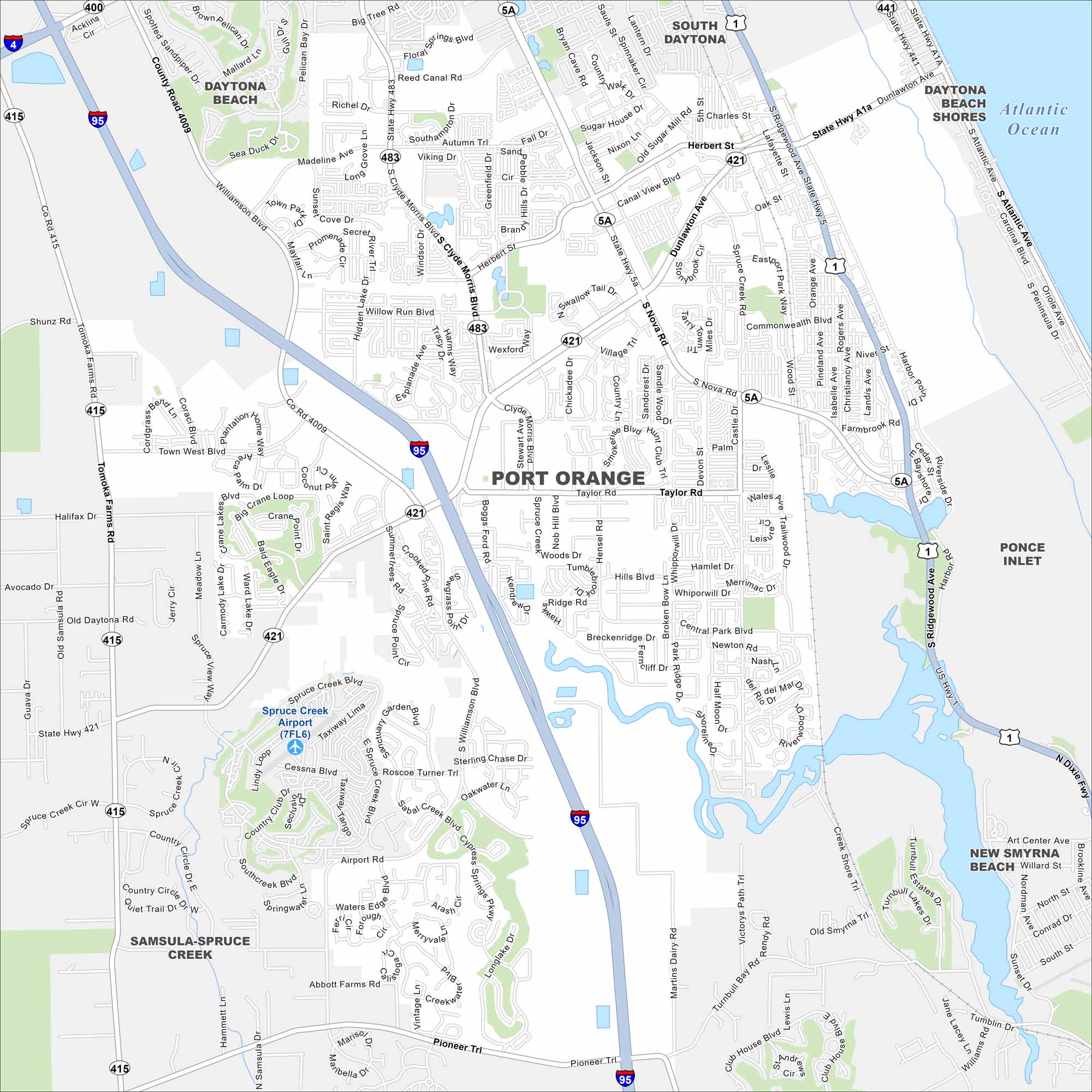
Our map of Port Orange lays out suburban neighborhoods along the Halifax River. You’ll see easy access to nearby beaches and wetlands. The city is just south of Daytona Beach.
Florida State Maps
Discover Florida through our state maps


Map Information
On the Map
Interstates/Highways: I-95, US Hwy 1, State Rte 5A, State Rte 421, State Rte 483, State Rte 415 Major Roads: Ridgewood Ave, Dunlawton Ave, Nova Rd, Taylor Rd, Williamson Blvd, Clyde Morris Blvd, Spruce Creek Blvd, Pioneer Trl, Tomoka Farms Rd, Madeline Ave, Herbert St, Commonwealth Blvd, Spruce Creek Rd, Airport Rd, Village Trl, Town West Blvd, Crane Lakes Blvd, Summerrees Rd, Willow Run Blvd, Reed Canal Rd Airports: Spruce Creek Airport (7FL6) Lakes and Reservoirs: Atlantic Ocean Nearby Communities: Daytona Beach, South Daytona, Daytona Beach Shores, Ponce Inlet, New Smyrna Beach, Samsula-Spruce CreekFlorida City Maps
Chart your course through Miami and Florida’s cities


