Map of Port Huron, Michigan
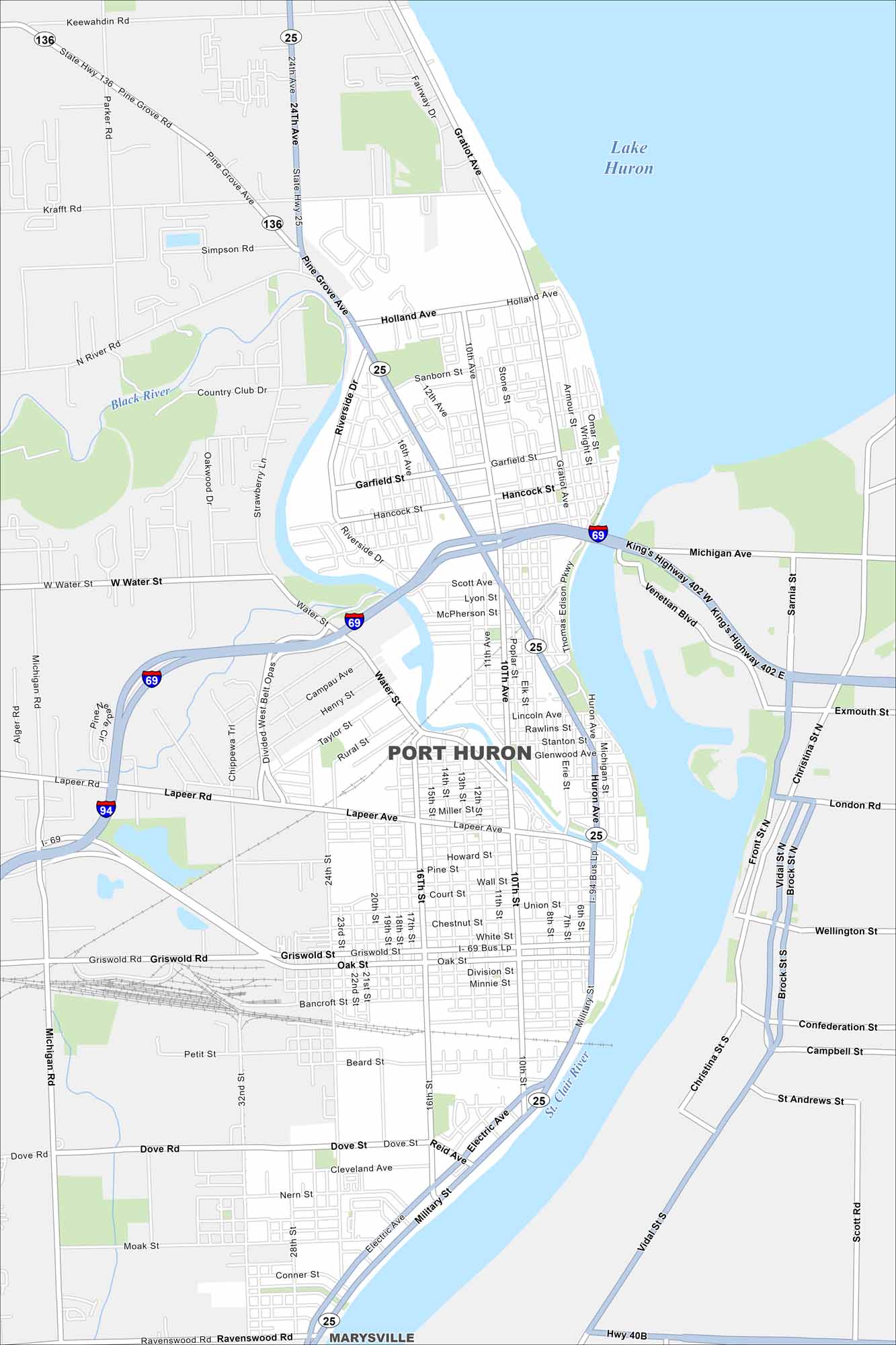
Port Huron sits at the base of Lake Huron where the St. Clair River begins. Our map makes it easy to see the downtown stretch along the waterfront. The Blue Water Bridge connects directly to Canada.
Map Information
On the Map
Interstates/Highways: I-69, I-94, State Rte 25, State Rte 136 Major Roads: Pine Grove Ave, Lapeer Ave, Military St, 24th Ave, Gratiot Ave, Water St, Griswold St, Hancock St, Holland Ave, Krafft Rd, Keewahdin Rd, 10th St, 16th St, 10th Ave, Riverside Dr, Michigan Ave, Sanborn St, 7th St, Dove Rd, Electric Ave Lakes and Reservoirs: Lake Huron Major Rivers: St. Clair River, Black River Nearby Communities: Marysville, SarniaMichigan State Maps
Get to know Michigan with our detailed maps


City Maps of Michigan
Check out our maps of Detroit and other cities in Michigan


