Map of Port Chester, New York
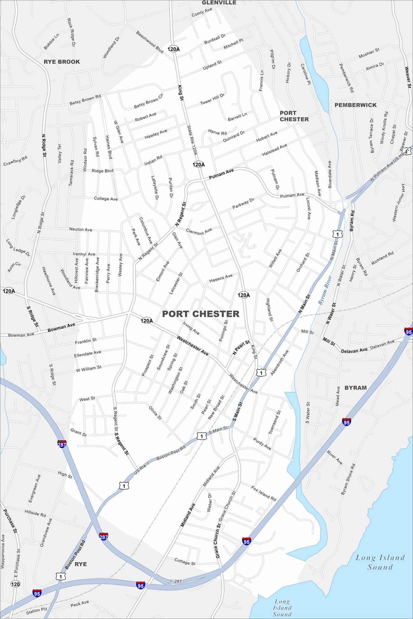
Our map of Port Chester shows its compact downtown along the Byram River. The streets lead right into the waterfront of the Long Island Sound. The town also borders Connecticut, making it part of a busy metro corridor.
Map Information
On the Map
Interstates/Highways: I-95, I-287, US Rte 1, State Rte 120, State Rte 120A Major Roads: Main St, Boston Post Rd, Westchester Ave, King St, Putnam Ave, Regent St, Ridge St, Bowman Ave, Grace Church St, Midland Ave, Pearl St, Willett Ave, Main St, High St, College Ave, Byram Rd, Henry St, Mill St, Purchase St, Glenville Rd Lakes and Reservoirs: Long Island Sound Major Rivers: Byram River Nearby Communities: Rye Brook, Glenville, Pemberwick, Byram, RyeNew York State Maps
Find state maps of the Empire State.


City Maps of New York
Here are the city maps that define New York


