Map of Plantation, Florida
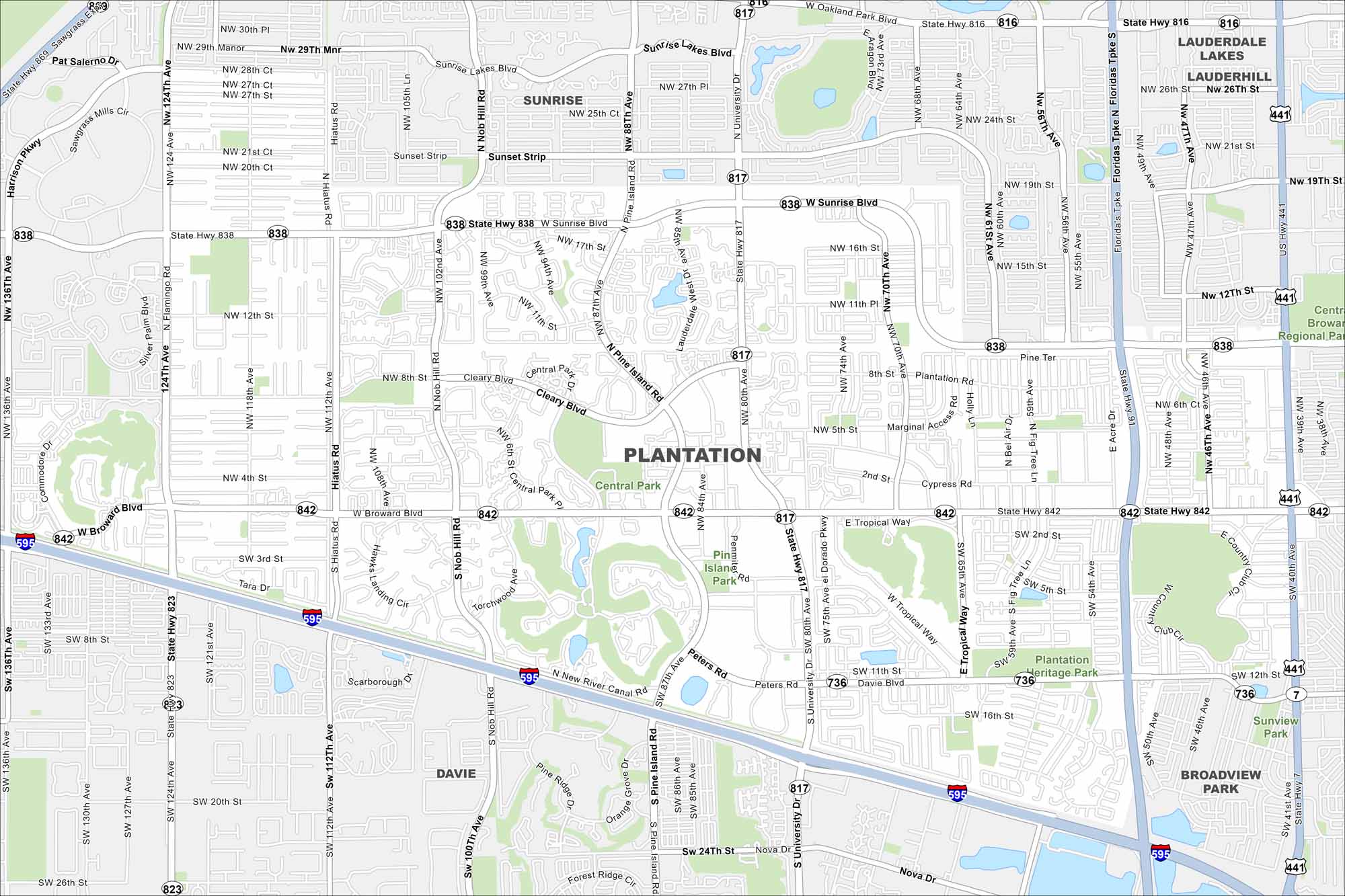
Check out our map of Plantation, west of Fort Lauderdale. It highlights residential neighborhoods, highways, and canals. The city has a suburban feel with easy access to the coast.
Florida State Maps
Discover Florida through our state maps


Map Information
On the Map
Interstates/Highways: I-595, US Hwy 441, State Rte 838, State Rte 842, State Rte 817, State Rte 823 Major Roads: Sunrise Blvd, Broward Blvd, University Dr, Pine Island Rd, Peters Rd, Cleary Blvd, Nob Hill Rd, Hiatus Rd, Flamingo Rd, 441, New River Canal Rd, 5th St, 8th St, 2nd St, Cypress Rd, 70th Ave, 102nd Ave, 124th Ave, 63rd Ave, 46th Ave Parks and Preserves: Central Park, Pine Island Park, Plantation Heritage Park, Sunview Park Nearby Communities: Sunrise, Davie, Broadview Park, Lauderdale Lakes, LauderhillFlorida City Maps
Chart your course through Miami and Florida’s cities


