Map of Pinehurst, North Carolina
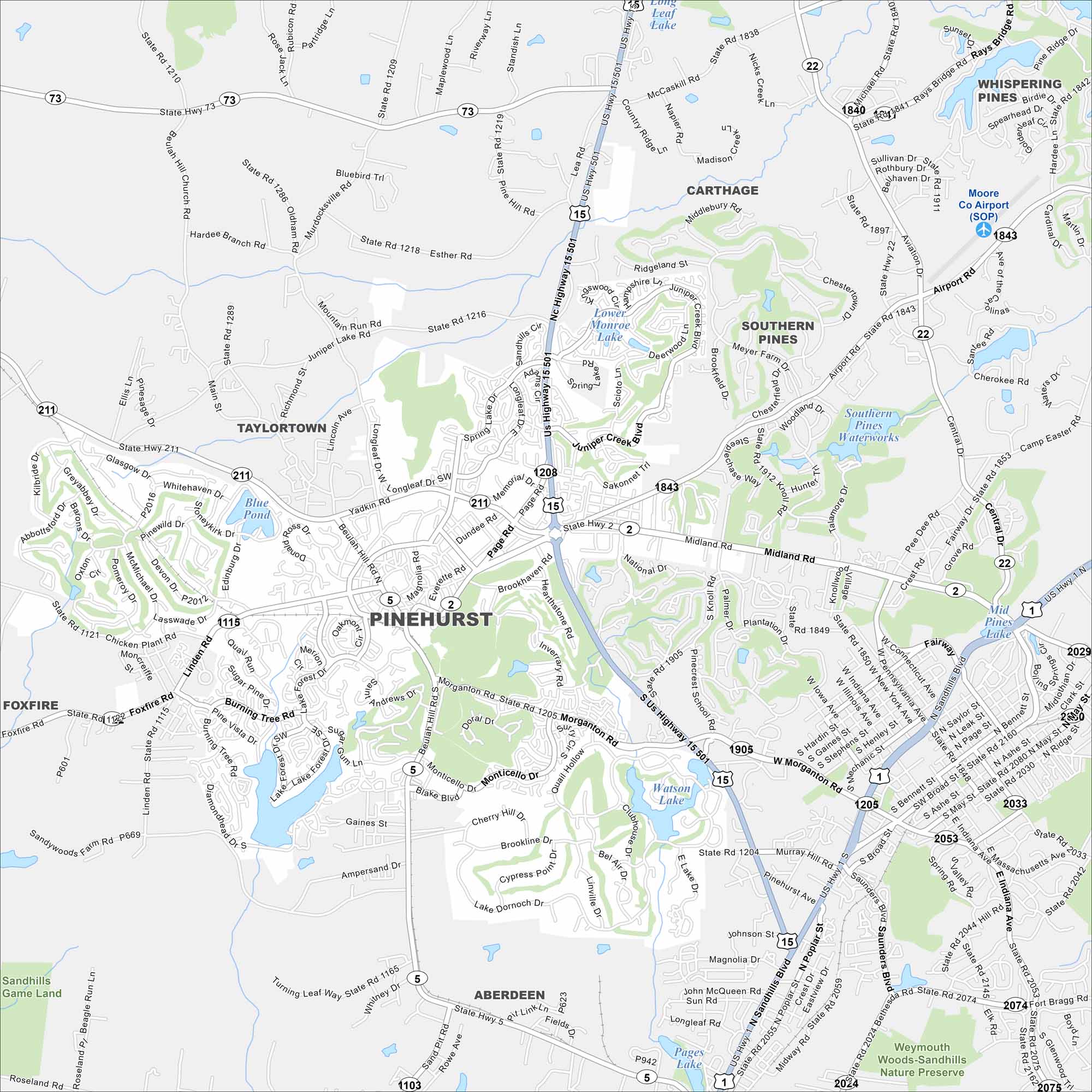
Take a look at Pinehurst, famous for its golf courses. Our map shows its winding streets around resort communities and green spaces. The village is at the heart of North Carolina’s Sandhills.
Map Information
On the Map
Interstates/Highways: US Hwy 1, US Hwy 15, US Hwy 501, State Rte 2, State Rte 5, State Rte 22, State Rte 73, State Rte 211 Major Roads: Morganton Rd, Midland Rd, Page Rd, Memorial Dr, Beulah Hill Rd, Linden Rd, Central Ave, Pennsylvania Ave, Connecticut Ave, Indiana Ave, Saunders Blvd, Hoffman Rd, Airport Rd, Vass Rd, Murdocksville Rd, Carthage Rd, Bluebird Trl, Monticello Dr, Longleaf Dr, Rattlesnake Trl Airports: Moore Co Airport (SOP) Lakes and Reservoirs: Pine Lake, Lower Monroe Lake, Watson Lake, Pages Lake, Blue Pond, Mid Pines Lake, Long Leaf Lake Parks and Preserves: Sandhills Game Land, Weymouth Woods-Sandhills Nature Preserve Nearby Communities: Carthage, Whispering Pines, Southern Pines, Aberdeen, Taylortown, FoxfireNorth Carolina State Maps
Get to know the mountains and coastlines of North Carolina.


City Maps of North Carolina
Journey through North Carolina with our city maps


