Map of Peoria, Arizona
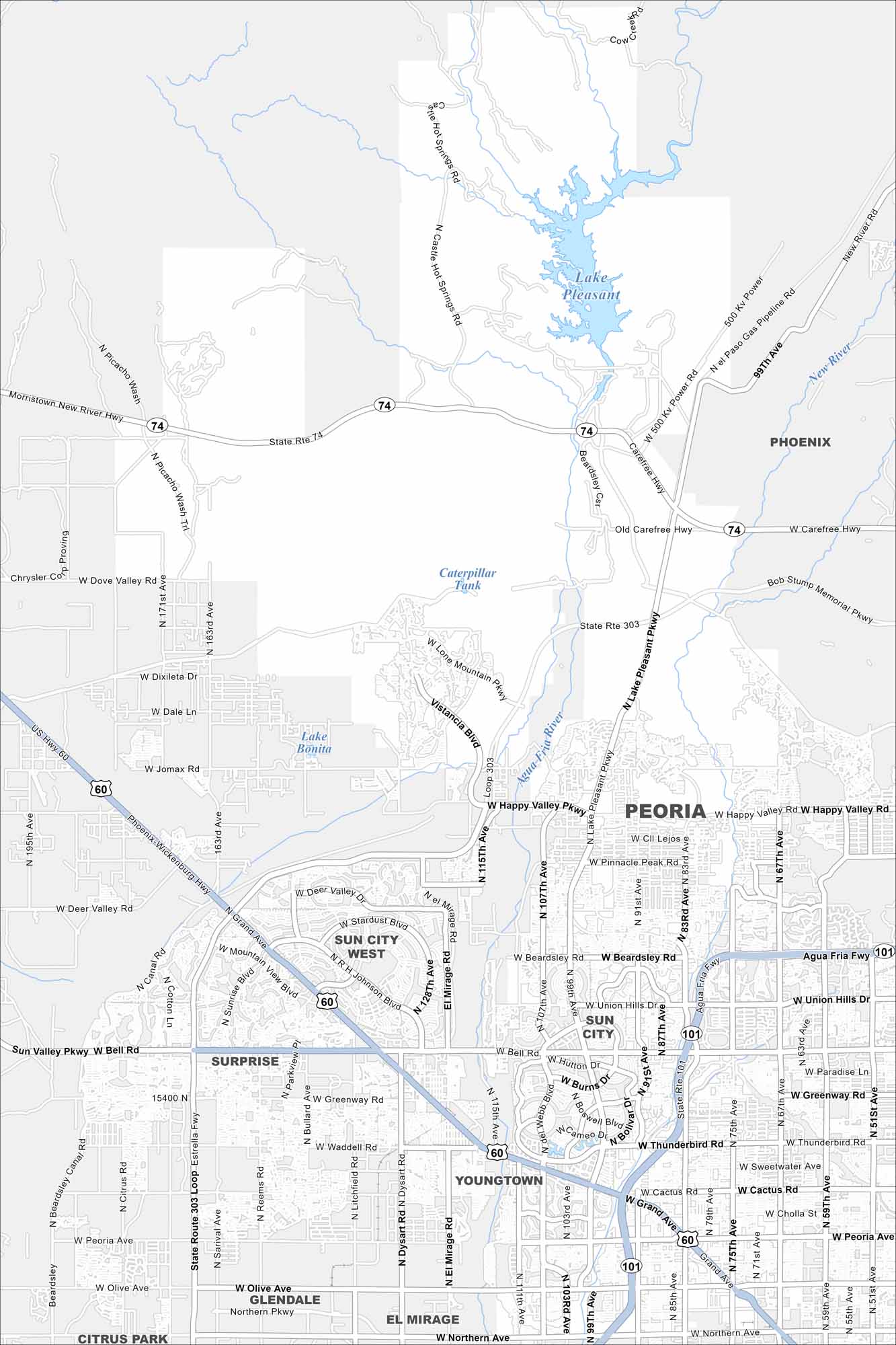
Take a look at Peoria spreading northwest of Phoenix. The map shows Lake Pleasant to the north and desert neighborhoods stretching outward. Hiking trails add to the mix.
Arizona State Maps
Check out our Arizona state maps we’ve put together


Map Information
On the Map
Interstates/Highways: State Rte 74, US Hwy 60, Grand Ave, State Route 303 Loop, Agua Fria Fwy (101). Major Roads: Happy Valley Rd, Lake Pleasant Pkwy, Bell Rd, Vistancia Blvd, Olive Ave, Northern Ave, Peoria Ave, Cactus Rd, Thunderbird Rd, Greenway Rd, Union Hills Dr, Beardsley Rd, Deer Valley Rd, Jomax Rd, Lone Mountain Pkwy, Dixileta Dr, Dove Valley Rd, Carefree Hwy, Sun Valley Pkwy, El Mirage Rd Lakes and Reservoirs: Lake Pleasant, Lake Bonita, Caterpillar Tank Rivers and Creeks: Agua Fria River, New River Nearby Communities: Surprise, Sun City, Sun City West, Youngtown, El Mirage, Glendale, PhoenixArizona City Maps
Here’s our full batch of Arizona city maps


