Map of Peekskill, New York
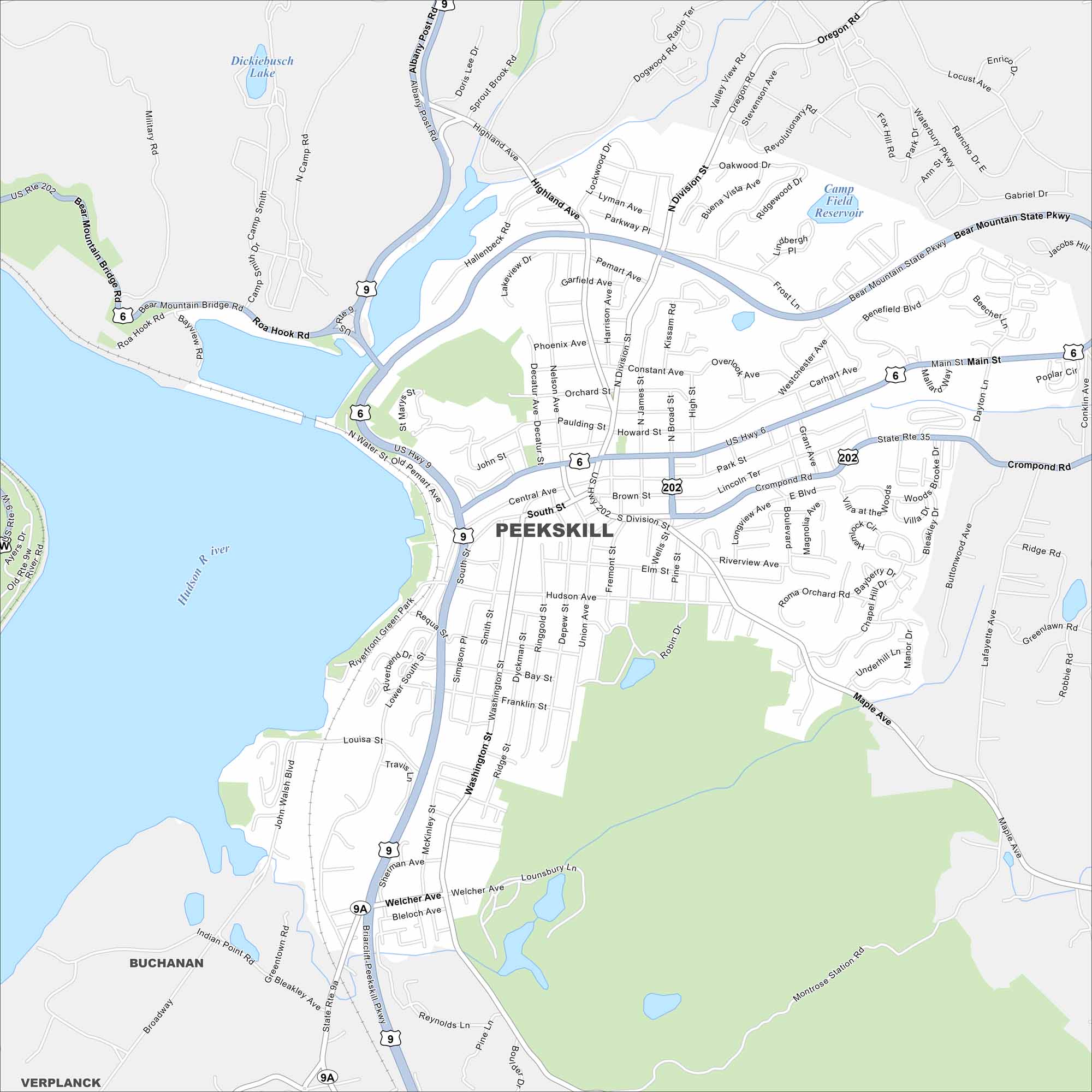
Our map of Peekskill outlines a small city on the Hudson River. Hills rise behind its downtown and riverfront. The city is known for its arts scene and historic architecture.
Map Information
On the Map
Interstates/Highways: US Hwy 6, US Hwy 9, US Hwy 202, State Rte 9A, State Rte 35 Major Roads: Main St, Crompond Rd, South St, Division St, Washington St, Welcher Ave, Highland Ave, Bear Mountain Bridge Rd, Albany Post Rd, Hudson Ave, Central Ave, Nelson Ave, Broad St, Wells St, Maple Ave, Park St, Grant Ave, Beach Rd, Locust Ave, Oregon Rd Lakes and Reservoirs: Dickiebusch Lake, Camp Field Reservoir Major Rivers: Hudson River Nearby Communities: Buchanan, VerplanckNew York State Maps
Find state maps of the Empire State.


City Maps of New York
Here are the city maps that define New York


