Map of Parkland, Florida
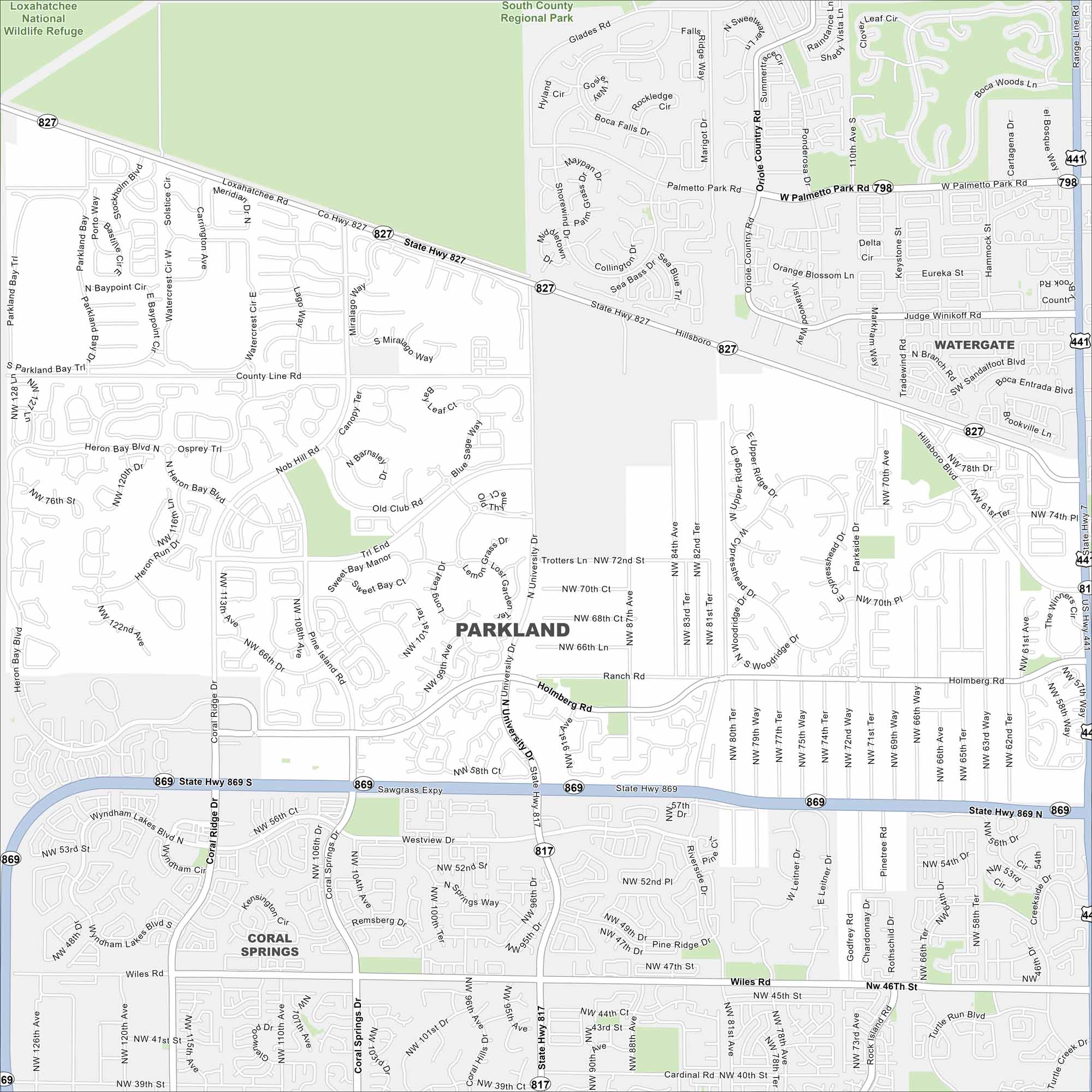
Take a look at Parkland, a suburban city north of Fort Lauderdale. Our map shows quiet neighborhoods, lakes, and parks. The area balances residential living with green space.
Florida State Maps
Discover Florida through our state maps


Map Information
On the Map
Interstates/Highways: US Hwy 441, State Rte 7, State Rte 81, State Rte 827, State Rte 869 Major Roads: Loxahatchee Rd, Holmberg Rd, Wiles Rd, University Dr, Coral Ridge Dr, Hillsboro Blvd, Palmetto Park Rd, Nob Hill Rd, Pine Island Rd, Godfrey Rd, Rock Island Rd, Turtle Run Blvd, Parkside Dr, Woodridge Dr, Cypresshead Dr, Riverside Dr, Leitner Dr Parks and Preserves: South County Regional Park, Loxahatchee National Wildlife Refuge Nearby Communities: Coral Springs, WatergateFlorida City Maps
Chart your course through Miami and Florida’s cities


