Map of Panama City, Florida
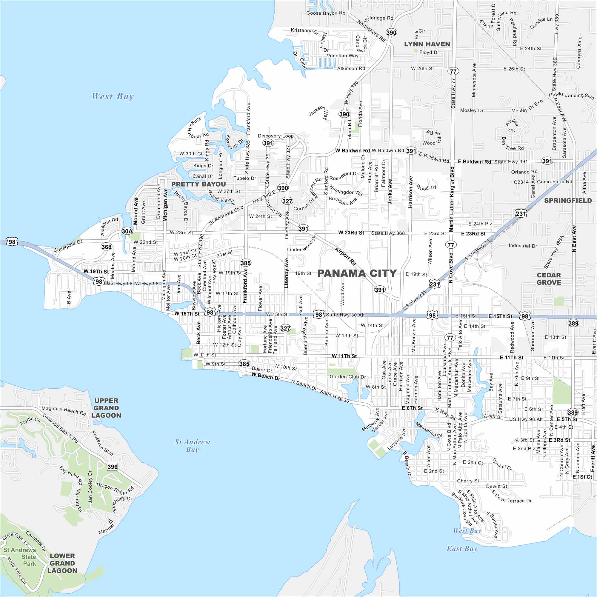
Take a look at Panama City on St. Andrews Bay. This map highlights its downtown, port areas, and residential neighborhoods. The city serves as the commercial and cultural hub of Bay County.
Florida State Maps
Discover Florida through our state maps


Map Information
On the Map
Interstates/Highways: US Hwy 98, US Hwy 231, State Rte 22, State Rte 30, State Rte 75, State Rte 77, State Rte 368, State Rte 389, State Rte 390, State Rte 391 Major Roads: 23rd St, 15th St, 11th St, 6th St, 5th St, Baldwin Rd, Lisenby Ave, Harrison Ave, Martin Luther King Jr Blvd, Cove Blvd, Beck Ave, Frankford Ave, Airport Rd, Jenks Ave, St Andrews Blvd, Michigan Ave, Beach Dr, Game Farm Rd, Everitt Ave Lakes and Reservoirs: St Andrew Bay, West Bay, East Bay, Goose Bayou Nearby Communities: Pretty Bayou, Lynn Haven, Springfield, Cedar Grove, Upper Grand Lagoon, Lower Grand LagoonFlorida City Maps
Chart your course through Miami and Florida’s cities


