Map of Palm Beach, Florida
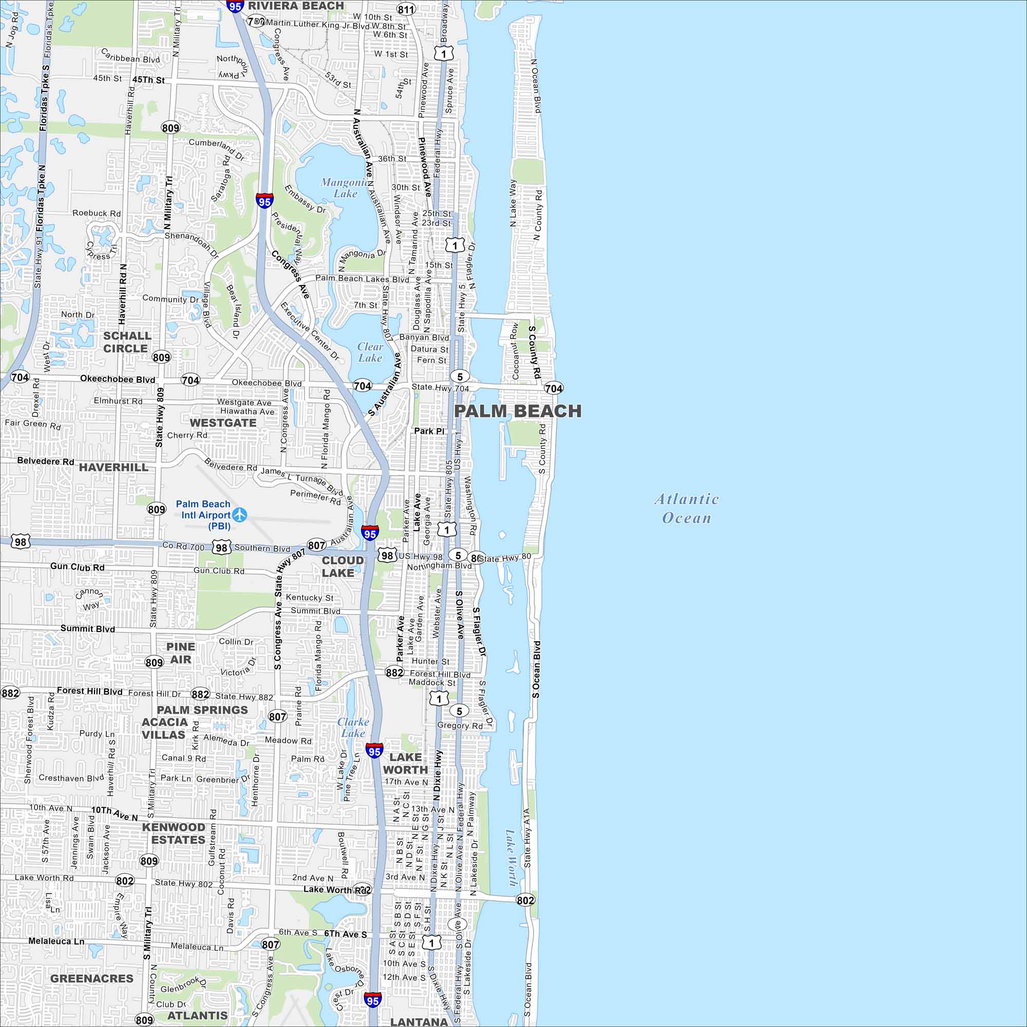
Palm Beach sits on a barrier island between the Intracoastal Waterway and the Atlantic. Use this map to see its oceanfront estates and famous shopping districts. The Breakers and Worth Avenue stand out as landmarks.
Florida State Maps
Discover Florida through our state maps


Map Information
On the Map
Interstates/Highways: I-95, US Hwy 1, US Hwy 98, State Rte 704, State Rte 802, State Rte 807, State Rte 809, State Rte 882 Major Roads: Southern Blvd, Okeechobee Blvd, Forest Hill Blvd, Lake Worth Rd, Congress Ave, Military Trl, Dixie Hwy, Olive Ave, Flagler Dr, Ocean Blvd, Australian Ave, Belvedere Rd, Parker Ave, Summit Blvd, Gun Club Rd, Haverhill Rd, Jog Rd, 10th Ave, 6th Ave Airports: Palm Beach Intl Airport (PBI) Lakes and Reservoirs: Atlantic Ocean, Lake Worth, Mangonia Lake, Clear Lake, Clarke Lake, Osborne Lake Nearby Communities: Riviera Beach, Schall Circle, Westgate, Haverhill, Cloud Lake, Palm Springs, Acacia Villas, Kenwood Estates, Greenacres, Atlantis, Lake Worth, LantanaFlorida City Maps
Chart your course through Miami and Florida’s cities


