Map of Palm Bay, Florida
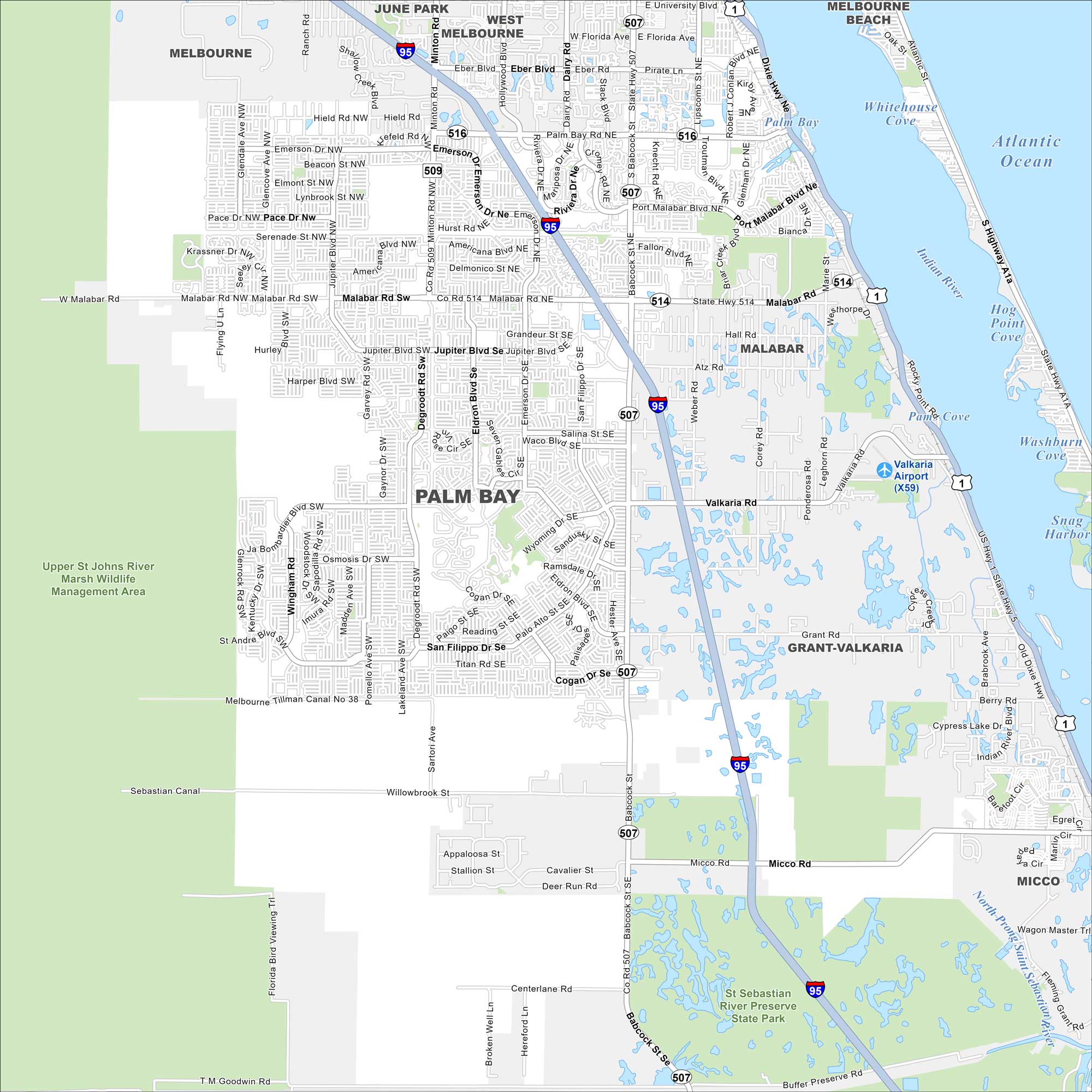
Palm Bay stretches along the Indian River Lagoon on Florida’s Space Coast. Check out our map to see its wide suburban layout and nearby nature preserves. The city is one of the largest in the region.
Florida State Maps
Discover Florida through our state maps


Map Information
On the Map
Interstates/Highways: I-95, US Hwy 1, State Rte 507, State Rte 514, State Rte 516, Dixie Hwy Major Roads: Malabar Rd, Babcock St, Minton Rd, Palm Bay Rd, Emerson Dr, Jupiter Blvd, San Filippo Dr, Riviera Dr, Eldron Blvd, Degroodt Rd, Port Malabar Blvd, Robert J Conlan Blvd, University Blvd, Florida Ave, Dairy Rd, Eber Blvd, Hield Rd Airports: Valkaria Airport (X59) Lakes and Reservoirs: Atlantic Ocean, Indian River, Palm Bay, Snag Harbor, Washburn Cove, Snag Harbor, Whitehouse Cove, Rocky Point Cove, Hog Point Cove Major Rivers: Indian River Parks and Preserves: Upper St Johns River Marsh Wildlife Management Area, St Sebastian River Preserve State Park Nearby Communities: Melbourne, June Park, West Melbourne, Melbourne Beach, Malabar, Grant-Valkaria, MiccoFlorida City Maps
Chart your course through Miami and Florida’s cities


