Map of Orlando, Florida
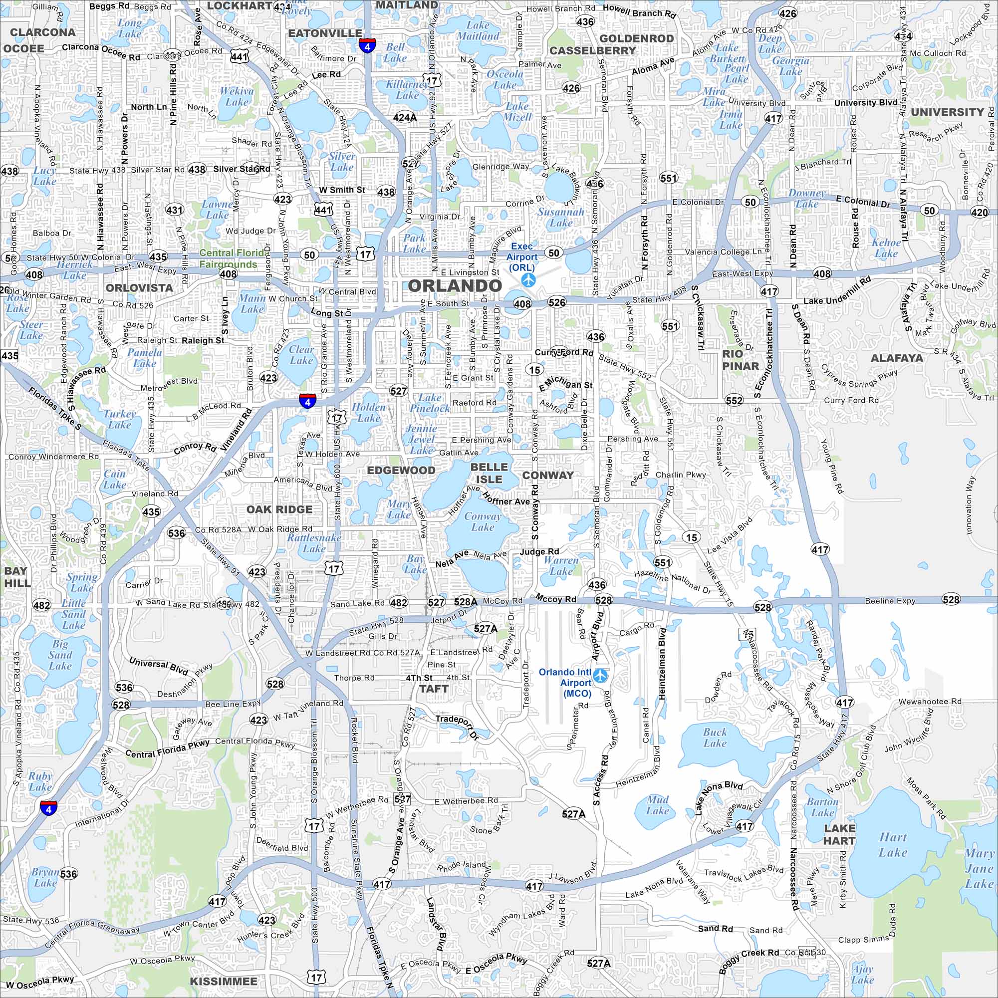
Orlando spreads across central Florida with lakes scattered everywhere. Our map highlights the downtown grid and road network. The city is world-famous for its theme parks.
Florida State Maps
Discover Florida through our state maps


Map Information
On the Map
Interstates/Highways: I-4, US Hwy 17, US Hwy 92, US Hwy 441, State Rte 408, State Rte 417, State Rte 429, State Rte 528 Major Roads: Colonial Dr, Orange Ave, Semoran Blvd, Kirkman Rd, Sand Lake Rd, International Dr, John Young Pkwy, Hiawassee Rd, Silver Star Rd, Lee Rd, Michigan St, Curry Ford Rd, Alafaya Trl, University Blvd, Goldenrod Rd, Conway Rd, Narcoossee Rd, Central Florida Pkwy, Osceola Pkwy Airports: Executive Airport (ORL), Orlando Intl Airport (MCO) Lakes and Reservoirs: Lake Maitland, Lake Howell, Lake Jessamine, Lake Conway, Lake Hart, Lake Mary Jane, Clear Lake, Silver Lake, Lake Underhill, Lake Pinelock, Lake Holden, Lake Nona, Buck Lake, Mud Lake, Barton Lake, Kehoe Lake, Deep Lake, Lake University, Pearl Lake Parks and Preserves: Central Florida Fairgrounds Nearby Communities: Lockhart, Eatonville, Maitland, Casselberry, Goldenrod, University, Alafaya, Rio Pinar, Conway, Belle Isle, Edgewood, Oak Ridge, Pine Castle, Taft, Hunters Creek, Kissimmee, Orlovista, Pine Hills, Ocoee Neighborhoods: Downtown OrlandoFlorida City Maps
Chart your course through Miami and Florida’s cities


