Map of Oneonta, New York
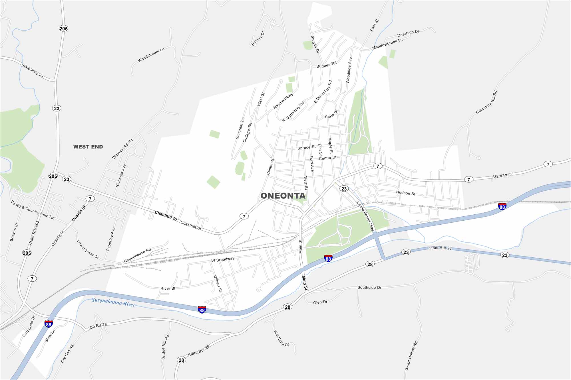
Oneonta rests in the northern Catskills. Our map shows a compact downtown with Interstate 88 running through on the south side. College campuses are a common sight so it has a strong student presence.
Map Information
On the Map
Interstates/Highways: I-88, State Rte 7, State Rte 23, State Rte 28, State Rte 205 Major Roads: Main St, Chestnut St, River St, Broadway, Southside Dr, Oneida St, Winney Hill Rd, Richards Ave, Ceperley Ave, Lower River St, East St, Center St, Ford Ave, Dietz St, Clinton St, West St, Ravine Pkwy, Swart Hollow Rd, Glen Dr, Cemetery Hill Rd Major Rivers: Susquehanna River Nearby Communities: West EndNew York State Maps
Find state maps of the Empire State.


City Maps of New York
Here are the city maps that define New York


