Olympic National Park Map
Olympic National Park is spread across Washington’s Olympic Peninsula. Our park map shows trails, roads, campgrounds, beaches, and more.
Map Information
On the Map
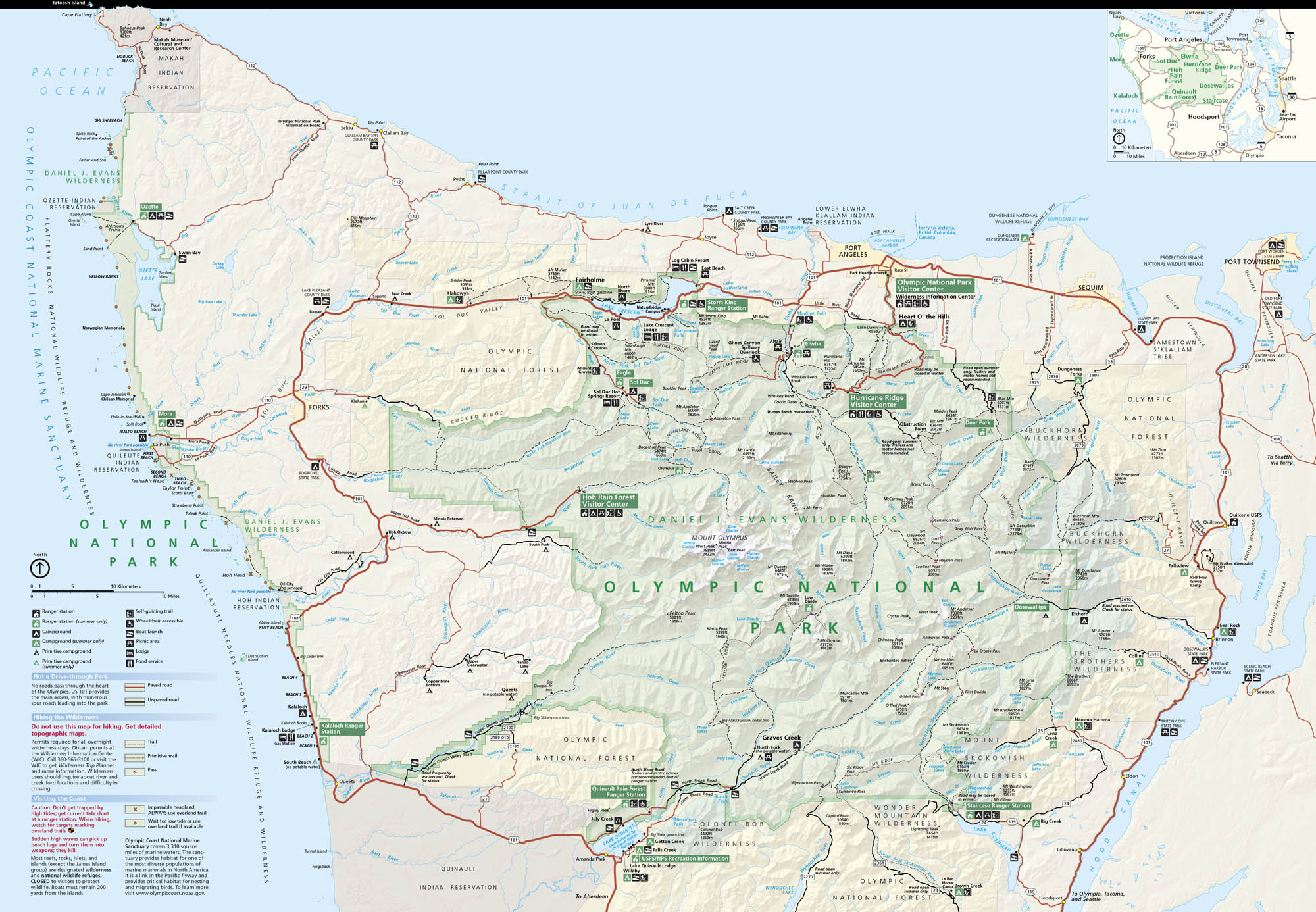
Parks: Olympic National Forest, Daniel J. Evans Wilderness, Olympic Coast National Marine Sanctuary Visitor Centers: Olympic National Park Visitor Center, Hoh Rain Forest Visitor Center, Hurricane Ridge Visitor Center, Storm King Ranger Station, Kalaloch Ranger Station, Quinault Rain Forest Ranger Station Major Roads: US Hwy 101, State Rte 112, State Rte 113, State Rte 20, State Rte 19, Upper Hoh Rd, Sol Duc Hot Springs Rd, Hurricane Ridge Rd, Deer Park Rd, Dosewallips Rd, Duckabush Rd, North Fork Rd, Quinault Lake South Shore Rd, Quinault Lake North Shore Rd Rivers, Lakes and Oceans: Pacific Ocean, Strait of Juan de Fuca, Lake Crescent, Lake Cushman, Lake Ozette, Quinault Lake, Hoh River, Quileute River, Queets River, Elwha River, Dosewallips River Cities/Towns: Port Angeles, Forks, Port Townsend, Sequim, Queets, Amanda Park, Quinault, Hoodsport, Quilcene Campgrounds/Park Sites: Heart O’ the Hills, Fairholme, Sol Duc, Mora, Hoh, Kalaloch, South Beach, Queets, Graves Creek, North Fork, Staircase, Deer Park Other Landmarks: Mount Olympus, Hurricane Ridge, Sol Duc Hot Springs, Lake Crescent Lodge, Log Cabin Resort, Kalaloch Lodge, Lake Quinault Lodge, Cape Flattery, Shi Shi Beach, Rialto Beach, Ruby BeachNational Park Maps
Find maps of green spaces and national parks near you.


