Map of North Miami, Florida
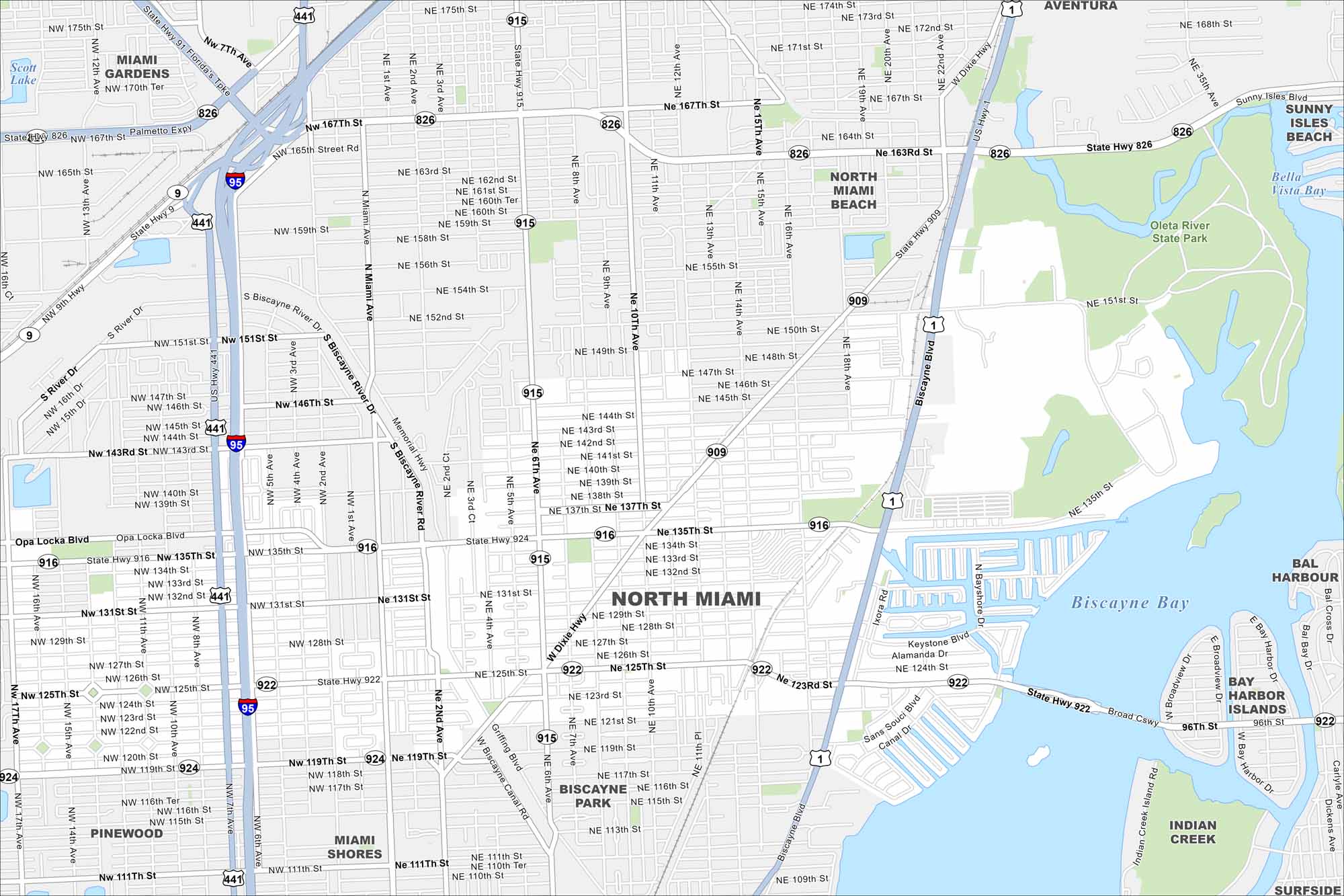
Our map of North Miami highlights this city along Biscayne Bay. It’s mostly waterways and dense neighborhoods that shape the area here. Oleta River State Park stands out as a large green space.
Florida State Maps
Discover Florida through our state maps


Map Information
On the Map
Interstates/Highways: I-95, US Hwy 1, US Hwy 441, State Hwy 826, State Hwy 915, State Hwy 909, State Hwy 916, State Hwy 922, State Hwy 924 Major Roads: 163rd St, North Miami Beach Blvd, 135th St, 125th St, 119th St, 6th Ave, Biscayne Blvd, 7th Ave, 2nd Ave, 12th Ave, 137th St, 143rd St, 151st St, 167th St, 10th Ave, 131st St, 147th St, 153rd St, 123rd St, 111th St Lakes and Reservoirs: Biscayne Bay, Bella Vista Bay Parks and Preserves: Oleta River State Park Nearby Communities: North Miami Beach, Miami Gardens, Aventura, Sunny Isles Beach, Bal Harbour, Bay Harbor Islands, Indian Creek, Surfside, Biscayne Park, Pinewood, Miami ShoresFlorida City Maps
Chart your course through Miami and Florida’s cities


