Map of North Miami Beach, Florida
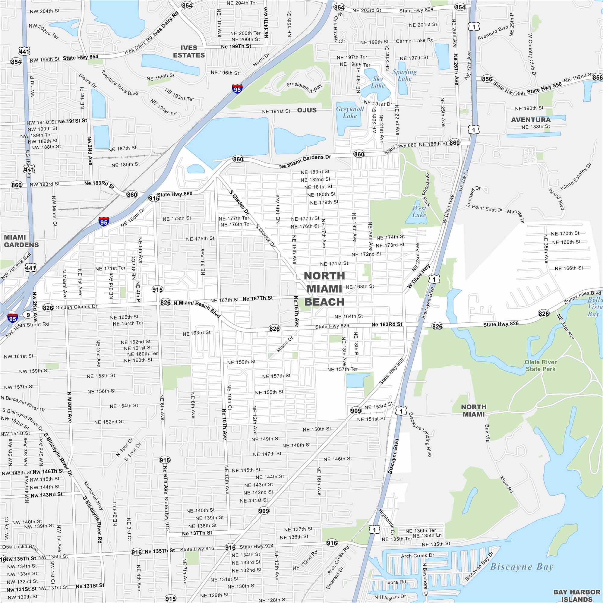
North Miami Beach lies inland from the coast but close to Biscayne Bay. This map shows a suburban layout of lakes, highways and streets. It’s one of the many linked communities in the Miami area.
Florida State Maps
Discover Florida through our state maps


Map Information
On the Map
Interstates/Highways: I-95, US Hwy 1, US Hwy 441, State Hwy 860, State Hwy 826, State Hwy 915, State Hwy 854, State Hwy 909, State Hwy 916, State Hwy 924 Major Roads: Miami Gardens Dr, 163rd St, North Miami Beach Blvd, 135th St, 6th Ave, Biscayne Blvd, 12th Ave, 2nd Ave, Ives Dairy Rd, 185th St, 175th St, 151st St, 147th St, 143rd St, 199th St, 203rd St, 167th St, 129th St, 10th Ave, 18th Ave Lakes and Reservoirs: Biscayne Bay, Sky Lake, Sparling Lake, Greyknoll Lake, West Lake Parks and Preserves: Oleta River State Park Nearby Communities: Ives Estates, Ojus, Aventura, Miami Gardens, North Miami, Bay Harbor IslandsFlorida City Maps
Chart your course through Miami and Florida’s cities


