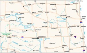
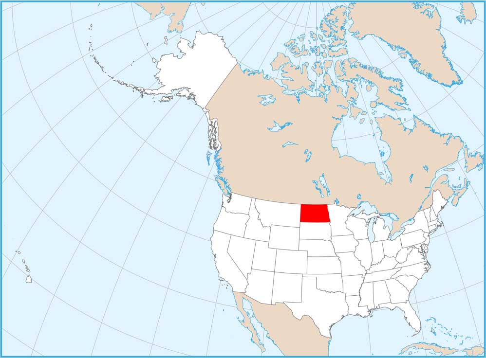
North Dakota National Parks and Forests Map
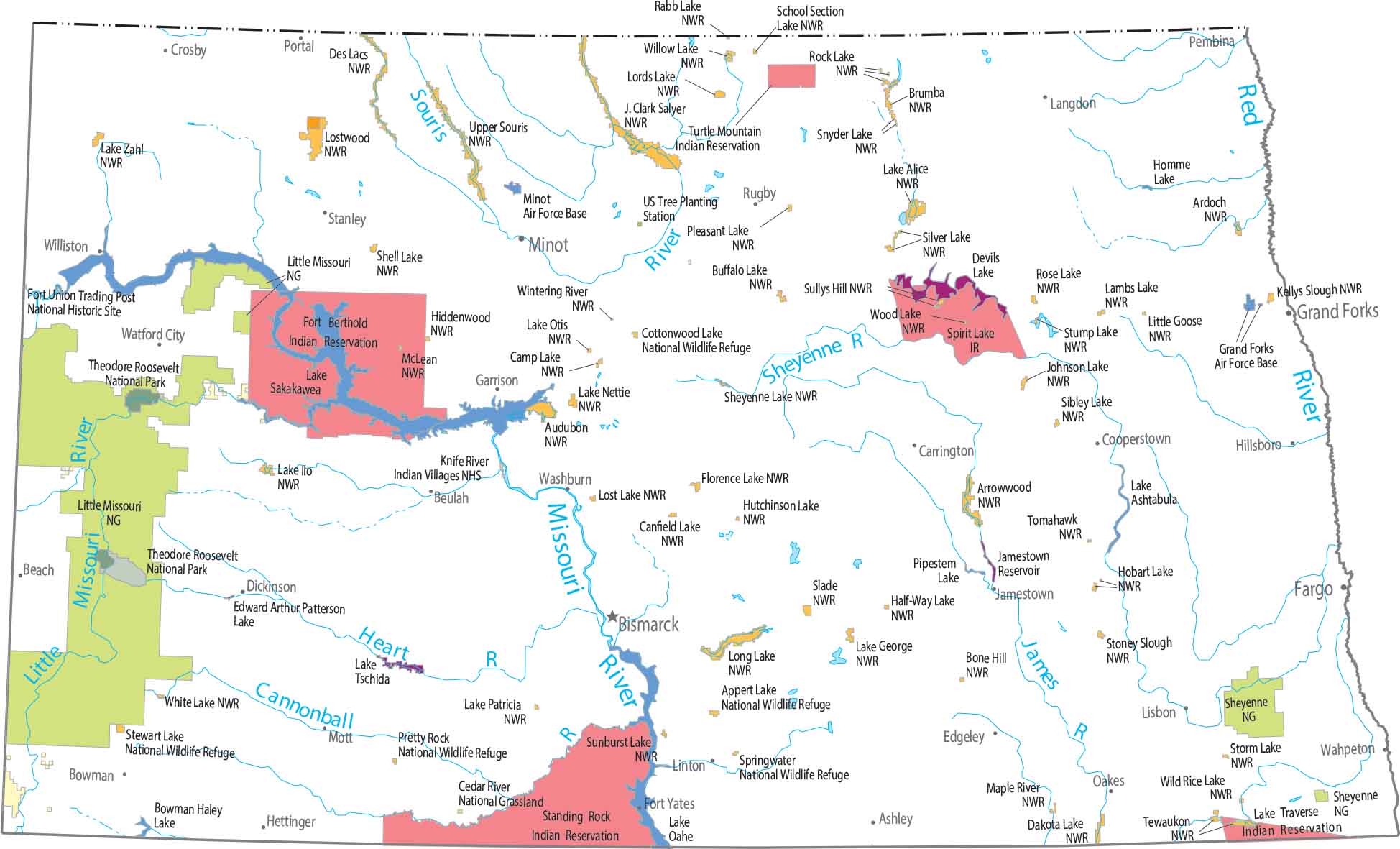
Check out our map showing Theodore Roosevelt National Park and the Badlands. Great Plains stretching across most of the state. That’s why Little Missouri and Sheyenne National Grasslands preserve these prairie landscapes.
Map Information
On the Map
Parks, Forests and Federal Lands
National Parks (NP): Theodore Roosevelt NP National Grasslands and Historic Sites: Cedar River National Grassland, Fort Union Trading Post National Historic Site, Knife River Indian Villages NHS, Little Missouri National Grassland, Sheyenne National Grassland, US Tree Planting Station Indian Reserves (IR): Fort Berthold IR, Lake Traverse IR, Spirit Lake IR, Standing Rock IR, Turtle Mountain IR Army, Naval and Military: Grand Forks Air Force Base, Minot Air Force Base National Wildlife Refuges (NWR): Appert Lake NWR, Ardoch NWR, Arrowwood NWR, Audubon NWR, Bone Hill NWR, Brumba NWR, Buffalo Lake NWR, Camp Lake NWR, Canfield Lake NWR, Cottonwood Lake NWR, Dakota Lake NWR, Des Lacs NWR, Florence Lake NWR, Half-Way Lake NWR, Hiddenwood NWR, Hobart Lake NWR, Hutchinson Lake NWR, J. Clark Salyer NWR, Johnson Lake NWR, Kellys Slough NWR, Lake Alice NWR, Lake George NWR, Lake Ilo NWR, Lake Nettie NWR, Lake Otis NWR, Lake Patricia NWR, Lake Zahl NWR, Lambs Lake NWR, Little Goose NWR, Long Lake NWR, Lords Lake NWR, Lost Lake NWR, Lostwood NWR, Maple River NWR, McLean NWR, Pleasant Lake NWR, Pretty Rock NWR, Rabb Lake NWR, Rock Lake NWR, Rose Lake NWR, School Section Lake NWR, Shell Lake NWR, Sheyenne Lake NWR, Sibley Lake NWR, Silver Lake NWR, Slade NWR, Snyder Lake NWR, Springwater NWR, Stewart Lake NWR, Stoney Slough NWR, Storm Lake NWR, Stump Lake NWR, Sullys Hill NWR, Sunburst Lake NWR, Tewaukon NWR, Tomahawk NWR, Upper Souris NWR, White Lake NWR, Wild Rice Lake NWR, Willow Lake NWR, Wintering River NWR, Wood Lake NWRLand Information
State Capital: Bismarck Major Cities: Fargo, Grand Forks, Minot Cities and Towns: Ashley, Beach, Beulah, Bismarck, Bowman, Carrington, Cooperstown, Crosby, Dickinson, Edgeley, Fargo, Fort Yates, Garrison, Grand Forks, Hettinger, Hillsboro, Jamestown, Langdon, Linton, Lisbon, Minot, Mott, Oakes, Pembina, Portal, Rugby, Stanley, Wahpeton, Washburn, Watford City, Williston Lakes and Reservoirs: Bowman Haley Lake, Devils Lake, Edward Arthur Patterson Lake, Homme Lake, Jamestown Reservoir, Lake Ashtabula, Lake Oahe, Lake Sakakawea, Lake Tschida, Pipestem Lake Rivers and Streams: Cannonball River, Heart River, James River, Little Missouri River, Missouri River, Red River, Sheyenne River, Souris RiverNorth Dakota State Maps
Find the map you need of the Peace Garden State.