North America Map
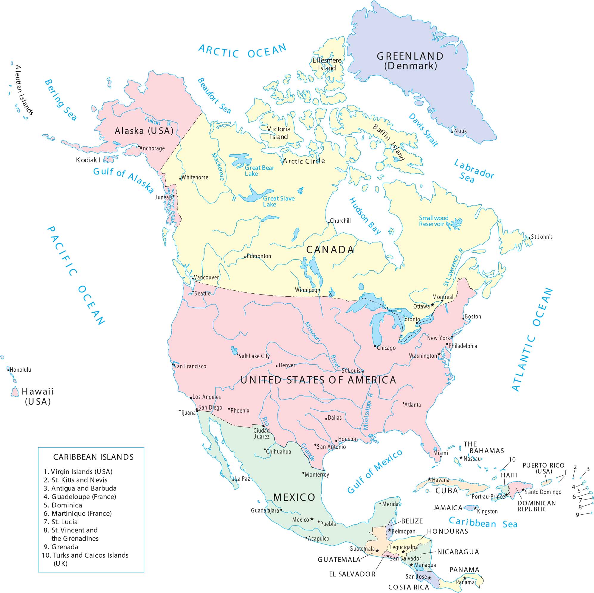
This map shows the United States in its wider continental context. Borders, coastlines, and major landforms connect the U.S. to Canada and Central America. It helps place the country within the larger geography of North America.
Map Information
On the Map
Our table below lists all the countries, cities, and locations that are featured on our map.
|
Region |
Labels / Locations |
|
Canada |
Ottawa (Capital), Toronto, Montreal, Vancouver, Winnipeg, Edmonton, Churchill, St. John’s, Whitehorse, Great Bear Lake, Great Slave Lake, Smallwood Reservoir, Victoria Island, Ellesmere Island, Baffin Island. |
|
United States |
Washington (Capital), New York, Philadelphia, Boston, Chicago, Atlanta, Miami, Dallas, Houston, San Antonio, Denver, Salt Lake City, Phoenix, Los Angeles, San Diego, San Francisco, Seattle, Honolulu (Hawaii), Anchorage (Alaska), Juneau (Alaska). |
|
Mexico |
Mexico City (Capital), Puebla, Acapulco, Guadalajara, Monterrey, Chihuahua, Ciudad Juarez, Tijuana, La Paz, Mérida. |
|
Central America |
Belize (Belmopan), Guatemala (Guatemala City), Honduras (Tegucigalpa), El Salvador (San Salvador), Nicaragua (Managua), Costa Rica (San José), Panama (Panama City). |
|
Caribbean Islands |
Cuba (Havana), Jamaica (Kingston), Haiti (Port-au-Prince), Dominican Republic (Santo Domingo), The Bahamas (Nassau), Puerto Rico (USA), and the numbered list (1-10) including Virgin Islands, Dominica, Grenada, etc. |
|
Territories & Other |
Greenland (Denmark) and its capital Nuuk. |
|
Rivers & Waterways |
Mississippi River, Missouri River, Rio Grande, St. Lawrence River, Mackenzie River, Yukon River, Davis Strait. |
|
Oceans & Seas |
Arctic Ocean, Atlantic Ocean, Pacific Ocean, Caribbean Sea, Labrador Sea, Beaufort Sea, Bering Sea, Hudson Bay, Gulf of Alaska. |
Country Maps
Explore the geography that defines this nation.


