Map of New Smyrna Beach, Florida
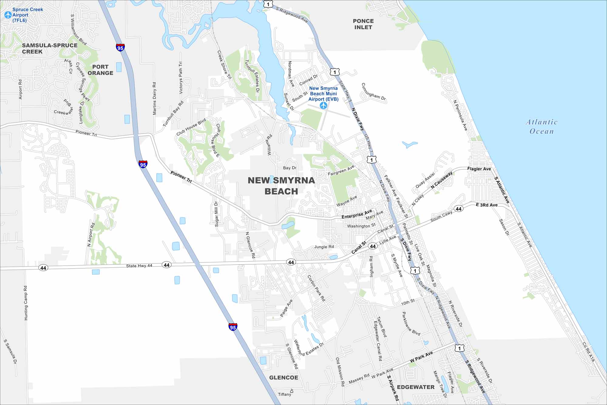
New Smyrna Beach lines the Atlantic coast south of Daytona. Check out our to see its roads highways, bridges, and riverfront. The Intracoastal Waterway shapes much of its geography.
Florida State Maps
Discover Florida through our state maps


Map Information
On the Map
Interstates/Highways: I-95, US Hwy 1, State Hwy 44, State Hwy 5, State Hwy 442 Major Roads: Pioneer Trl, Glencoe Rd, Canal St, Lytle Ave, 10th St, Park Ave, Williams Rd, Wayne Ave, Enterprise Ave, Flagler Ave, Riverside Dr, Atlantic Ave, Peninsula Ave, Causeway, Turnbull Bay Rd, Creek Shore Trl, Airport Rd, Martins Dairy Rd, South St, Conrad Dr Airports: New Smyrna Beach Muni Airport (EVB), Spruce Creek Airport (7FL6) Lakes and Reservoirs: Atlantic OceanFlorida City Maps
Chart your course through Miami and Florida’s cities


