Map of New Port Richey, Florida
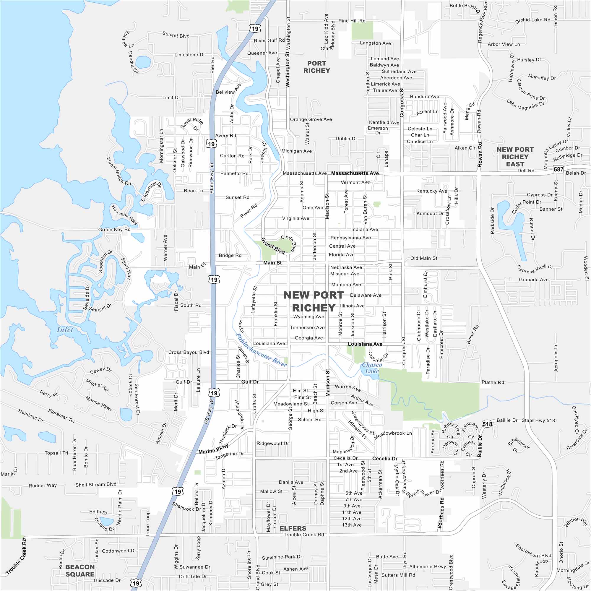
New Port Richey lies north of Tampa along the Pithlachascotee River. This map shows highways/roads, parks and Gulf access nearby. It mixes small-town character with metro growth.
Florida State Maps
Discover Florida through our state maps


Map Information
On the Map
Interstates/Highways: US Hwy 19, State Rte 518, State Rte 587 Major Roads: Main St, Madison St, Massachusetts Ave, Louisiana Ave, Marine Pkwy, Trouble Creek Rd, Grand Blvd, Congress Ave, Rowan Rd, Congress St, High St, Plathe Rd, Gulf Dr, Sunset Blvd, River Rd, Washington St, Seven Springs Blvd, Delaware Ave Lakes and Reservoirs: Chasco Lake Major Rivers: Pithlachascotee River Nearby Communities: Port Richey, New Port Richey East, Elfers, Beacon SquareFlorida City Maps
Chart your course through Miami and Florida’s cities


