Map of Muskegon, Michigan
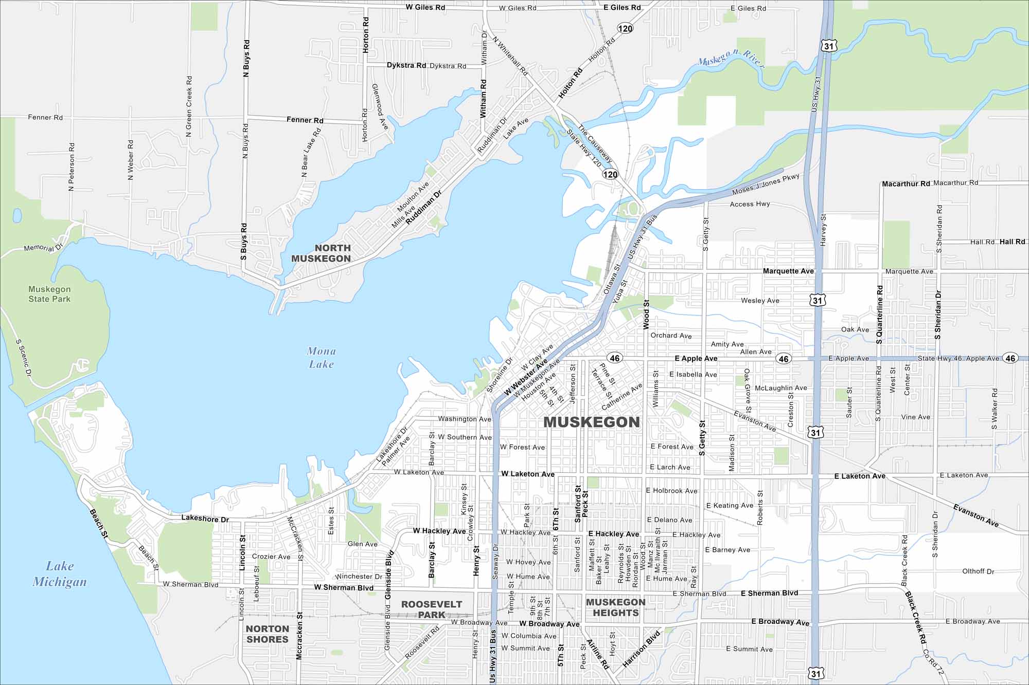
Muskegon rests on Lake Michigan with a large harbor and waterfront. Our map shows its downtown area, industrial port, and surrounding neighborhoods. The beaches are a major draw in summer.
Map Information
On the Map
Interstates/Highways: US Hwy 31, State Rte 46, State Hwy 120 Major Roads: Apple Ave, Laketon Ave, Sherman Blvd, Broadway Ave, Hackley Ave, Getty St, Seaway Dr, Muskegon Ave, Webster Ave, Shoreline Dr, Giles Rd, Fenner Rd, Dykstra Rd, Whitehall Rd, Holton Rd, Access Hwy, Quarterline Rd, Sheridan Dr, Roberts St, Peck St Lakes and Reservoirs: Lake Michigan, Muskegon Lake, Mona Lake Major Rivers: Muskegon River Parks and Preserves: Muskegon State Park Nearby Communities: North Muskegon, Roosevelt Park, Norton Shores, Muskegon HeightsMichigan State Maps
Get to know Michigan with our detailed maps


City Maps of Michigan
Check out our maps of Detroit and other cities in Michigan


