Mount Rainier National Park Map
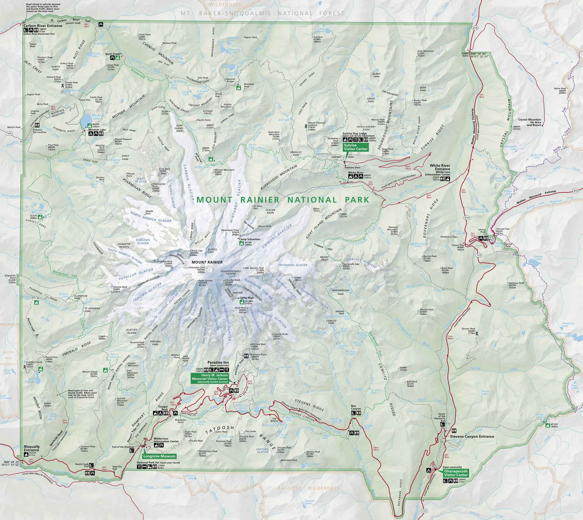
Mount Rainier National Park towers with its sheer presence. Our park map shows roads, trails, viewpoints, visitor centers, and glaciers on the mountain’s slopes.
Map Information
On the Map
Parks: Mount Baker-Snoqualmie National Forest, Tatoosh Wilderness Visitor Centers: Henry M. Jackson Memorial Visitor Center, Sunrise Visitor Center, White River Wilderness Information Center, Ohanapecosh Visitor Center, Longmire Museum Major Roads: State Rte 410, State Rte 123, State Rte 706, Stevens Canyon Rd, Mather Memorial Parkway, Sunrise Park Rd, Westside Rd, Carbon River Rd Rivers/Lakes: Carbon River, White River, Cowlitz River, Nisqually River, Mowich Lake, Mystic Lake, Tipsoo Lake, Reflection Lakes Campgrounds/Park Sites: Cougar Rock, Ohanapecosh, White River, Ipsut Creek, Mowich Lake, National Park Inn, Paradise Inn, Sunrise Day Lodge, Camp Muir, Camp Schurman Other Landmarks: Mount Rainier, Liberty Cap, Point Success, Disappointment Cleaver, Emmons Glacier, Winthrop Glacier, Carbon Glacier, Nisqually Glacier, Paradise River, Narada Falls, Christine Falls, Box CanyonNational Park Maps
Find maps of green spaces and national parks near you.


