Map of Mount Airy, North Carolina
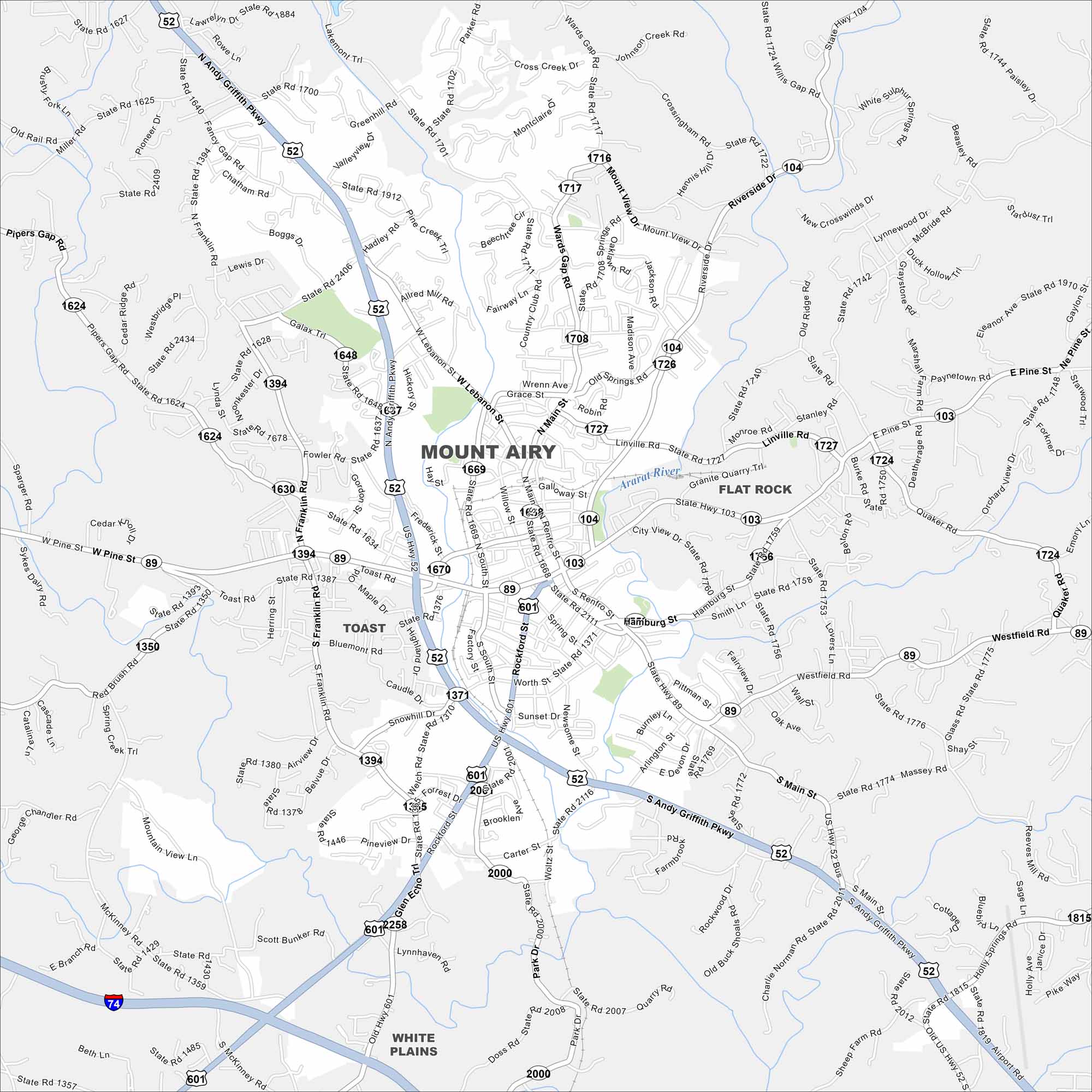
Mount Airy is tucked against the Blue Ridge foothills. Our map shows its downtown area and spreading residential streets. It’s famously linked to “The Andy Griffith Show”.
Map Information
On the Map
Interstates/Highways: I-74, US Hwy 52, US Hwy 601, State Rte 89, State Rte 103, State Rte 104 Major Roads: Andy Griffith Pkwy, Fancy Gap Rd, Pine Ridge Rd, Lebanon St, Main St, Renfro St, Rockford St, Fowler Rd, Toast Rd, Bluemont Rd, Caudle Dr, Snowhill Dr, Welch Rd, Linville Rd, Granite Quarry Rd, Riverside Dr, Mount View Dr, Wards Gap Rd, Quality Rd, Airport Rd Major Rivers: Ararat River Nearby Communities: Toast, Flat Rock, White PlainsNorth Carolina State Maps
Get to know the mountains and coastlines of North Carolina.


City Maps of North Carolina
Journey through North Carolina with our city maps


