Map of Mooresville, North Carolina
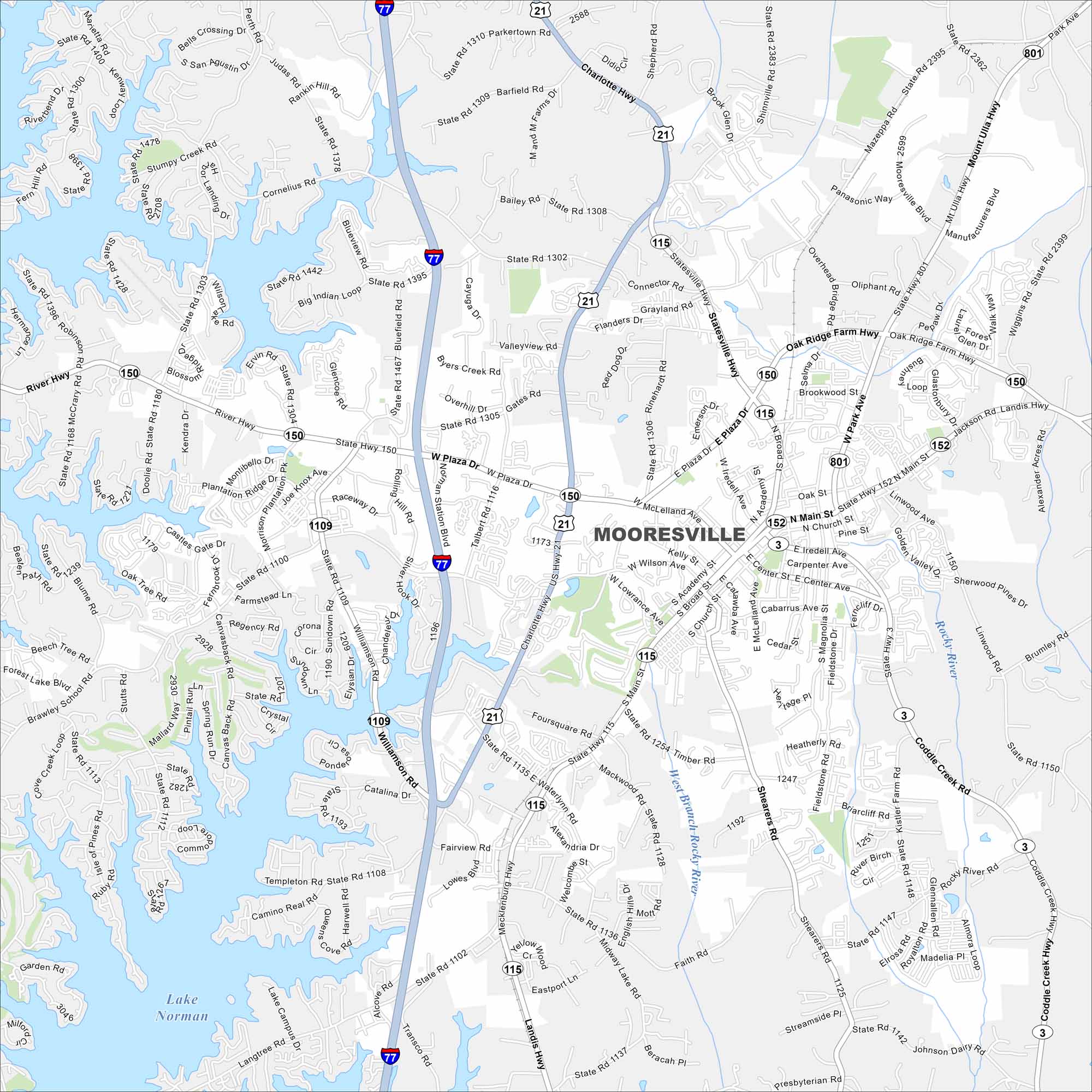
Our map of Mooresville highlights its position near Lake Norman. Suburbs, lakefront neighborhoods, and race team shops fill the area. It’s often called “Race City USA” because it’s the home of many NASCAR racing teams and drivers.
Map Information
On the Map
Interstates/Highways: I-77, US Hwy 21, State Rte 115, State Rte 150, State Rte 152, State Rte 3 Major Roads: Main St, Plaza Dr, Statesville Hwy, Mecklenburg Hwy, Brawley School Rd, Williamson Rd, River Hwy, Charlotte Hwy, Oak Ridge Farm Hwy, Mazeppa Rd, Perth Rd, Cornelius Rd, Faith Rd, Shearers Rd, Coddle Creek Hwy, Wiggins Rd, Landis Hwy, Iredell Ave, Center St, Academy St Lakes and Reservoirs: Lake Norman Major Rivers: Rocky River Nearby Communities: Davidson, Mount Ulla, MazeppaNorth Carolina State Maps
Get to know the mountains and coastlines of North Carolina.


City Maps of North Carolina
Journey through North Carolina with our city maps


