Map of Monroe, North Carolina
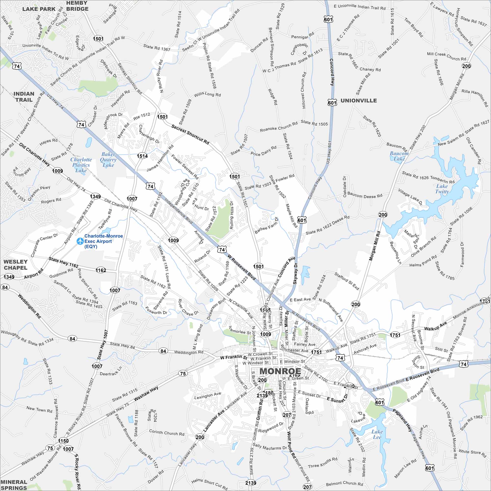
Our map of Monroe shows this city hub southeast of Charlotte. Historic downtown streets stand out, while newer neighborhoods spread outward. It serves as the seat of Union County.
Map Information
On the Map
Interstates/Highways: US Hwy 74, US Hwy 601, State Rte 75, State Rte 84, State Rte 200, State Rte 207 Major Roads: Roosevelt Blvd, Skyway Dr, Franklin St, Main St, Charlotte Ave, Concord Hwy, Lancaster Ave, Morgan Mill Rd, Pageland Hwy, Richardson St, Sunset Dr, Old Charlotte Hwy, Airport Rd, Goldmine Rd, Rocky River Rd, Weddington Rd, Walkup Ave, Secrest Shortcut Rd, Williams Rd, Fowler Secrest Rd Airports: Charlotte-Monroe Exec Airport (EQY) Lakes and Reservoirs: Lake Lee, Lake Twitty, Baucom Lake, Baker Quarry Lake Nearby Communities: Unionville, Wesley Chapel, Mineral Springs, WingateNorth Carolina State Maps
Get to know the mountains and coastlines of North Carolina.


City Maps of North Carolina
Journey through North Carolina with our city maps


