Missouri National Parks and Forests Map
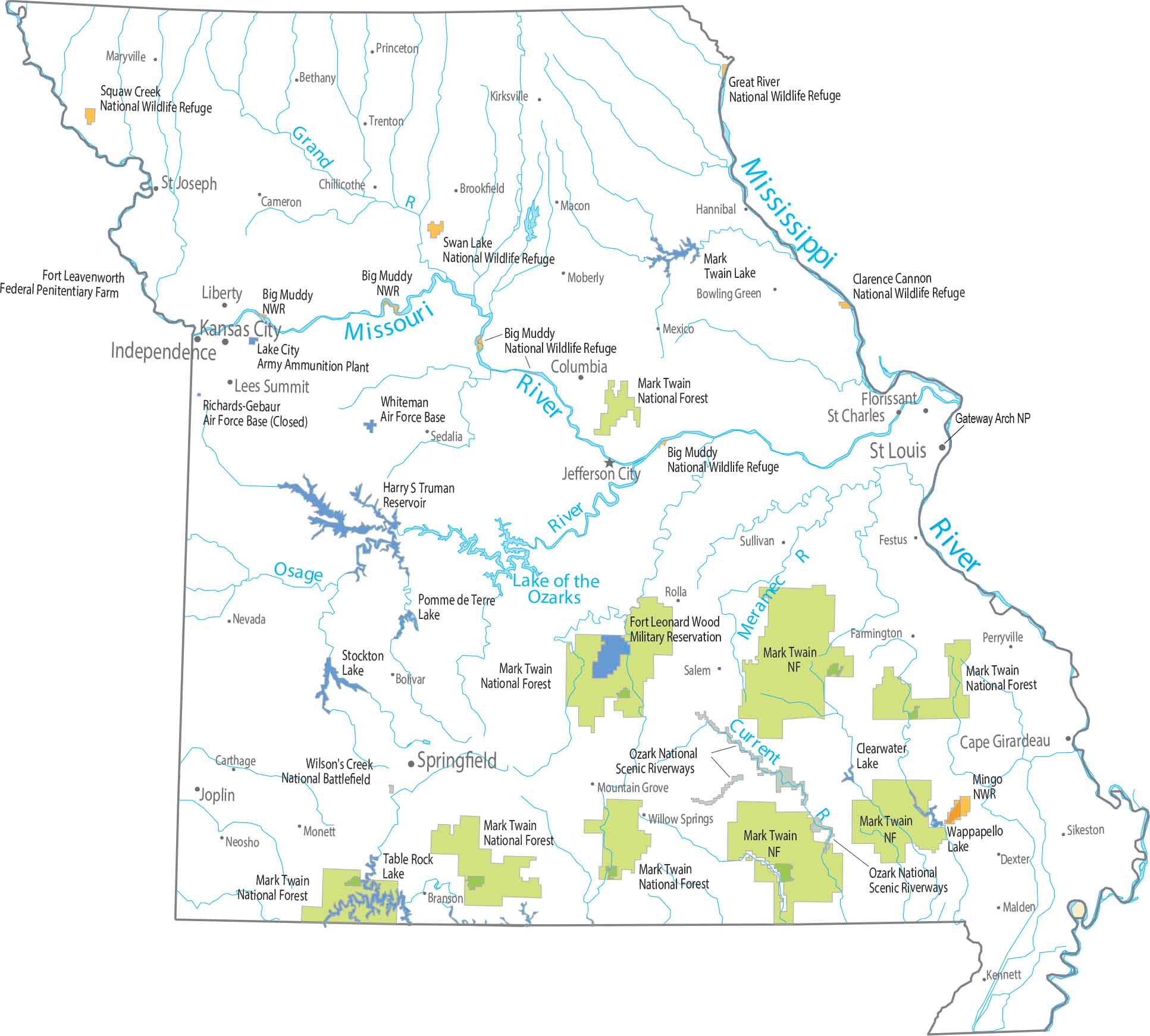
Our national forests and parks map highlights Mark Twain National Forest and other federal lands. The southern half spreads across the Ozark highlands with scattered forests. Whereas the northern half is mostly rolling plains and farmland.
Map Information
On the Map
Parks, Forests and Federal Lands
National Forests (NF): Mark Twain National Forest National Wildlife Refuges (NWR): Big Muddy NWR, Clarence Cannon NWR, Great River NWR, Mingo NWR, Squaw Creek NWR, Swan Lake NWR Other Landmarks: Harry S Truman Reservoir, Ozark National Scenic Riverways, Wilson’s Creek National Battlefield Army, Naval and Military: Fort Leavenworth Federal Penitentiary Farm, Fort Leonard Wood Military Reservation, Lake City Army Ammunition Plant, Richards-Gebaur Air Force Base (Closed), Whiteman Air Force BaseLand Information
State Capital: Jefferson City Major Cities: Independence, Kansas City, Springfield, St. Louis Cities and Towns: Bethany, Bolivar, Bowling Green, Branson, Brookfield, Cameron, Cape Girardeau, Carthage, Chillicothe, Columbia, Dexter, Farmington, Festus, Hannibal, Joplin, Kennett, Kirksville, Lees Summit, Liberty, Macon, Malden, Maryville, Mexico, Moberly, Monett, Mountain Grove, Neosho, Nevada, Perryville, Princeton, Rolla, St. Charles, St. Joseph, Sullivan, Trenton, Willow Springs Lakes and Reservoirs: Lake of the Ozarks Rivers and Streams: Current River, Grand River, Meramec River, Mississippi River, Missouri River, Osage RiverMissouri State Maps
Check out state maps of the Show-Me State.


