Map of Miramar, Florida
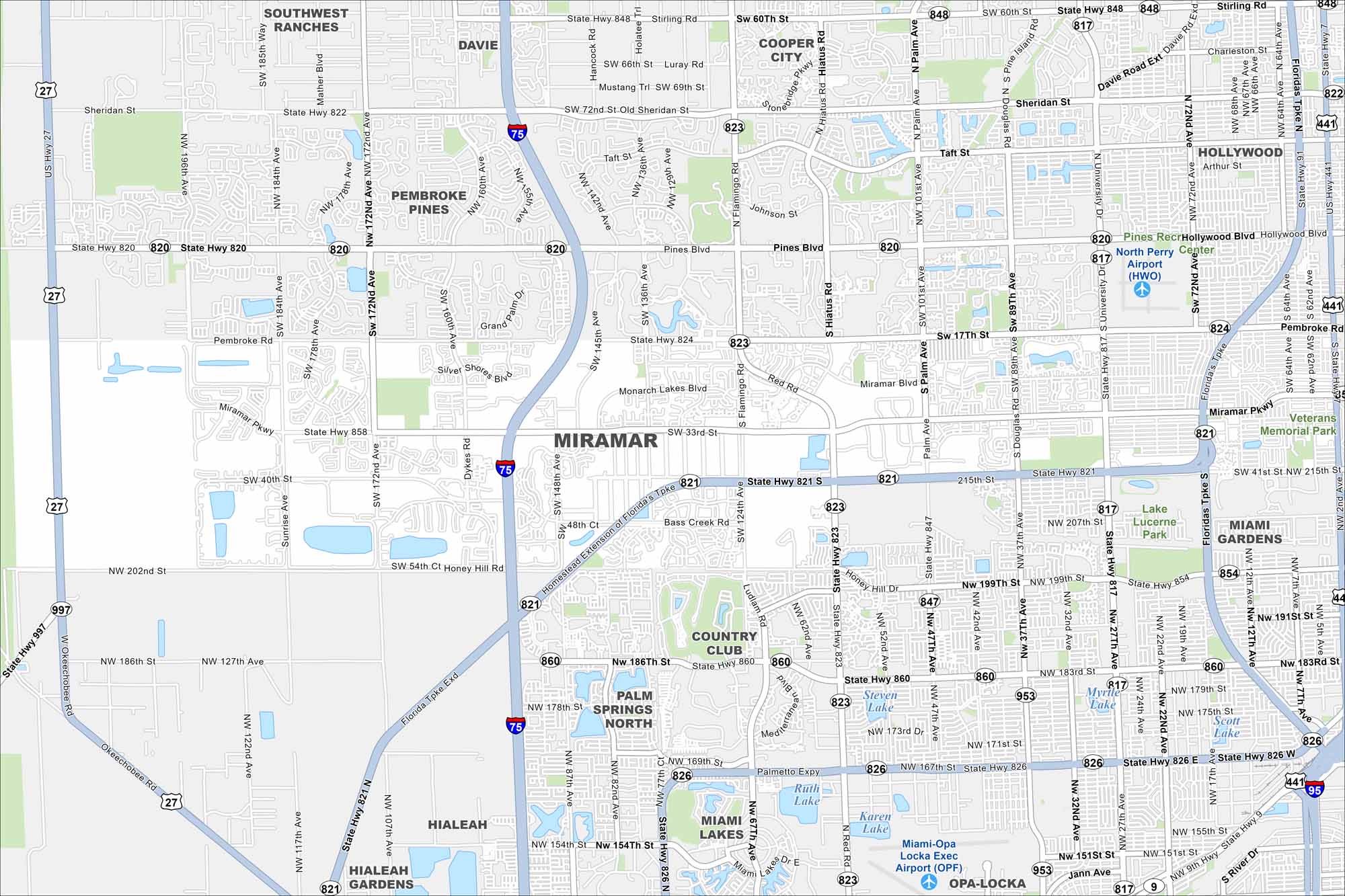
Miramar sits between Miami and Fort Lauderdale. Our map shows wide residential neighborhoods, lakes, and major highways. It’s definitely a fast-growing part of South Florida.
Florida State Maps
Discover Florida through our state maps


Map Information
On the Map
Interstates/Highways: I-75, US Hwy 27, US Hwy 441, State Rte 821, State Rte 826, State Rte 820, State Rte 858, State Rte 817, State Rte 824, State Rte 848 Major Roads: Miramar Pkwy, Pines Blvd, University Dr, Flamingo Rd, NW 27th Ave, NW 57th Ave, Palm Ave, Red Rd, Douglas Rd, Hiatus Rd, Miramar Blvd, Honey Hill Rd, SW 172nd Ave Airports: North Perry Airport (HWO), Miami-Opa Locka Exec Airport (OPF) Lakes and Reservoirs: Steven Lake, Myrtle Lake, Scott Lake, Ruth Lake, Karen Lake Parks and Preserves: Lake Lucerne Park, Veterans Memorial Park Nearby Communities: Southwest Ranches, Davie, Cooper City, Pembroke Pines, Hollywood, West Park, Miami Gardens, Country Club, Palm Springs North, Miami Lakes, Hialeah, Hialeah Gardens, Opa-LockaFlorida City Maps
Chart your course through Miami and Florida’s cities


