Map of Midland, Michigan
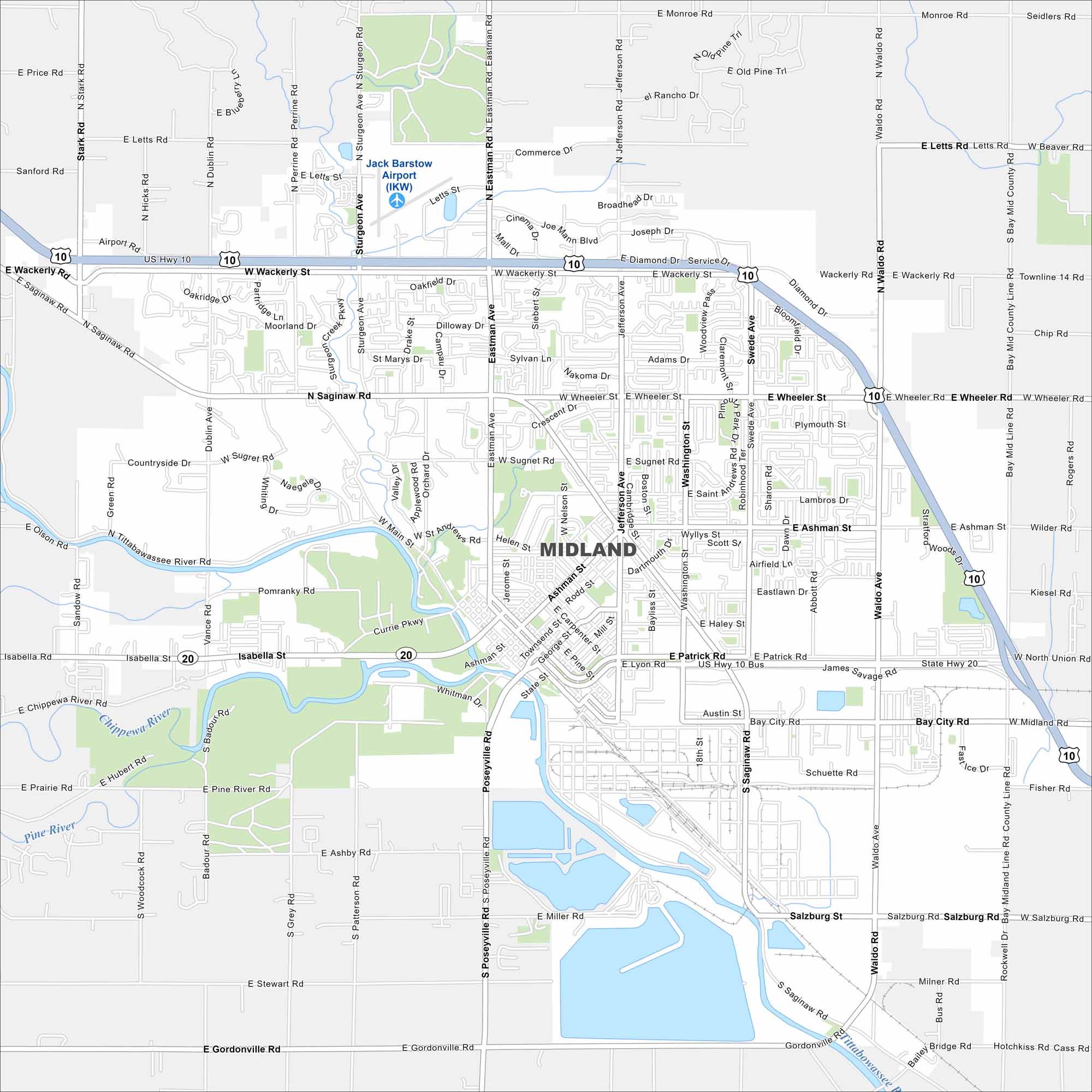
Our map of Midland highlights the Tittabawassee River running through the city. Parks and trails make up a big part of the urban layout. This city is known for its ties to the chemical industry.
Map Information
On the Map
Interstates/Highways: US Hwy 10, State Rte 20 Major Roads: Wackerly St, Saginaw Rd, Eastman Rd, Jefferson Ave, Ashman St, Patrick Rd, Main St, Lyon Rd, Waldo Rd, Bay City Rd, Sturgeon Ave, Dublin Ave, Stark Rd, Perrine Rd, Swede Ave, Washington St, Sugnet Rd, Wheeler Rd, Monroe Rd, Gordonville Rd Airports: Jack Barstow Airport (IKW) Lakes and Reservoirs: Major Rivers: Tittabawassee River, Chippewa River, Pine River Nearby Communities: MidlandMichigan State Maps
Get to know Michigan with our detailed maps


City Maps of Michigan
Check out our maps of Detroit and other cities in Michigan


