Map of Middletown, New York
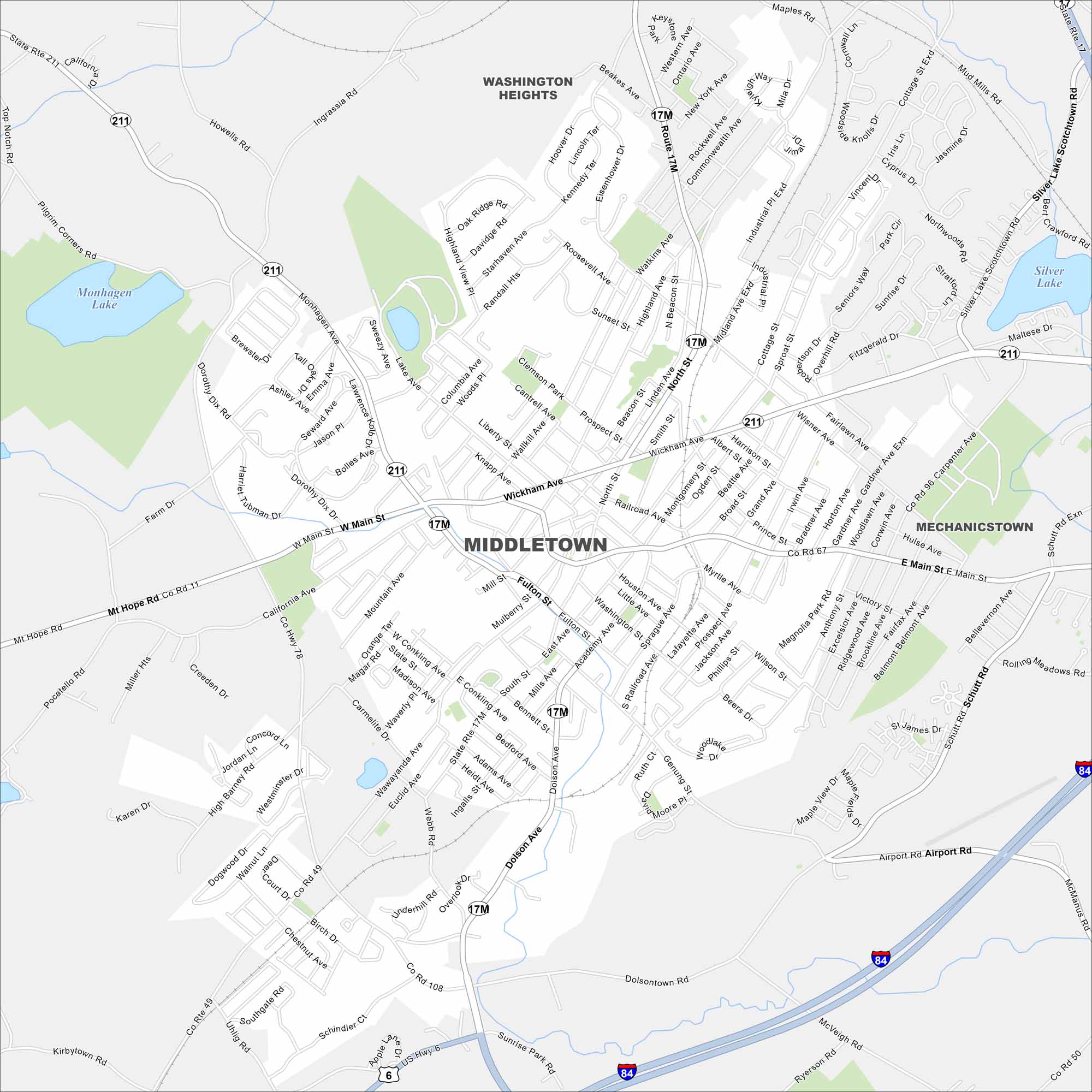
Discover Middletown with our road map. With a compact downtown, it’s surrounded by residential neighborhoods. It’s a regional hub for Orange County in the Hudson Valley
Map Information
On the Map
Interstates/Highways: I-84, State Rte 17M, State Rte 211, US Hwy 6, State Rte 17 Major Roads: Main St, Dolson Ave, Airport Rd, Wickham Ave, North St, Fulton St, Academy Ave, Highland Ave, Wawayanda Ave, Monhagen Ave, Wisner Ave, Carpenter Ave, Schutt Rd, Tower Dr, Midland Ave, California Ave, Mt Hope Rd, Ingrassia Rd, Goshen Tpk, Dolsontown Rd Lakes and Reservoirs: Monhagen Lake, Silver Lake Nearby Communities: Middletown, Washington Heights, MechanicstownNew York State Maps
Find state maps of the Empire State.


City Maps of New York
Here are the city maps that define New York


