Map of Mesa, Arizona
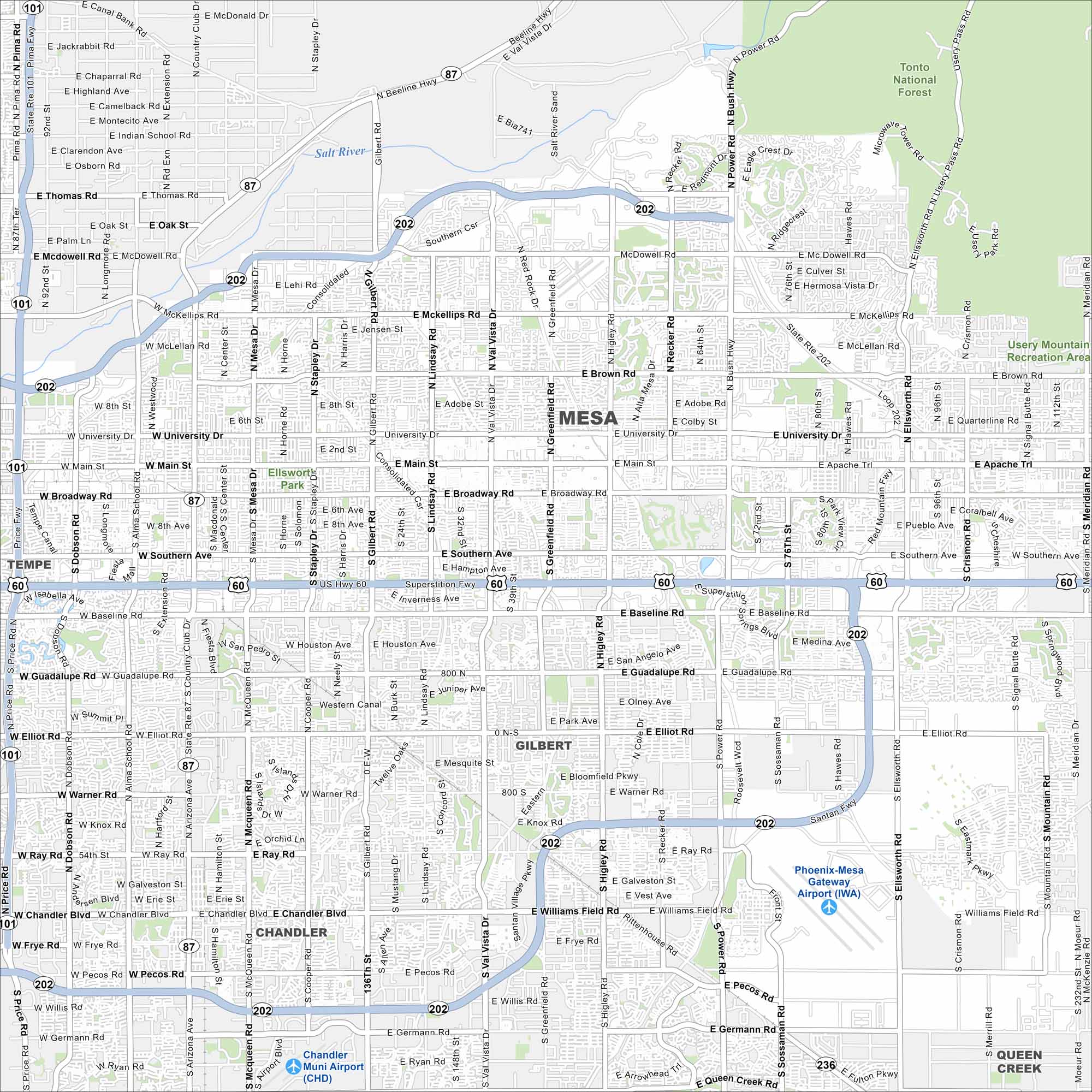
Our map of Mesa shows a vast suburban grid east of Phoenix. The Salt River lies to the north, with desert stretching beyond. It’s actually one of the largest cities in Arizona.
Arizona State Maps
Check out our Arizona state maps we’ve put together


Map Information
On the Map
Interstates/Highways: US Hwy 60, Loop 202, State Rte 87, State Rte 101 Major Roads: University Dr, Main St, Broadway Rd, Southern Ave, Baseline Rd, Guadalupe Rd, Elliot Rd, Warner Rd, Ray Rd, Chandler Blvd, Pecos Rd, Germann Rd, Gilbert Rd, Lindsay Rd, Val Vista Dr, Greenfield Rd, Higley Rd, Recker Rd, Power Rd, Sossaman Rd Airports: Phoenix-Mesa Gateway Airport (IWA), Chandler Muni Airport (CHD) Rivers and Creeks: Salt River Parks/Preserves/Forests: Tonto National Forest, Usery Mountain Recreation Area, Ellsworth Park Nearby Communities: Tempe, Gilbert, Chandler, Queen CreekArizona City Maps
Here’s our full batch of Arizona city maps


