Map of Matthews, North Carolina
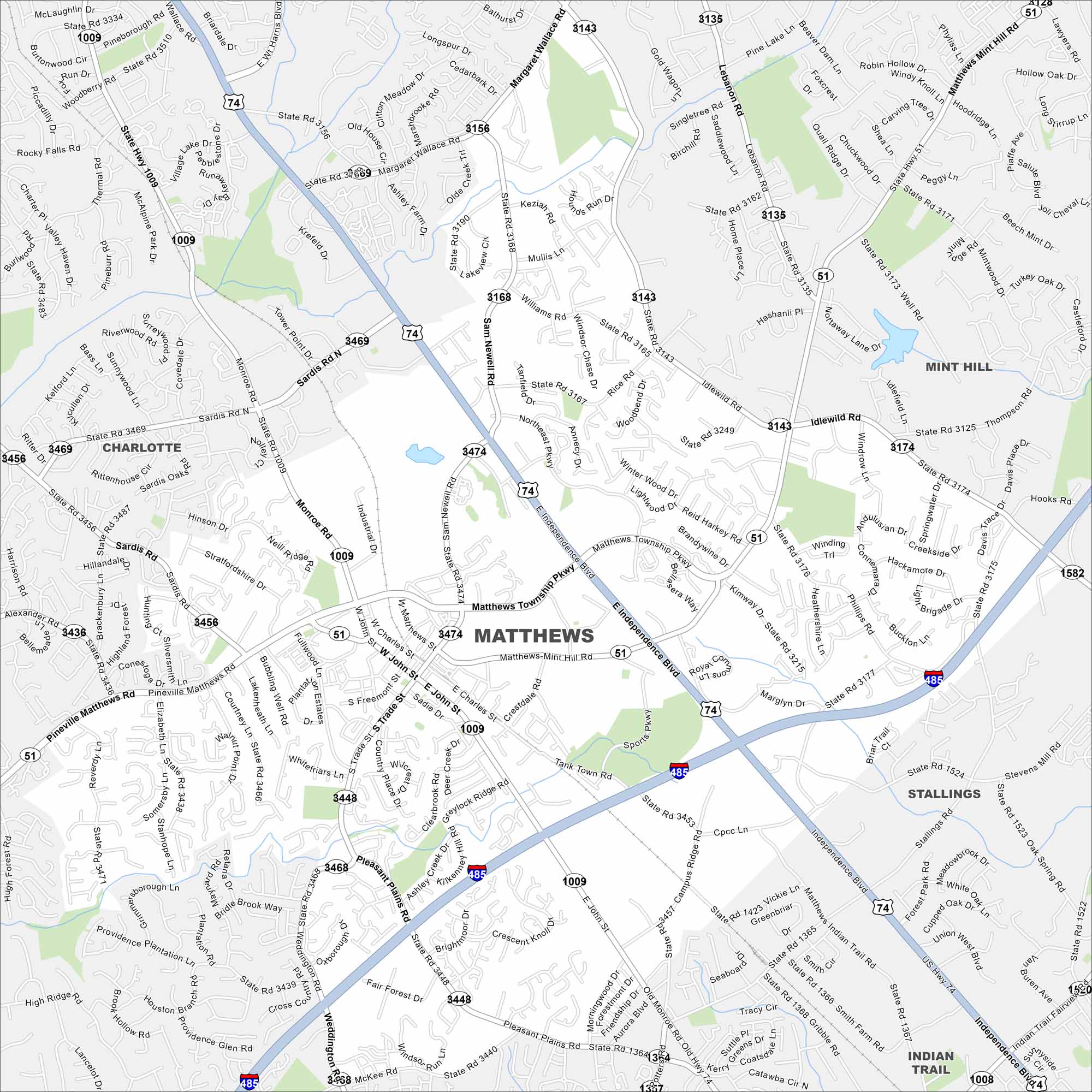
Discover Matthews, North Carolina on our map. It’s located in the southeast of Charlotte. Residential areas mix with a historic downtown and surrounding highways.
Map Information
On the Map
Interstates/Highways: US Hwy 74, I-485, State Rte 51 Major Roads: Independence Blvd, Matthews Township Pkwy, Matthews Mint Hill Rd, John St, Trade St, Monroe Rd, Fullwood Ln, Sam Newell Rd, Idlewild Rd, Margaret Wallace Rd, Sardis Rd, Pineville Matthews Rd, Weddington Rd, Pleasant Plains Rd, Stallings Rd, Indian Trail Rd, Lawyers Rd, Phillips Rd, Campus Ridge Rd, Gribble Rd Nearby Communities: Charlotte, Mint Hill, Stallings, Indian Trail, WeddingtonNorth Carolina State Maps
Get to know the mountains and coastlines of North Carolina.


City Maps of North Carolina
Journey through North Carolina with our city maps


