Map of Marana, Arizona
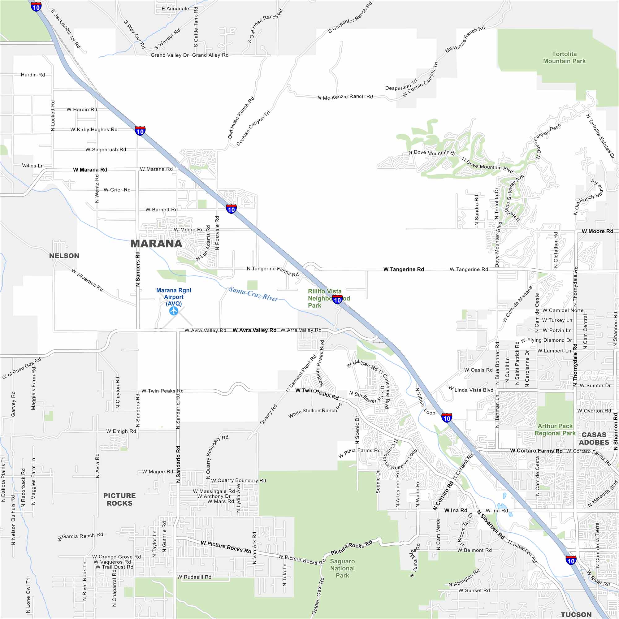
Marana stretches across the desert northwest of Tucson. Our map shows its highways, rail line, and scattered neighborhoods. Mountains rise in the distance.
Arizona State Maps
Check out our Arizona state maps we’ve put together


Map Information
On the Map
Interstates/Highways: I-10 Major Roads: Tangerine Rd, Moore Rd, Twin Peaks Rd, Avra Valley Rd, Ina Rd, Silverbell Rd, Cortaro Rd, Marana Rd, Grier Rd, Barnett Rd, Hardin Rd, Sanders Rd, Lon Adams Rd, Postvale Rd, Coachline Blvd, Saguaro Peaks Blvd, Continental Reserve Loop, Pima Farms Rd, Thornydale Rd, Linda Vista Blvd Airports: Marana Rgnl Airport (AVQ) Rivers and Creeks: Santa Cruz River Parks/Preserves/Forests: Saguaro National Park, Tortolita Mountain Park, Arthur Pack Regional Park, El Rio Preserve, Rillito Vista Neighborhood Park Nearby Communities: Nelson, Picture Rocks, Rillito, Casas Adobes, TucsonArizona City Maps
Here’s our full batch of Arizona city maps


