Map of Buckeye, Arizona
Check out our map of Buckeye, where desert neighborhoods spread west of Phoenix. The White Tank Mountains rise along the edge.
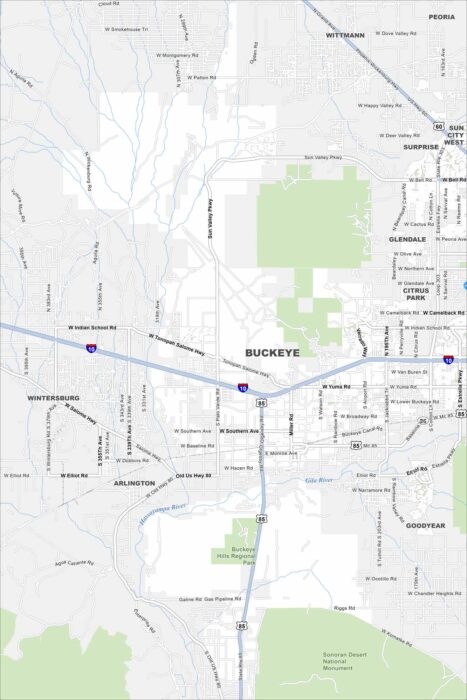
Check out our map of Buckeye, where desert neighborhoods spread west of Phoenix. The White Tank Mountains rise along the edge.
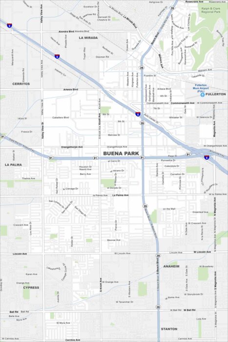
See the highways, streets, and park areas laid out here. Our map of Buena Park highlights its roads and open spaces.
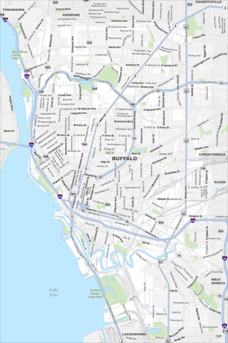
Buffalo, New York sits on Lake Erie at the head of the Niagara River. Our map shows the waterfront, highways/streets, and green parkways.
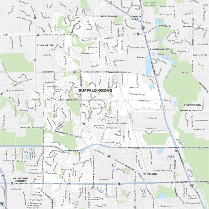
Explore Buffalo Grove with our map, containing roads, parks and lakes. It lies northwest of Chicago. The Des Plaines River is nearby.
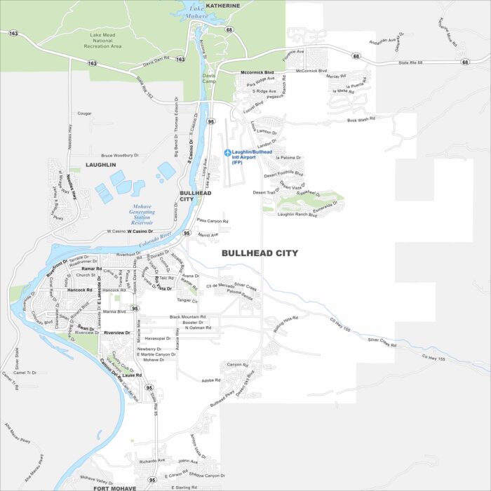
Our map of Bullhead City highlights its position on the Colorado River. Roads follows the riverbanks across from Laughlin, Nevada.
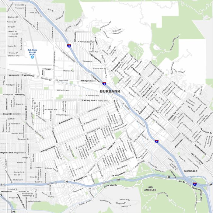
Burbank is in the San Fernando Valley, bordered by the Verdugo Mountains. Our map shows major routes and connections to nearby Los Angeles.
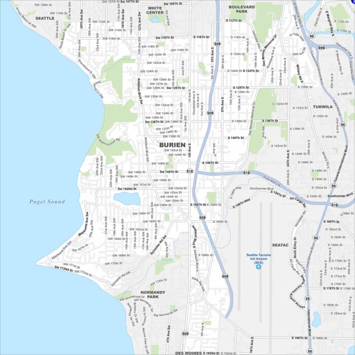
See Burien on our road map, sitting between Seattle and Puget Sound. Parks, lakes, and shoreline stand out in this area.
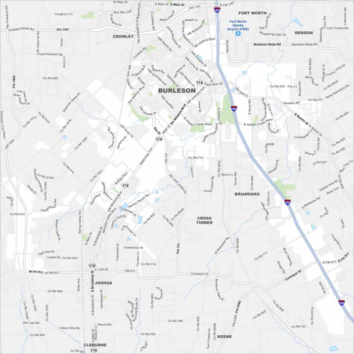
Check out our map of Burleson, just south of Fort Worth. It’s marked by suburban growth, wide streets, and open spaces.
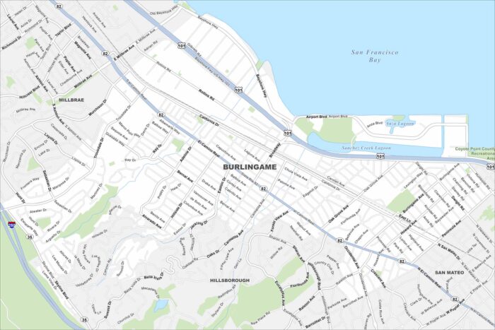
Our map of Burlingame shows its waterfront along San Francisco Bay. You’ll find highways, rivers, lakes and green spaces.
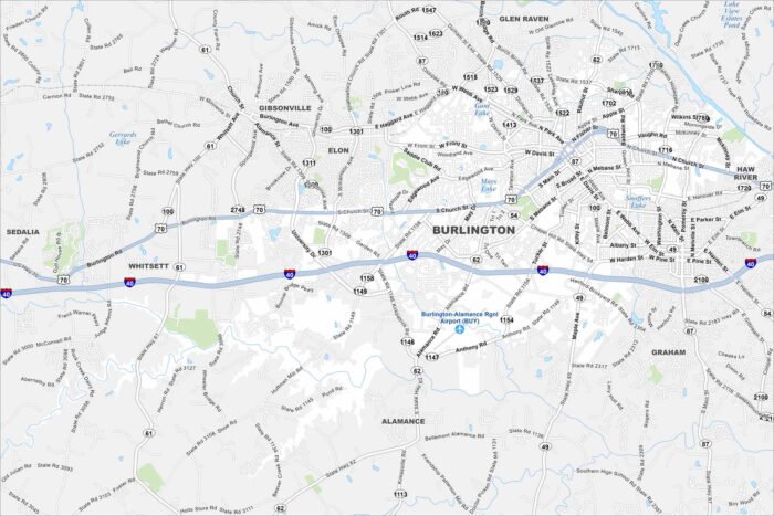
Burlington is between Greensboro and Durham in central North Carolina. Our map highlights its streets, rail lines, and nearby lakes.
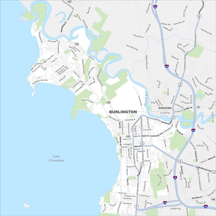
Burlington is set on the eastern shore of Lake Champlain. Our map shows its waterfront parks, highways and the Winooski River.
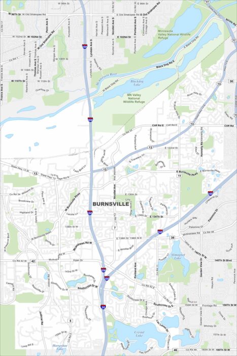
Check out our map of Burnsville, just south of Minneapolis. It highlights lakes, parks, and the Minnesota River forming the city’s edge.
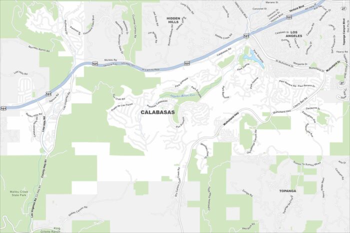
Explore Calabasas with our map, where neighborhoods wind through the Santa Monica Mountains. Roads curve instead of form grids.
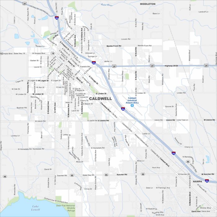
Our map of Caldwell shows the city in the Treasure Valley, west of Boise. The Boise River and farmland stretch around it.
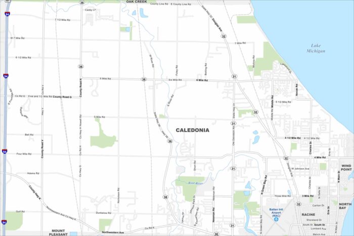
Caledonia is in southeastern Wisconsin along Lake Michigan. Our map shows rural stretches, highways, and its long shoreline.