Delaware Population Map
Northern Delaware holds most of the population on our population density map. There are high density areas especially near Wilmington.
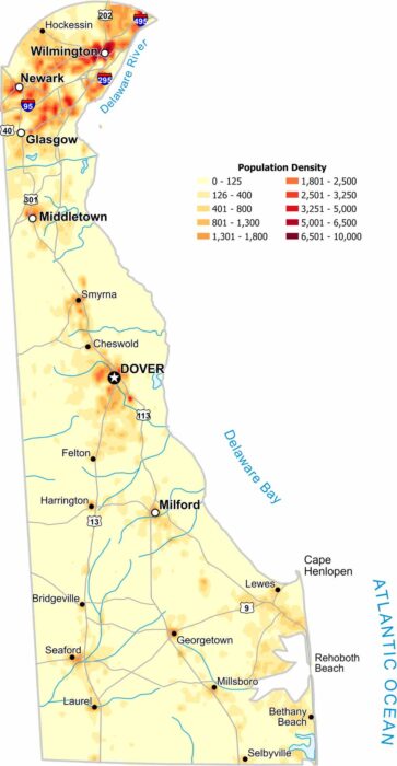
Northern Delaware holds most of the population on our population density map. There are high density areas especially near Wilmington.
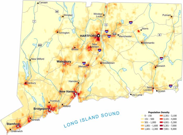
Population density is surprisingly high across much of the state. Our map shows very little empty space, even in rural areas.
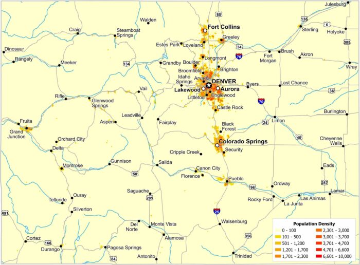
Most residents in Colorado live along the eastern edge of the Rockies. The Front Range forms a clear north–south corridor.
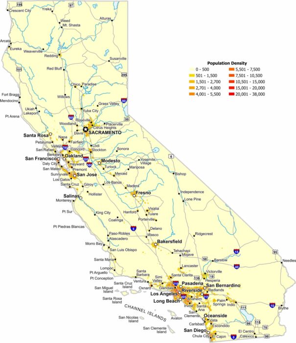
Coastal metro areas and the Central Valley have high population density. Whereas deserts and mountains create wide low-density gaps.
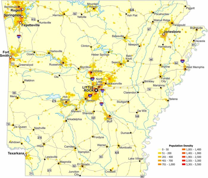
Population density in Arkansas increases near major cities like Little Rock. Our map also shows large rural regions with far fewer residents.
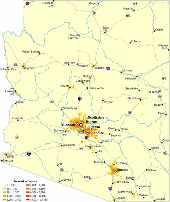
Much of Arizona’s population is concentrated in the south and central parts of the state. Check out our map to see its population density.
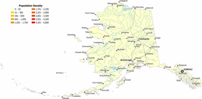
Our population density map of Alaska shows extremely low population density, except for Anchorage, Juneau and Fairbanks.
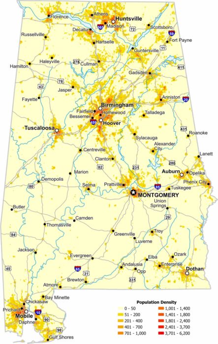
Population across Alabama is uneven, with clear clusters around major cities. Our map highlights higher density areas like Birmingham.
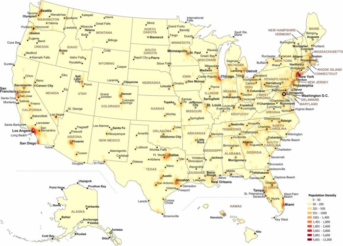
Our map shows how population density changes across the United States. Check out our map to see where people are most concentrated.
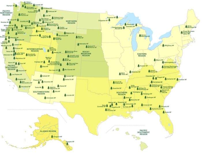
Our map shows where America’s national forests stretch across the country. It highlights forest regions, state boundaries and lakes.
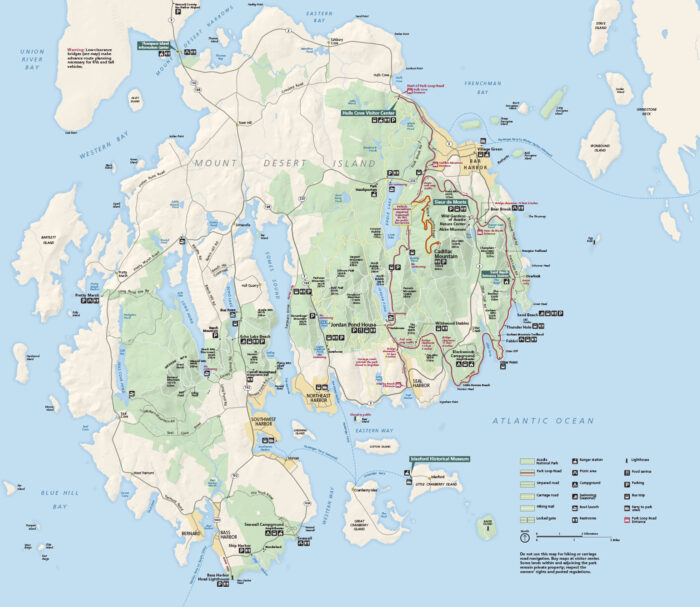
Acadia National Park is off the coast of Maine. It’s known for its rocky shores, forests, lakes, and views. Our map splits the park into three.
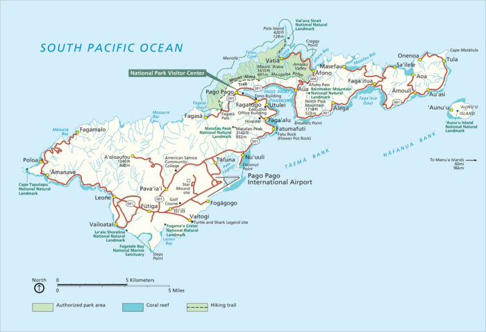
The American Samoa National Park feels completely untouched. Our park map shows hiking trails, coral reefs, and key visitor points.
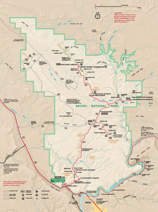
Arches National Park is located near Moab, Utah. Our national park map includes roads, trails, and star gazing sites.
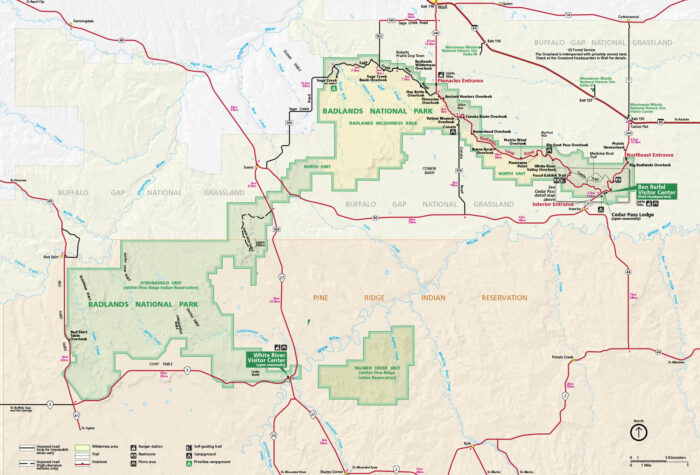
In southwestern South Dakota, the Badlands stretch across the prairies. Our map shows overlooks, trails, roads, and campgrounds.
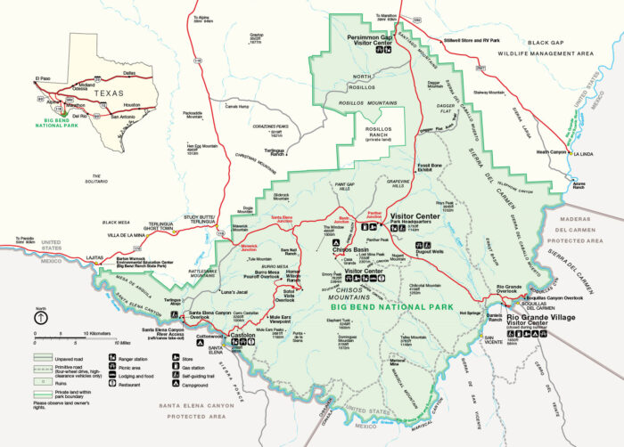
Big Bend is situated along the Texas–Mexico border along the Rio Grande. Our map marks roads, trails, campgrounds, and key entrances.