Pennsylvania Population Map
Population concentrates at the eastern and western ends of the state. The central mountains show much lower density.
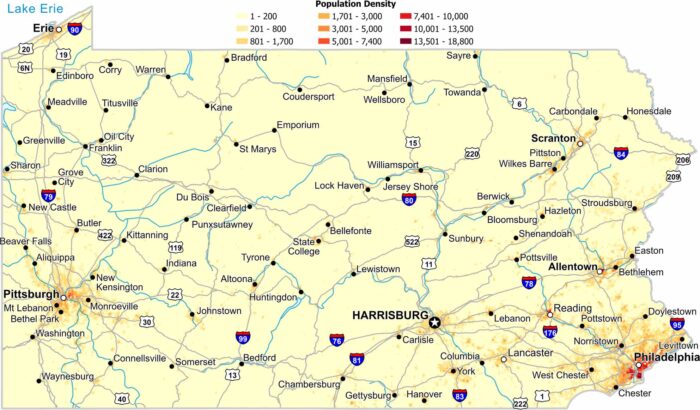
Population concentrates at the eastern and western ends of the state. The central mountains show much lower density.
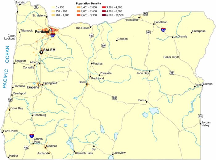
Most people in Oregon live west of the Cascade Range. Our population density map of Oregon shows very sparse density east of the mountains.
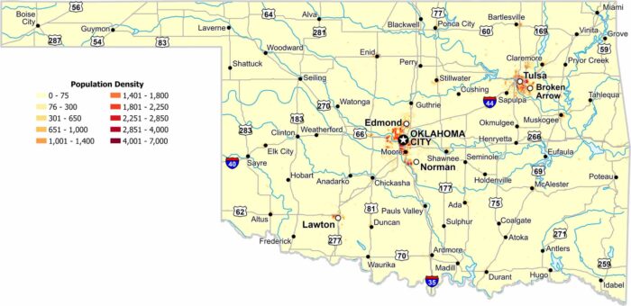
Population density in Oklahoma centers on a handful of cities. Our map shows open land dominating much of the state.
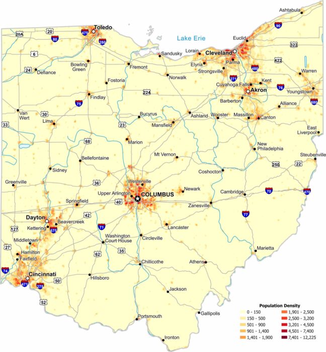
Ohio’s population is spread across several large urban regions. Our population density map of Ohio shows higher density near major cities.
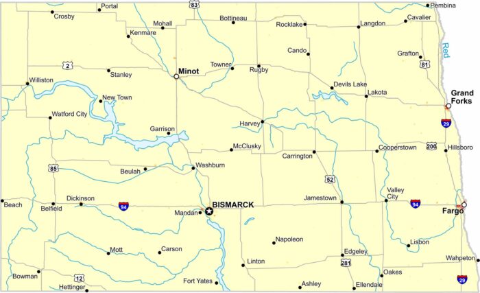
Our population density map of North Dakota shows wide open plains. Population density remains low statewide except big cities.
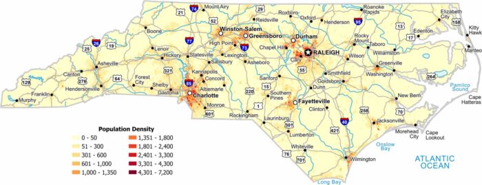
Check out our map to see the population density of North Carolina. Charlotte and Raleigh stick out the most with the highest density.
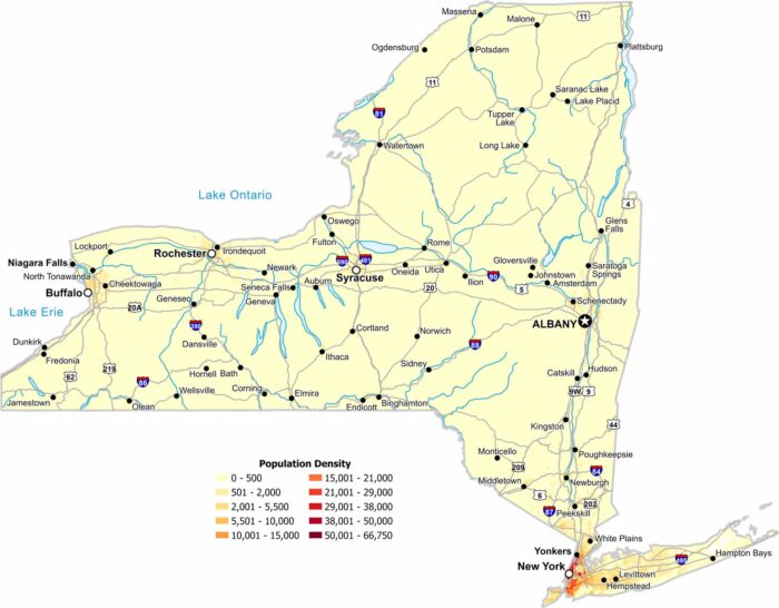
Our population density map of New York shows how geography divides the state. Density peaks in the southern New York City region.
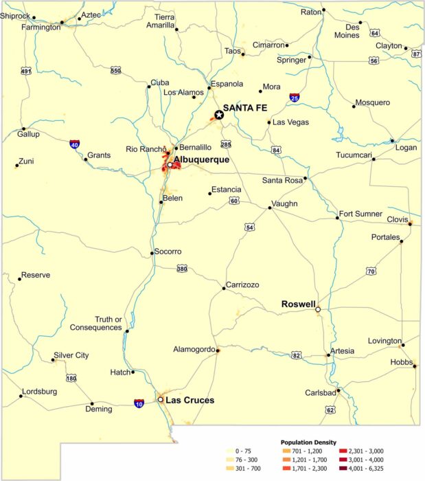
In New Mexico, population clusters around the big cities. Check out our map to see everything from high to low population density areas.
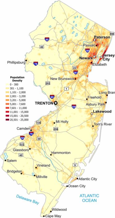
Population density is consistently high statewide. But cities like Newark and Jersey City drives density big time along the eastern edge.
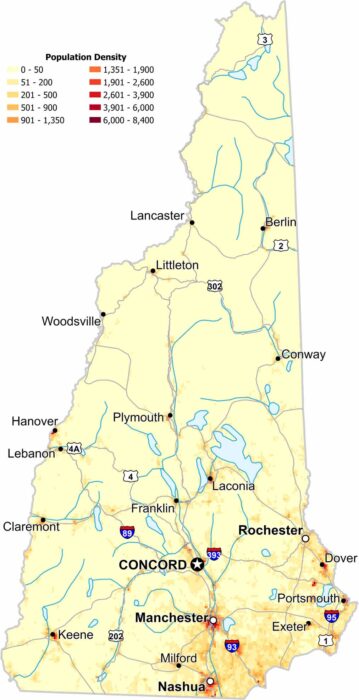
Check out our map to see population density in New Hampshire. While the southern region appears denser, forests remain dominant in the north.
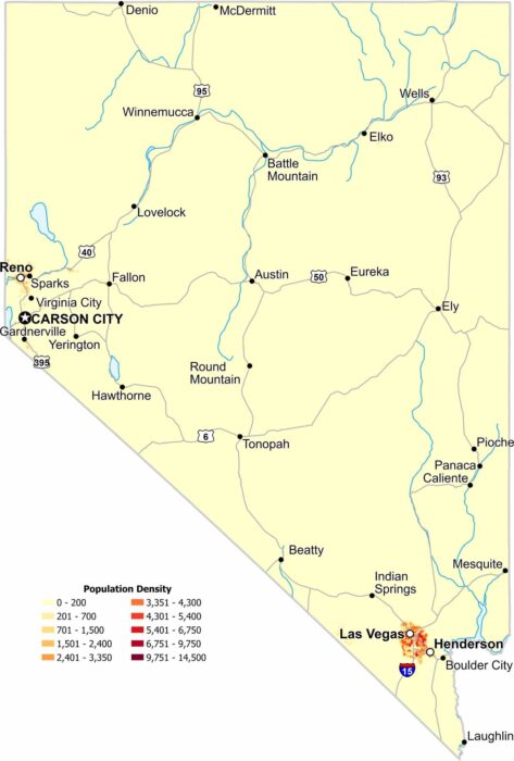
Most residents in Nevada live in just a few areas. Las Vegas, Reno and Sparks stand out sharply on the map in the southeast and west.
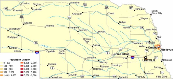
Eastern Nebraska holds the highest density in this state. Cities like Lincoln and Omaha stand out clearly with its bright red color.
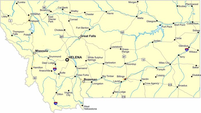
Population density in Montana is extremely low statewide. Our map shows long distances between towns, which is where most people live.
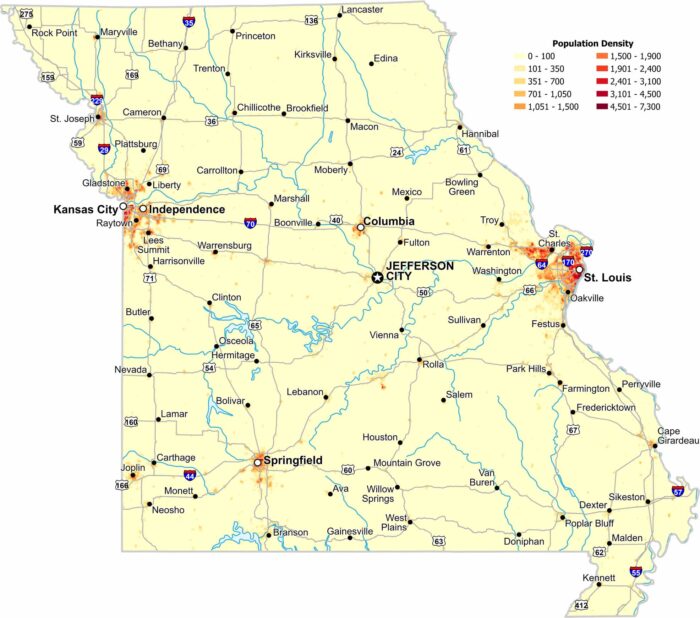
Population clusters around major metro areas like St. Louis and Kansas city. Central regions stay open with lower population density.
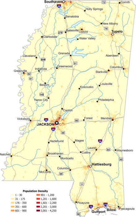
In Mississippi, population density increases near river corridors and major cities. Our map shows wide rural stretches with less population.