Arizona National Parks and Forests Map
Our national parks and forests map of Arizona shows the Grand Canyon and protected forests in the entire state.
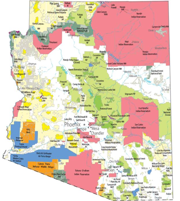
Our national parks and forests map of Arizona shows the Grand Canyon and protected forests in the entire state.
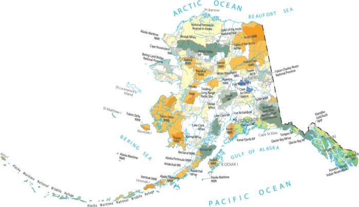
National parks and forests dominate much of Alaska. Our map shows massive protected areas broken only by rivers and coastlines.

Protected lands in Alabama sit mostly in the north and east. Our map shows forested areas like the Talladega National Forest.

Wyoming has some of the lowest population density in the country. Towns are widely spaced across open terrain.
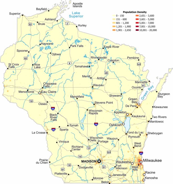
Our population density map of Wisconsin show higher population near large lakes and quieter areas in the northern forests.
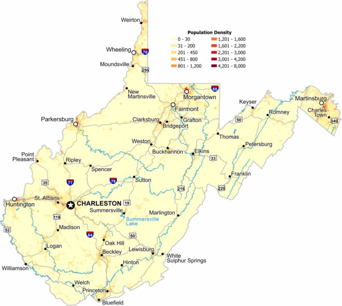
Population is spread thin across the rugged terrain of West Virginia. Small communities sit in valleys and along rivers.
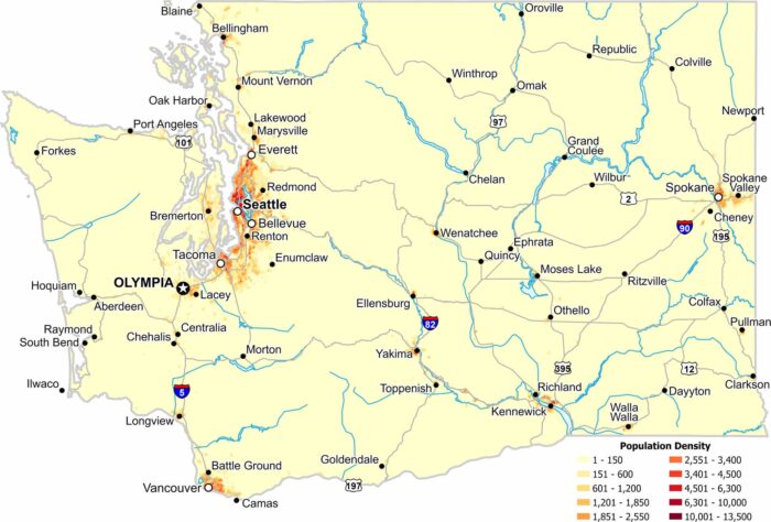
Our population density map of Washington shows a strong divide across the mountains. Western Washington holds most of the population.
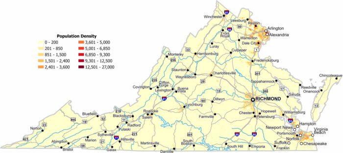
In our population density map of Virginia, the northern and eastern regions appear far denser than the rest of the state.

Population density stays low across the state. Small towns are scattered among forests and hills. Our population map shows few dense clusters.
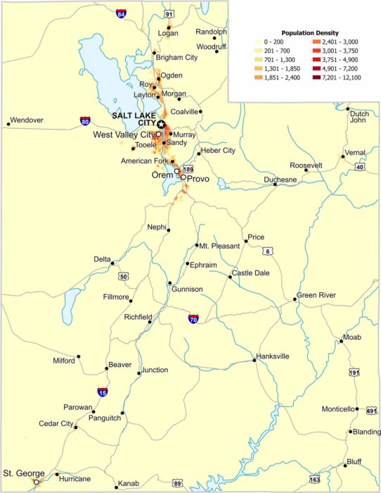
Our population density map of Utah shows sharp edges between dense and empty regions. Most of Utah’s population lines the valley regions.
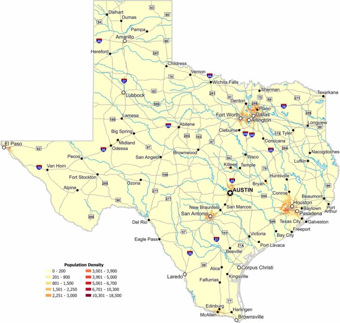
Texas shows strong population concentration around major metro areas. Our map highlights dense clusters and wide rural regions.

Population spreads across several urban areas rather than just one. Our population density map of Tennessee shows settlement and empty space.
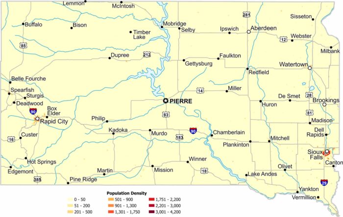
Most of South Dakota shows very low population density. Cities appear as small, isolated clusters like Sioux Fall and Rapid City.
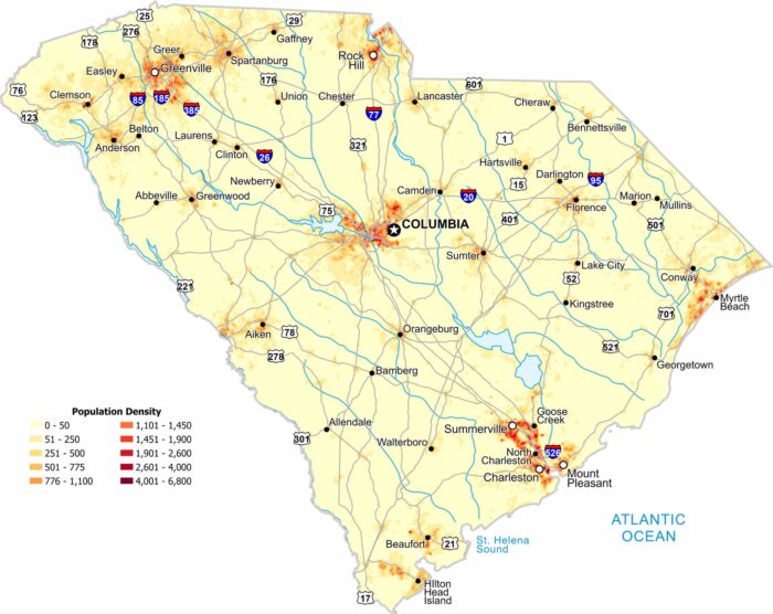
In South Carolina, population density increases near coastal areas and larger cities. Our map shows lighter settlement inland.

Our Rhode Island population density map shows how the concentration of people remains high across most of the state.