Map of Lawrence, Kansas
Our map of Lawrence shows the Kansas River running through downtown. The University of Kansas dominates the west side.
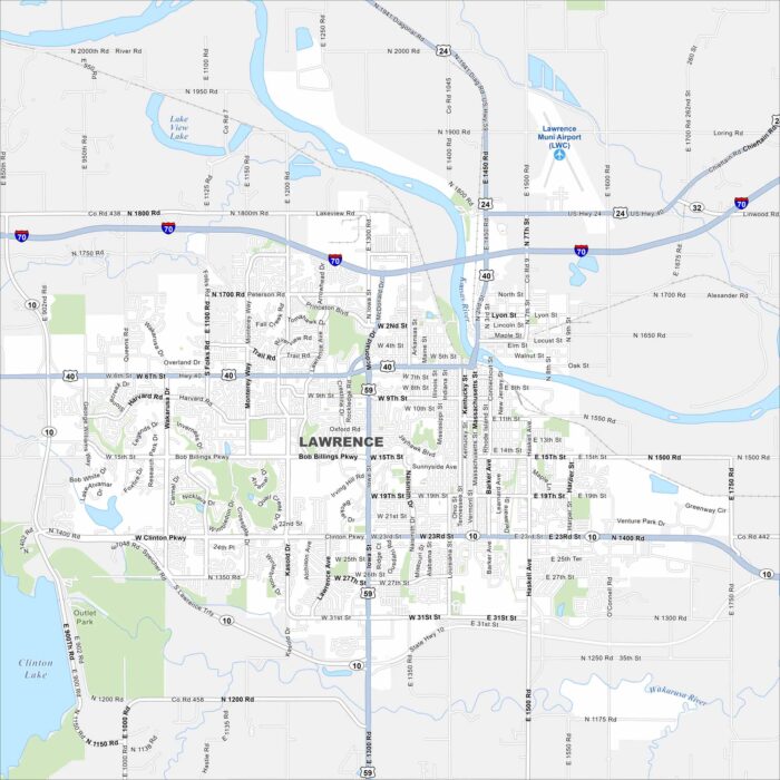
Our map of Lawrence shows the Kansas River running through downtown. The University of Kansas dominates the west side.
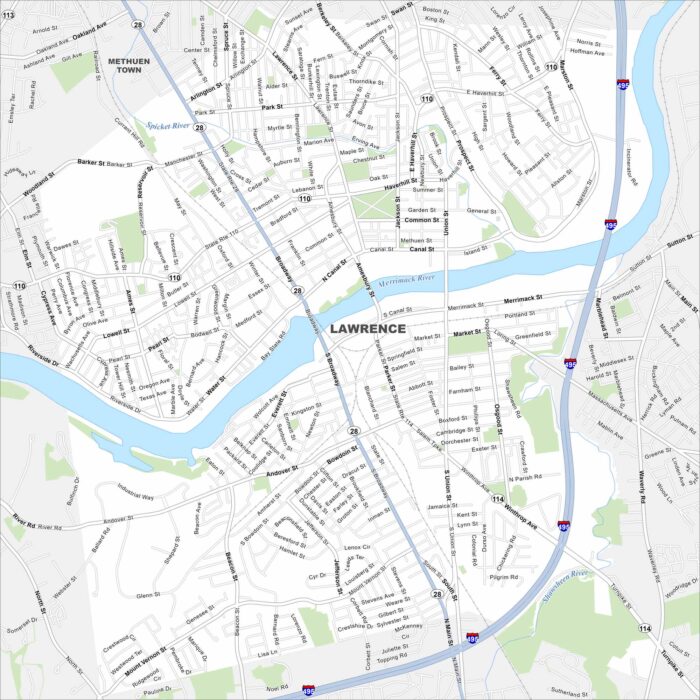
Lawrence sits on the Merrimack River in northeast Massachusetts. This map shows its mill buildings and tight urban road network.
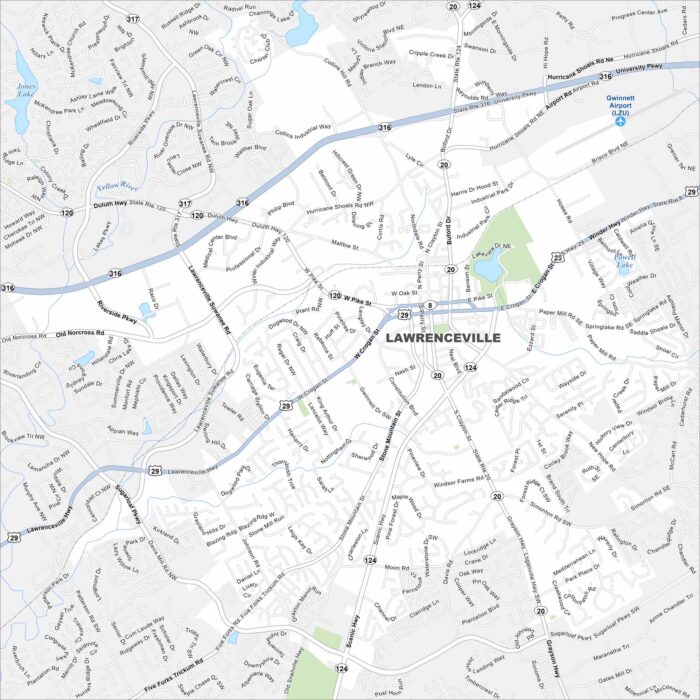
Explore Lawrenceville northeast of Atlanta, Georgia. The courthouse square anchors its center. New subdivisions fill the surrounding map.
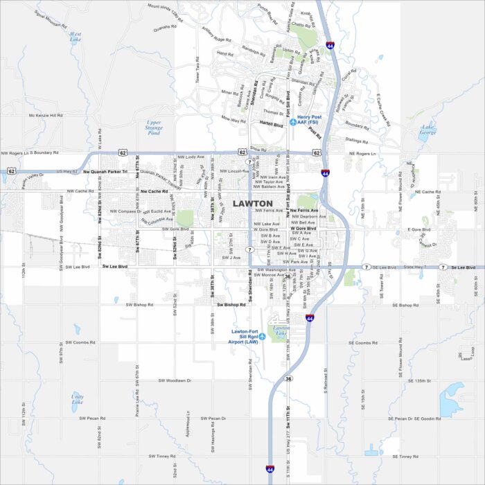
Our map of Lawton places it at the base of the Wichita Mountains. Fort Sill (Henry Post AAF) occupies a large section to the north.
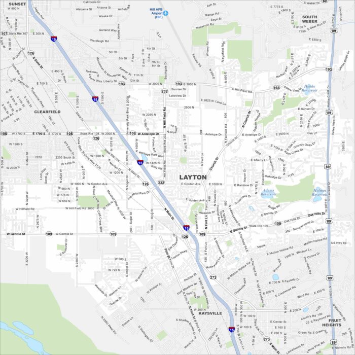
Layton stretches along the Wasatch Front. This map shows neighborhoods tucked between mountain slopes and the Great Salt Lake.
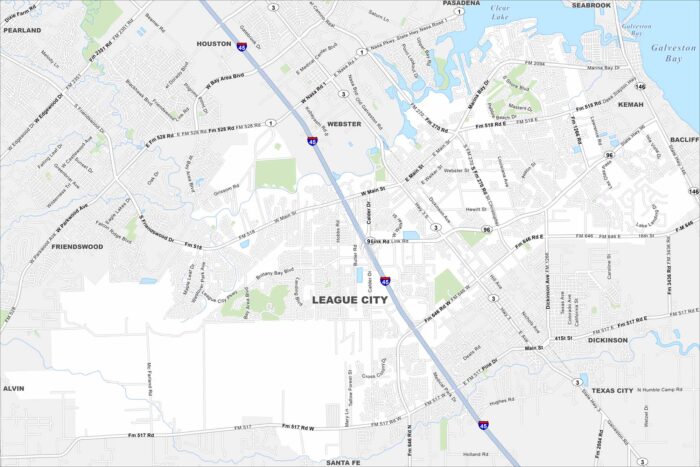
Our map of League City shows it stretched between Clear Lake and Galveston Bay. Waterways wind through its neighborhoods.
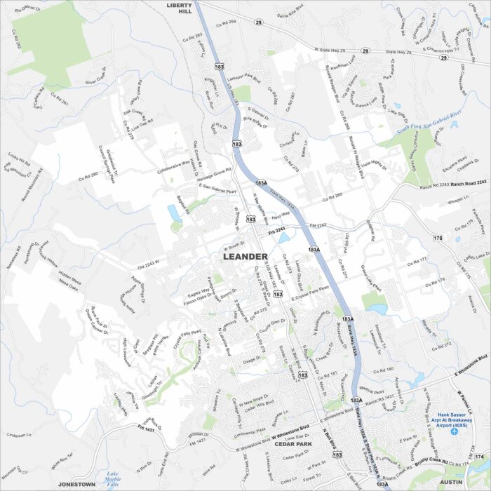
Leander, Texas appears on the map northwest of Austin. New subdivisions spread outward from its historic core.
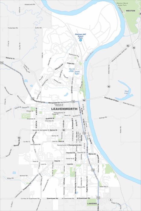
Check out Leavenworth on the Missouri River. Its historic downtown and Weston Bend State Park both stand out. Surrounding it is farmland.
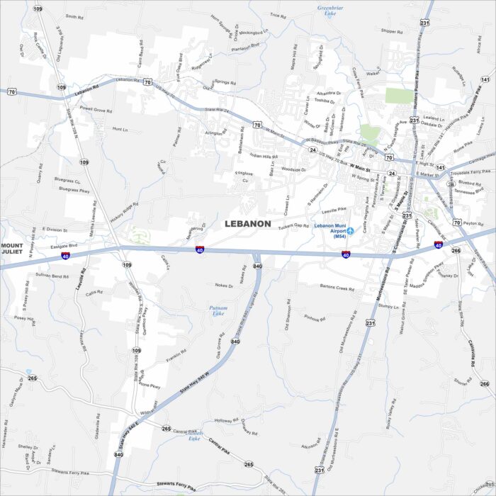
Lebanon sits east of Nashville, Tennessee. Our map displays its town square and street layout. The Cumberland River lies just beyond.
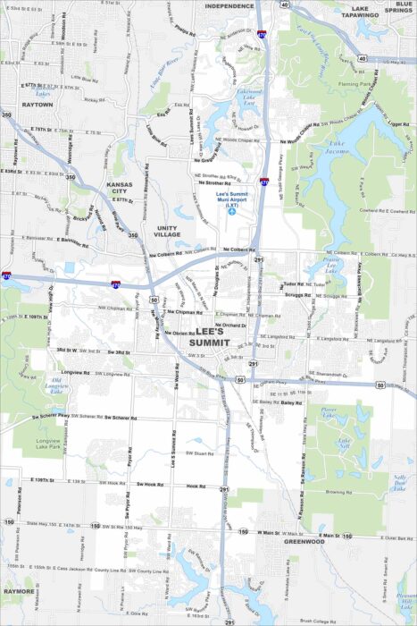
Our map of Lee’s Summit highlights lakes scattered across the city. The setting mixes open land with residential growth.
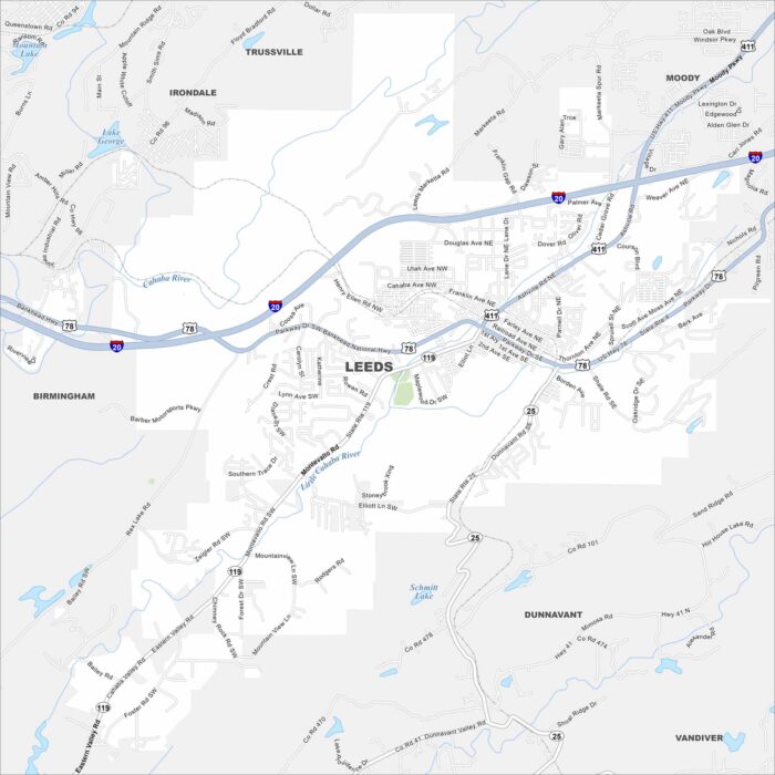
Leeds lies at the edge of the Appalachian foothills. The map shows neighborhoods tucked against low ridges. Small creeks run across the area.
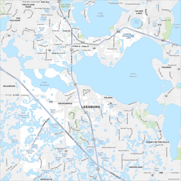
Our map shows Leesburg, Florida which stands between Lake Harris and Lake Griffin. Downtown streets cluster near the shoreline.
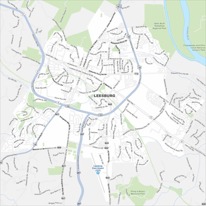
Leesburg anchors Loudoun County at the foot of the Blue Ridge. Our map shows its historic district at the core.
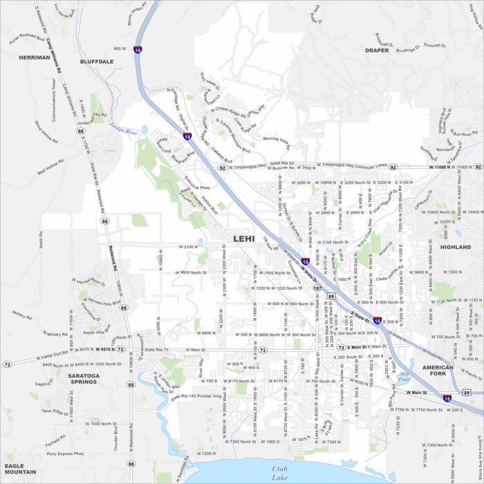
Our map of Lehi places it between Utah Lake and the Wasatch Mountains. The geography shows valley and mountain side by side.
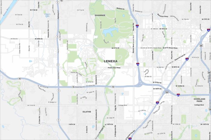
Lenexa is in suburban Johnson County. The map shows a mix of neighborhoods, parks, and lakes. It blends directly into the Kansas City metro.