Map of La Puente, California
Our map shows La Puente nestled just east of Los Angeles. It sits near the San Gabriel Mountains, giving a clear edge to the north.
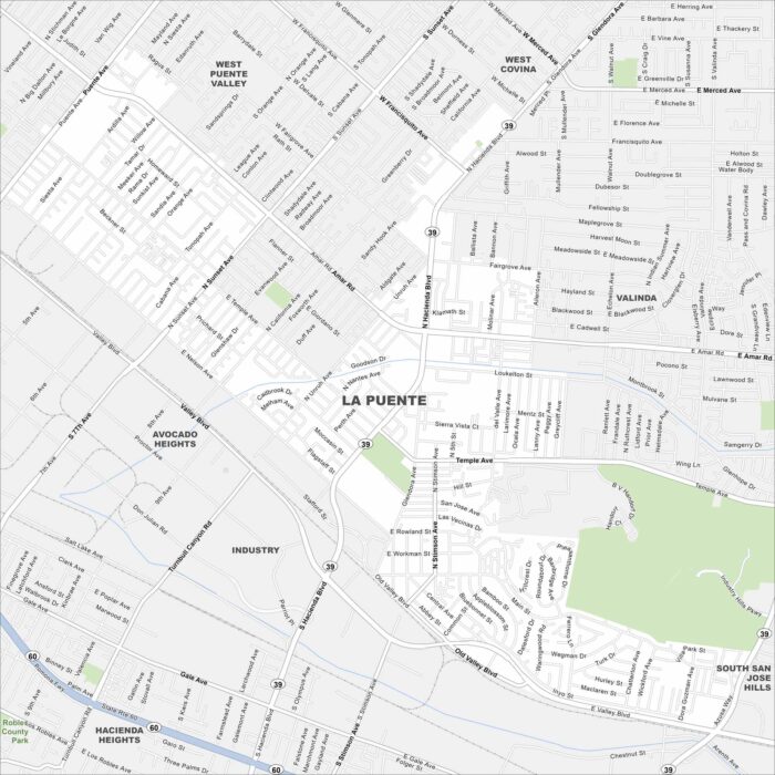
Our map shows La Puente nestled just east of Los Angeles. It sits near the San Gabriel Mountains, giving a clear edge to the north.
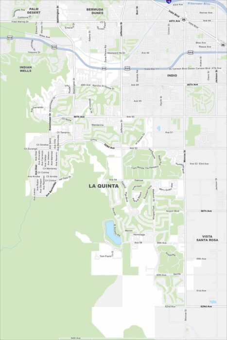
Check out La Quinta at the base of the Santa Rosa Mountains. Desert terrain shape its layout with the occasional golf course.
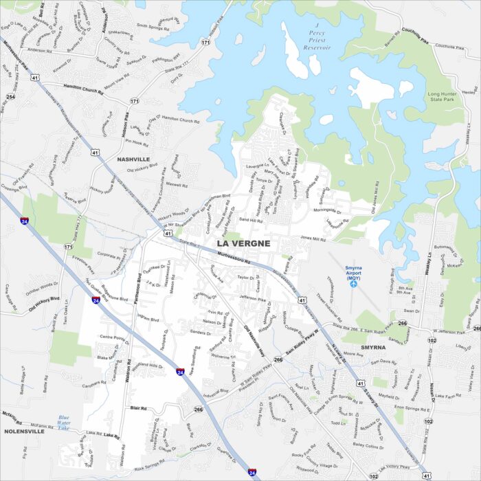
La Vergne is just southeast of Nashville. Percy Priest Lake is visible on the map, curling along the city’s northeast edge.
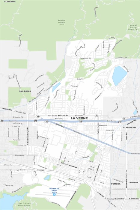
Our map shows La Verne hugging the foothills of the San Gabriel Mountains. Residential streets extend outward from downtown.
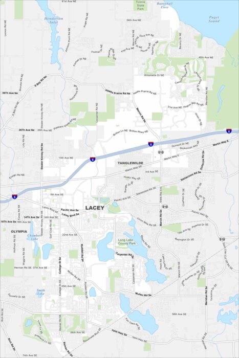
Explore Lacey, located south of Olympia. Lakes and parks are scattered through the city with I-5 cutting through along the north side.
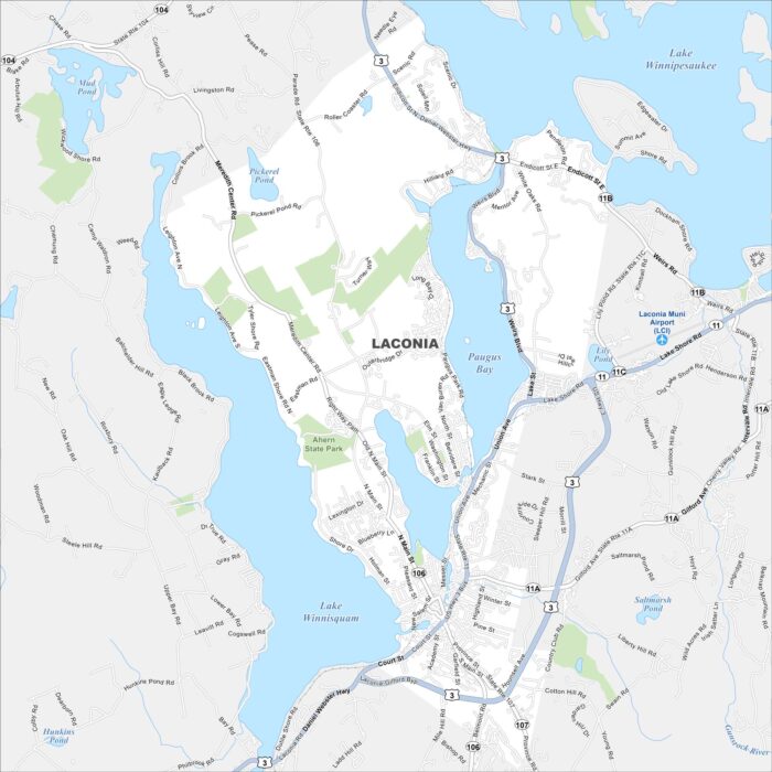
Laconia is located between Lake Winnipesaukee and Lake Winnisquam. Downtown streets cluster near the water.
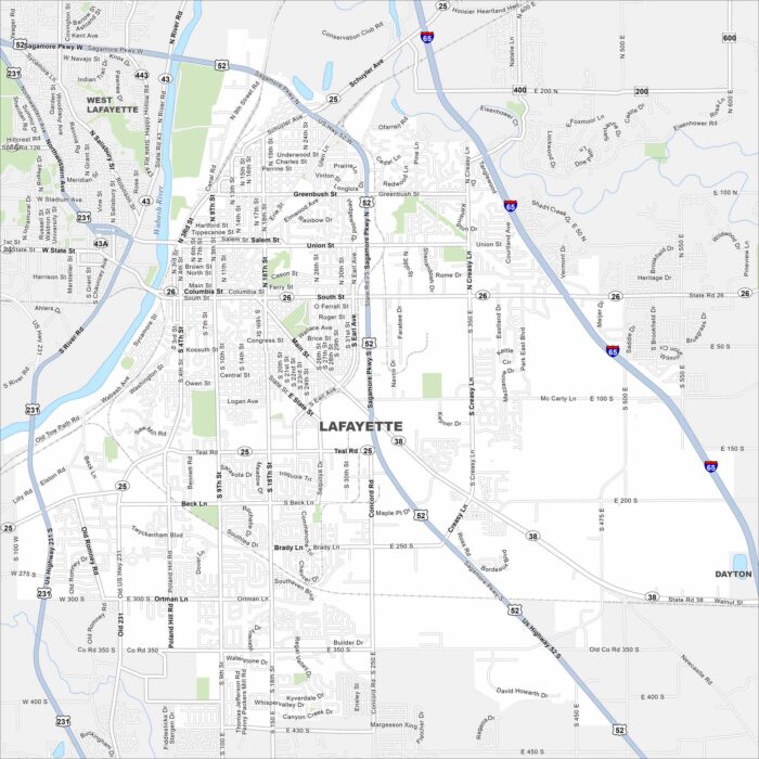
Our map of Lafayette shows the Wabash River cutting through downtown. Streets form a neat grid around the city.
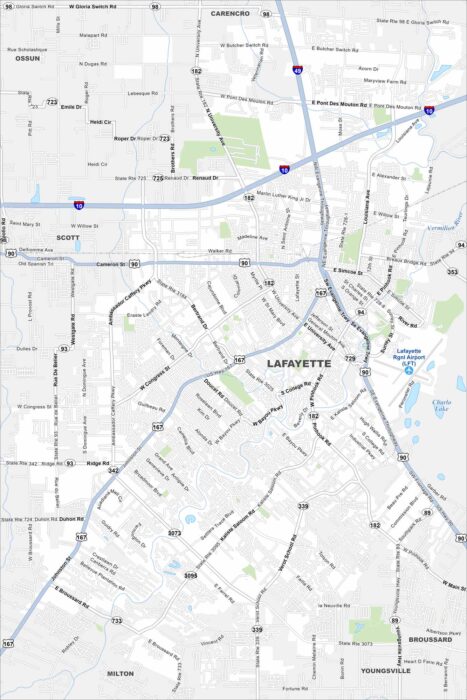
See Lafayette along the Vermilion River. Historic neighborhoods pop out on the map. Interstates connect the city to Baton Rouge.
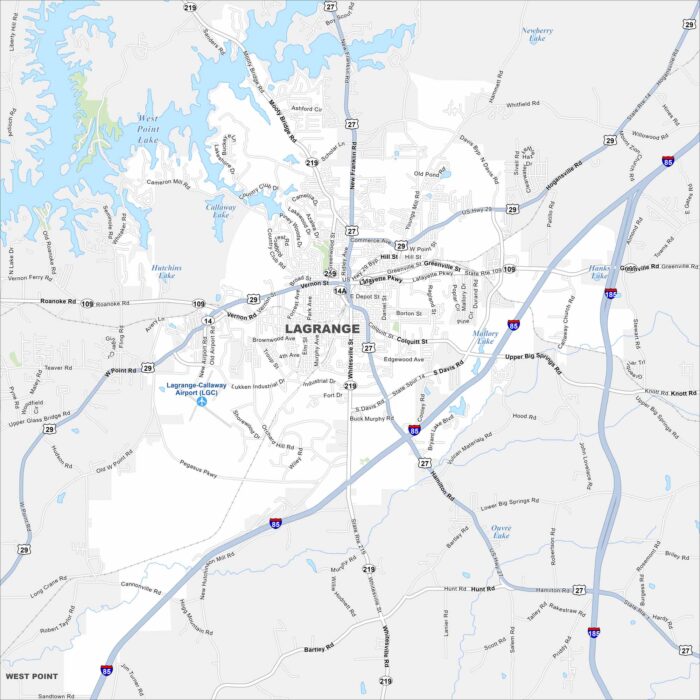
LaGrange is west of Atlanta, Georgia. West Point Lake spreads along the city’s western edge. The downtown square stands out at the center.
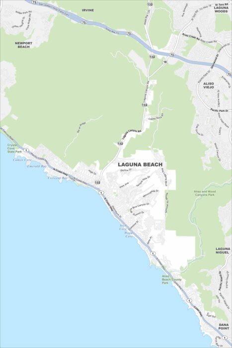
Our map of Laguna Beach follows the coastline of the Pacific Ocean. Canyons carve through the city and beaches line the oceanfront.
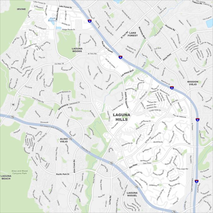
Our Laguna Hills map shows rolling hills combined with neighborhoods. Freeways frame the edges, linking it to Irvine and Mission Viejo.
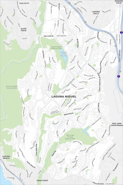
Laguna Niguel spreads out along curving canyon roads. This map highlights its open space reserves and trails.
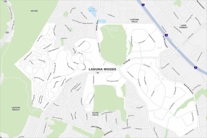
The city of Laguna Woods, California appears compact on the map. Highways surround it on nearly every side.
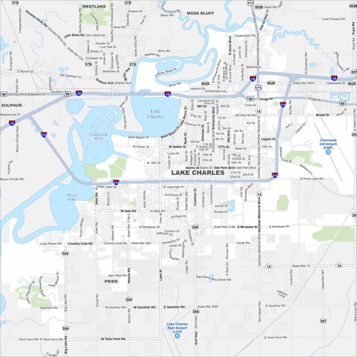
Our map of Lake Charles with highways, rivers and parks. Lake Charles dominates the map’s center. The Calcasieu River runs into the lake.
Our map highlights the massive natural lake at the heart of the city. While freeways skirt its western edge, hills rise just beyond town.