Map of Hawthorne, California
Hawthorne lies in Los Angeles County, just inland from the coast. On our map, you’ll see it boxed in by major freeways.
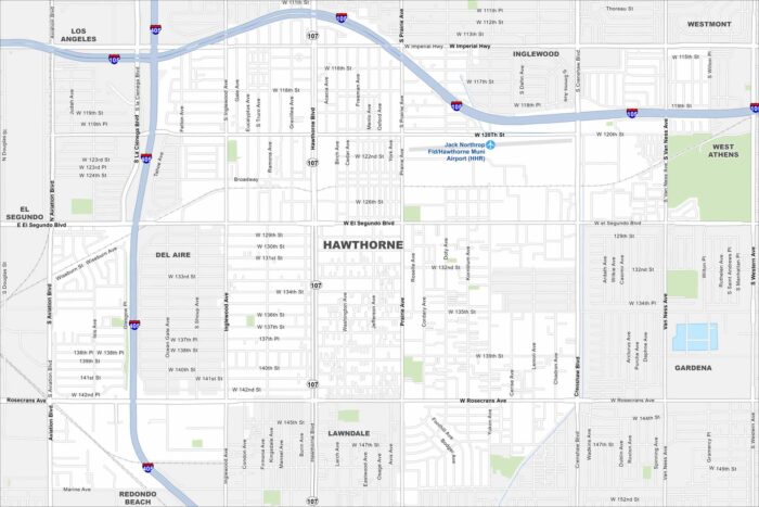
Hawthorne lies in Los Angeles County, just inland from the coast. On our map, you’ll see it boxed in by major freeways.
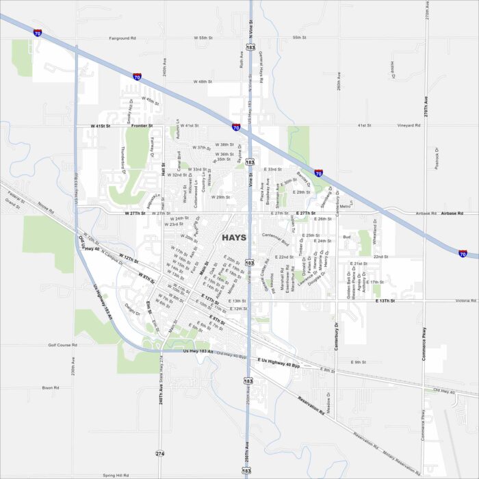
Hays is in western Kansas along Interstate 70. It’s surrounded by open prairie land. Our map of Hays shows its rivers, lakes and roads.
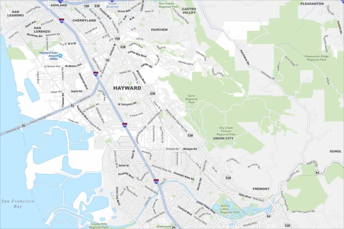
Hayward sits on the east side of the San Francisco Bay. You’ll notice wetlands along the shoreline on our map.
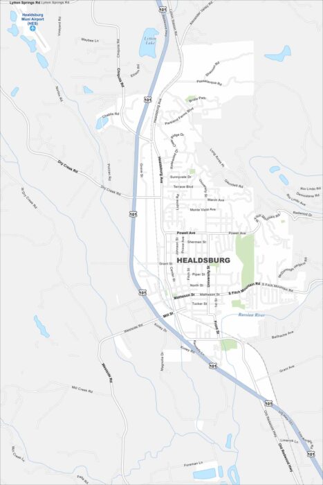
Healdsburg is in northern Sonoma County, surrounded by vineyards. Our map shows the Russian River winding through the area.
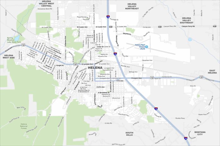
Helena sits in west-central Montana, resting against the Rocky Mountain foothills. This map highlights its mountain backdrop.
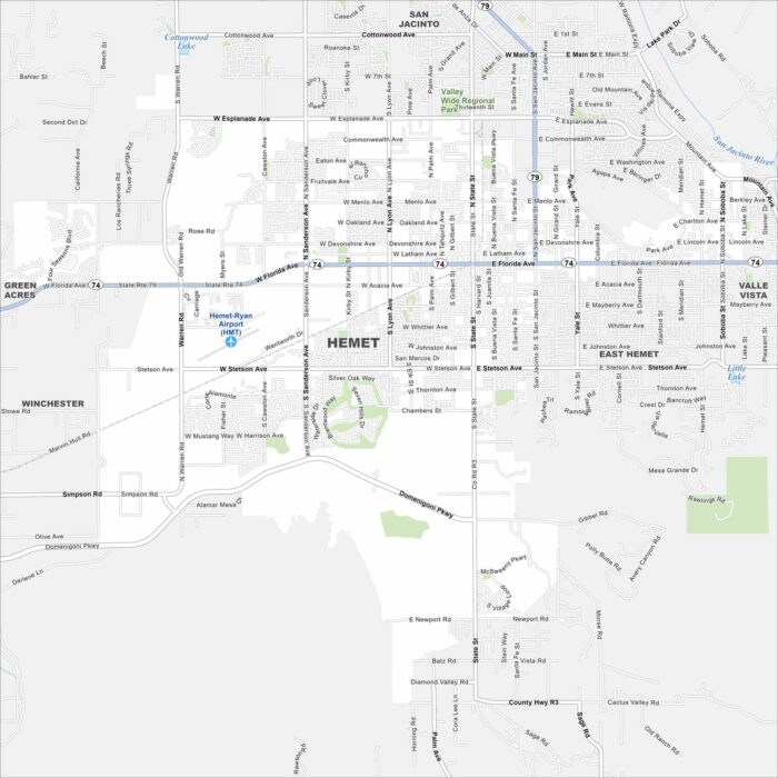
Hemet sits in Southern California’s Inland Empire. Our map shows the city surrounded by dry hills and valleys.
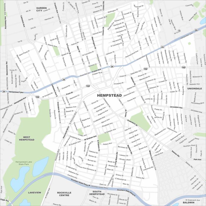
Our map of Hempstead places it on Long Island, just east of New York City. Major parkways run across the area.
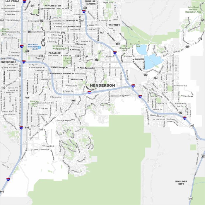
Henderson is just southeast of Las Vegas in the Mojave Desert. Neighborhoods spread between desert hills and the edge of Lake Mead.
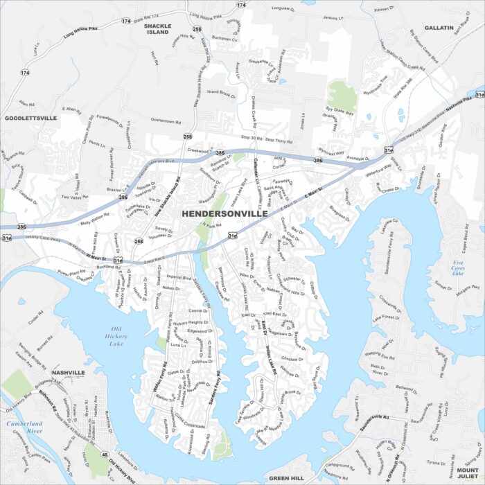
Explore our map of Hendersonville along the shores of Old Hickory Lake. Its roads spread north of Nashville, Tennessee.
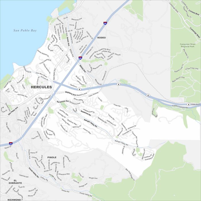
Hercules is on the northeastern edge of the San Francisco Bay Area. Our map shows this city pressed between the shoreline and nearby hills.
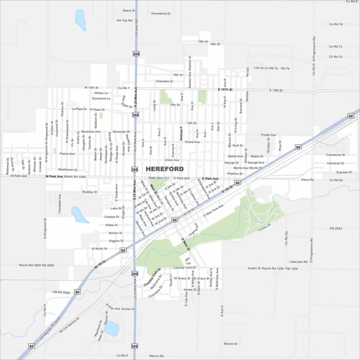
Our map of Hereford highlights its spot in the Texas Panhandle. Highways connect it west toward New Mexico.
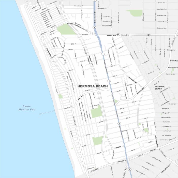
Hermosa Beach sits on the Southern California coast between Manhattan Beach and Redondo Beach. Our map shows its roads, green spaces and more.
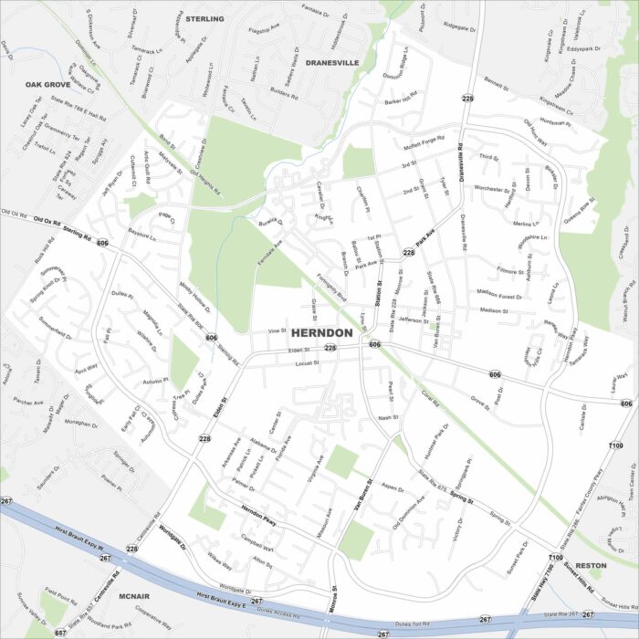
Herndon is just west of Washington, D.C., near Dulles Airport. This map shows its streets branching from the Dulles Toll Road in the south.
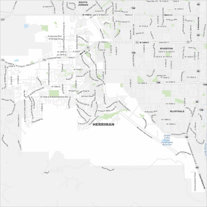
Check out our map of Herriman at the southwestern edge of the Salt Lake Valley. It backs up against the Oquirrh Mountains.
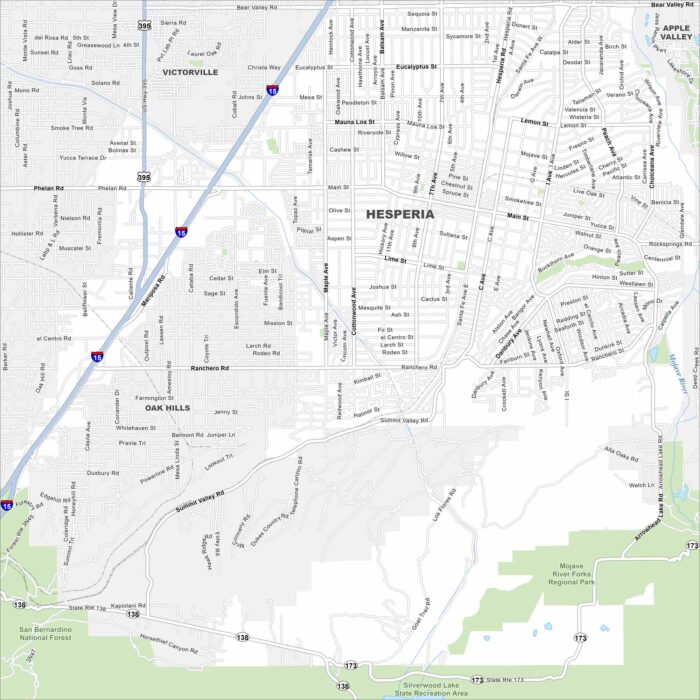
Hesperia lies in the Mojave Desert north of the San Bernardino Mountains. This map shows Interstate 15 running through the city.